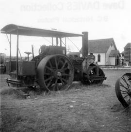
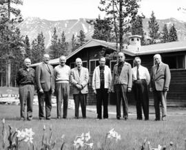
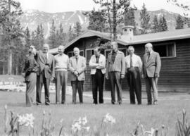
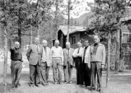
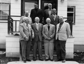
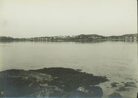
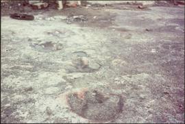
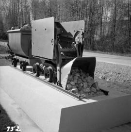
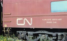
Photograph depicts the details of 3 axle trucks and car steps.
Photograph depicts details of a spout on a preserved water tank.
Photograph depicts stalks of devil club. Handwritten annotation below photograph reads, "devil club stalks".
Image depicts an aerial view of Diamond Island, near Quesnel, B.C.
Photograph depicts a former steam roller that was converted to diesel drive. It was no longer working.
Item is a photograph of a copy print that has been reproduced as a slide, resulting in low photographic quality. Location of original photograph unknown.
Photograph depicts a diesel switching locomotive, owned and on the premise of the Vancouver Iron and Engineering Works Ltd, at 1155 west 15th Ave. The view is looking north to False Creek.
Image depicts a dilapidated house in Sinclair Mills, B.C.
Image depicts two dilapidated houses in Sinclair Mills, B.C.
Image depicts an old house for sale surrounded by overgrown bushes in Upper Fraser, B.C. Map coordinates 54°07'15.0"N 121°57'02.0"W
Photograph depicts a small vessel called "Dinamac." It had a red hull, suggesting that it may have been a Department of Transport tender.
Image depicts an old building with a sign labelling it as a "Dining Lounge," it is possibly in Prince Rupert, B.C.
Item is a photograph of dinosaur footprints discovered at the W.A.C. Bennett Dam site.
Photograph depicts group of nine men standing on lawn in front of building known as "House 130" or "Director's Lodge". Left to right: Andre Beguin, unknown, Charles Rainforth Elliot, Jack Christian, W. Harold Connell, Plato Malezemoff (from Newmont Mining), Tam Zimmermann, Ken A. Creery, Fred Martin Connell. Daffodils and tulips planted in foreground, trees and mountains in background. Most men featured in photo are believed to be members of Cassiar's Board of Directors; Beguin was a General Superintendent.
Photograph depicts group of eight men standing on lawn in front of building known as "House 130" or "Director's Lodge" (see item 2000.1.1.3.19.88). Left to right: Nick Gritzuk, Charles Rainforth Elliot, Jack Christian, W. Harold Connell, Plato Malezemoff (from Newmont Mining), Tam Zimmermann, Ken A. Creery, Fred Martin Connell. Daffodils and tulips planted in foreground, trees and mountains in background. Most men featured in photo are believed to be members of Cassiar's Board of Directors.
Photograph depicts group of eight men standing on lawn in front of building known as "House 130" or "Director's Lodge". Left to right: Nick Gritzuk, Charles Rainforth Elliot, Jack Christian, W. Harold Connell, Plato Malezemoff (from Newmont Mining), Tam Zimmermann, Ken A. Creery, Fred Martin Connell. Elliot appears to be comparing height with Gritzuk. Trees and mountains in background. Most men featured in photo are believed to be members of Cassiar's Board of Directors.
Photograph depicts group of eight men standing on lawn in front of building known as "House 130" or "Director's Lodge". Left to right: Nick Gritzuk, Charles Rainforth Elliot, W. Harold Connell, Jack Christian, Fred Martin Connell, Ken A. Creery, Plato Malezemoff (from Newmont Mining), Tam Zimmermann. Gritzuk appears to be pointing at photographer. Trees and mountains in background. Most men featured in photo are believed to be members of Cassiar's Board of Directors.
Photograph depicts group of eight men standing on front steps of Cassiar's Main Office building. Top, left to right: Ken A. Creery, John Drybrough. Middle, left to right: John E. Kennedy, Tam Zimmermann. Bottom, left to right: Fred Martin Connell, George Washington Smith, W. Harold Connell, Charles Rainforth Elliot. Windows and doors to office in background, flowers in bottom right foreground. Photo believed to have been taken on the same day as items 2000.1.1.4.3.4 - 2000.1.1.4.3.6.
Photograph depicts group of eleven men standing in line in the Cassiar valley. Left to right: Jack Christian, Charles Rainforth Elliot, John Drybrough, John E. Kennedy, Fred Martin Connell, W. Harold Connell, Ken A. Creery, George Washington Smith, Tam Zimmermann, [Fred Murray]?, Nick Gritzuk. Power lines and mountains in background. Most men featured in photo are believed to be members of Cassiar's Board of Directors. Photograph was originally framed with note "Summer 1961" written on cardboard backing.
Photograph depicts group of eight men standing in line in the Cassiar valley. Left to right: Charles Rainforth Elliot, John Drybrough, John E. Kennedy, Fred Martin Connell, W. Harold Connell, Ken A. Creery, George Washington Smith, Tam Zimmermann. Power lines and mountains in background.
Image depicts a dirt road leading through numerous trees toward a mountain. The location is uncertain, likely on the way to Longworth, B.C.
Image depicts a dirt road and a possibly abandoned building at an uncertain location.
Photograph depicts a dirt road between Bella Coola and Anahim Lake utilized for transport during the WWII Polar Bear training exercise.
Photograph depicts a dirt road cut between two highbanks with a oil cans (?) stacked in the background between the banks.
Photograph depicts a dirt road through a forested landscape.
Image depicts a dirt road leading through a forest.
Image depicts a dirt road leading through a forest with what appears to be an area for turning around at the end.
Photograph depicts the dismantling of the KVR Spences Bridge to Penticton. Mileages are those established by the CPR sometime between 1955 and 1965.
Photograph depicts a display item in front of the office of the Nelson Machinery Co. Ltd. located on 1255 Welch St. in North Vancouver. It is a rock car on a 2 ft. gauge track.
Photograph depicts a distance perspective of an unidentified man standing in a large ditchline that runs through a forested landscape.
Opposite shore in background.
Photograph features Terrace Gardens.
Photograph depicts a distance view of tree covered mountain slopes in winter.
Photograph depicts a distant mountain range visible over a forested slope. The location of photo is between Wapiti Lake and Red Deer Valley.
Photograph depicts a tree-covered valley with a snow-covered mountain range in the background. The location of photo is between Wapiti Lake and Red Deer Valley.
Photograph depicts a distant river running through a forested mountainous landscape.
Photograph depicts a snowy plateau with a distant snow-covered mountain range in the background and coniferous trees in the foreground.
Photograph depicts a distant snow-covered mountain range with evergreen trees in the foreground.
Part of a set of 41 original black & white photographs [1908-1933-?]) of the Grand Trunk Pacific Railway line in BC depicting surveying crews, town sites (Prince Rupert and its port, Hazelton and Fort George), and First Nations Peoples.
Photograph depicts settlement across frozen lake. Trees cross midground, mountains stand in background. Handwritten annotation on verso of photograph reads: "Distant view of Tete Jaune B.C.", on recto of photograph: "I marked about where you loaded your boat the telephone pole is down the road toward 53. Tete Jaune Mile 52."
Item is a copyprint reproduced from the British Columbia Forest Service photographic records held at BC Archives.
Image depicts a section of disturbed ground at an unknown location.