Showing 920 results

Archival description
2006.18.6.05 · File · Jan. 1992
Part of Aleza Lake Research Forest Society fonds

File consists of a photograph commemorating the signing of the first Aleza Lake Research Forest Management Plan. Front row, left to right: Ken Pendergast, BC Forest Service Prince George District Manager; Harry Coates, BCFS Forest Research Technician (1957-1993); John Revel, BCFS Silviculture Forester (1960-1993). Back row, left to right: Mike [?], BCFS Prince George Silviculture Manager; Henry Benskin, BCFS Research Branch; Michael Jull, BCFS Research Silviculturist, Prince George Region; Dan Lousier, BCFS Prince George Region Research Section Head; Brian Harding, Northwood Pulp & Timber Ltd. Woodlands Manager.

2000.1.1.3.18.006 · Item · [ca. 1960?]
Part of Cassiar Asbestos Corporation Ltd. fonds

Photograph depicts the large bearing cups of one of the Ruston Hornsby diesel engines that turned the generators in the power house on the Cassiar plant. Engine believed to be under repair. Saw horse, machinery, and electric panels in background.

2000.1.1.2.04.05 · Item · [ca. 1970]
Part of Cassiar Asbestos Corporation Ltd. fonds

Photograph depicts large square model of the new mill building that was built at the Cassiar plant site in 1970. Model is displayed on platform draped with green material. Machinery modeled inside the structure is colour-coded.

2023.2.2.5 · Subseries · 1991-2023, predominant 2004
Part of Dr. Paul Sanborn fonds

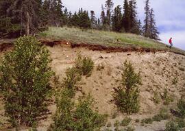
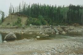
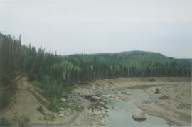
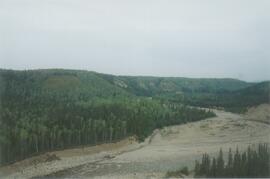
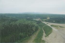
The Lost Chicken Mine, a placer gold mine in eastern Alaska, approximately 120 km west of Dawson City, Yukon, is an important fossil locality for the late Pliocene (approximately 2.5 – 3.0 million years ago). A comprehensive account of the stratigraphy and paleontology of this site was given by:
Matthews, J.V., Jr., J.A. Westgate, L. Ovenden, L.D. Carter, and T. Fouch. 2003. Stratigraphy, fossils, and age of sediments at the upper pit of the Lost Chicken gold mine: new information on the late Pliocene environment of east central Alaska. Quaternary Research 60: 9-18. https://doi.org/10.1016/S0033-5894(03)00087-5

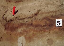
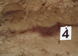
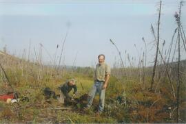
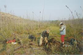
Dr. Paul Sanborn visited the site on July 20, 2004, as part of a group led by Duane Froese (Professor, University of Alberta). The group concentrated on a single exposure (~ 2 m thick) straddling the Lost Chicken tephra, a volcanic ash bed (2.9 ± 0.4 myr) which is a major stratigraphic marker at the site. Sanborn described, photographed, and sampled this exposure, and obtained a basic set of characterization data. Intact samples were collected but thin sections were never produced.

2023.2.2.3 · Subseries · 2004-2006
Part of Dr. Paul Sanborn fonds

As part of a multidisciplinary team led by Grant Zazula (then a Ph.D. student at Simon Fraser University; later a palaeontologist with the Government of Yukon) and Duane Froese (Professor, University of Alberta), Dr. Paul Sanborn examined a set of buried paleosols (fossil soils) preserved in frozen sediments exposed by placer mining in the spring of 2004.

The findings were published in:
Zazula, G.D., D.G. Froese, S.A. Elias, S. Kuzmina, C. La Farge, A.V. Reyes, P.T. Sanborn, C.E. Schweger, C.A.S. Smith, and R.W. Mathewes. 2006. Vegetation buried under Dawson tephra (25,300 14C yr BP) and locally diverse late Pleistocene paleoenvironments of Goldbottom Creek, Yukon, Canada. Palaeogeography, Palaeoclimatology, Palaeoecology 242: 253–286. https://doi.org/10.1016/j.palaeo.2006.06.005

2000.1.1.3.18.010 · Item · October 1958
Part of Cassiar Asbestos Corporation Ltd. fonds

Photograph depicts group of 12 men standing on steps at back of main office. Front row: Jack Berry, Mickey Dopson, Andre Beguin, Fred Murray. 2nd row: Dick Stevens, Rene Pasiaud. Third row: Craigie Hood, Alex Powell. Back row: Dr. Charles Cobb MD, Peter Davies, Chuck Caron (holding paper), Bill Johnston. Berry and Dopson are wearing hard hats. Windows and doors of office building in background. Stamped annotation on recto of photograph: "Munshaw Colour Service Ltd. OCT 24 1958".

2000.1.1.3.17.009 · Item · 1962
Part of Cassiar Asbestos Corporation Ltd. fonds

Photograph depicts tramline in a strip cleared of trees on McDame Mountain, bucket in foreground. Handwritten annotation on recto of photograph: "#2 SECTION LOOKING NORTH". Photograph was glued to cardboard backing with the annotation: "1962".