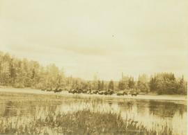
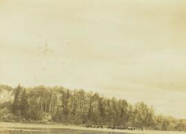
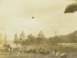
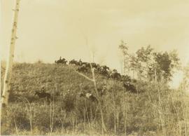
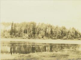
Photograph depicts a pack train of horses seen from across the Moberly River along a forested shoreline.
Photograph depicts a pack team of horses crossing the Moberly River with reeds in the foreground and a forested shoreline in the background.
Photograph depicts a pack train of horses fording the Moberly River with a forested shoreline in the background.
Photograph depicts a pack train of horses and several men on horseback riding along the east end of Moberly Lake.
Photograph depicts a pack horse outfit riding down a grassy slope with a sparse tree line in the foreground.
Image depicts the Pack River outlet at McLeod Lake.
Image depicts the Fraser River at Paddlewheel park, with a train on the other side of the river, in Prince George B.C.
Handwritten annotations on verso read: “Lawn Pool, Memorial, West Coast, VI, Summer ’06,” and “Sept. 15, 2006”.
An 'X' is marked in ink on forest in centre.
Balcony overlooks Terrace Gardens in Victoria, B.C.
Image depicts a view of a valley; the slide itself labels the image in two places, "central basin" on the left side of the image, and "Pat's Pass" on the top of the image between the two mountains.
Image depicts the First Nations village of Pavilion, B.C.
Image depicts an old earth flow somewhere near Pavilion, B.C.
Image depicts the remains of an old bridge, somewhere near Pavilion Mountain.
Image depicts the road to Pavilion Mountain.
Image depicts the Peace Canyon Dam and generating station under construction on the Peace River.
Image depicts the Peace River, possibly near Clayhurst or Hudson's Hope, B.C.
Image depicts what is possibly the Peace River.
Image depicts a river, possibly the Peace River.
Image depicts what is possibly the Peace River running parallel to a road, possibly Highway 29.
Image depicts the Peace River.
Image depicts the Peace River, possibly near Hudson's Hope, B.C.
Image depicts the Peace River.
Image depicts the Peace River and visible layers of sediment deposits in the surrounding cliffs.
Image depicts the Peace River, possibly somewhere near Fort St. John, B.C.
Image depicts a dam, possibly on the Peace River.
Image depicts a dam on what is possibly the Peace River.
Image depicts a dam and a reservoir of water, possibly on the Peace River.
Image depicts what is possibly the Peace River running next to some farm land at an uncertain location.
Image depicts a large group of unidentified individuals sitting on a hill; what is possibly the Peace River is visible in the background.
Photograph depicts the Peace River leading up to a strait called the "Gate" at Lynx Creek. The narrow strait is flanked by a forested, rocky shoreline.
Photograph depicts the Peace River Canyon with the Peace River in the foreground and rocky, tree-lined cliffs flanking the river. In the background a forested mountain base is visible.
Photograph depicts the Peace River curving around the tree-covered cliffs at the Peace River Canyon.
Image depicts a street of shops at an uncertain location somewhere in the Peace River Regional District. A pink and blue building, possibly a theatre, is labelled "Lux."
Image depicts grass burning at an uncertain location in the Peace River Region.
Image depicts a section of forest located somewhere in the Peace River Regional District of B.C.
Image depicts rail road tracks and several buildings in Pemberton, B.C.
Image depicts the condominiums in the "Pemberton Valley Estates" in Pemberton, B.C.
Image depicts a beehive burner somewhere in or near Penny, B.C.
Image depicts a red boat on a river, possibly the Fraser, near Penny, B.C.
Image depicts four unidentified individuals standing on the bank of a river, possibly the Fraser, somewhere in or near Penny, B.C.
Image depicts a river, possibly the Fraser, near Penny, B.C.
Image depicts Sue Sedgwick standing in front of an old, run-down house somewhere in or near Penny, B.C.
Image depicts a group of people heading towards a glacier, possibly the Robson Glacier.