Original photographic print included in "Northern Interior Forest Experiment Station: Report of Preliminary Investigations" by Percy Barr.
Item is a copyprint reproduced from the British Columbia Forest Service photographic records held at BC Archives.
Photograph shows an aerial view of Aleza Lake Research Forest in spring season.
Item is a copyprint reproduced from the British Columbia Forest Service photographic records held at BC Archives.
Original photographic print included in "Northern Interior Forest Experiment Station: Report of Preliminary Investigations" by Percy Barr.
Item is a copyprint reproduced from the British Columbia Forest Service photographic records held at BC Archives.
Item is a photograph of a copy print that has been reproduced as a slide, resulting in low photographic quality. Location of original photograph unknown.
"Another expression of the high morale which prevailed was a joint project which we pursued after hours, on our own time. Out of one huge spruce log we made a set of furniture using an axe and a crosscut saw. We made chairs, a table and a sofa." -- quote from Cedric W. Walker (1907-2003) in "An Early History of the Research Branch, British Columbia Ministry of Forests and Range" (p. 48)
Original photographic print included in "Northern Interior Forest Experiment Station: Report of Preliminary Investigations" by Percy Barr.
Photograph depicts three men standing behind salmon hung to dry on a wooden deck. Annotation on recto of photograph states: ""Spring Salmon" Rivers Inlet, B.C"
Photograph depicts large stream of water spraying from pipe in mining area, steep cliffs in background.
Photograph depicts man standing in front of large streams of water spraying from pipe into mining area, hills in background.
Photograph depicts a miner spraying enclosed area of river bed with water at high velocity. Cliffs in background.
Photograph depicts water being sprayed from a pipe at high velocity over edge in mining area. Man's leg in foreground, cliffs in background.
Photograph depicts water being sprayed from pipes at high velocity in mining area. Unidentified man in midground, cliffs in background.
Photograph is one of five depicting EP 106.
Photograph depicts scattered buildings, an outhouse, and tents on a rough clearing. A river and its cutbacks are in the background.
Wooden piles driven into a river bed, pile driver visible in background. Handwritten annotation on recto reads: "South fork intake before gate built, pile driven to refusal".
Photograph of a vessel filled with lumber just off the coast of a shore also littered with lumber. Mountains are barely visible in the background.
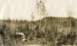
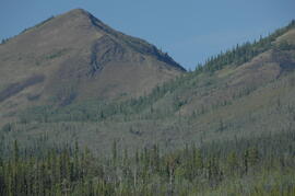
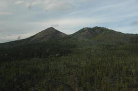
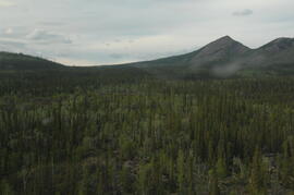
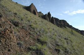
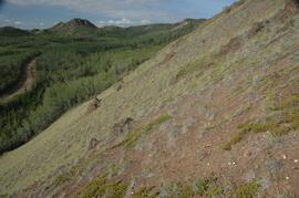
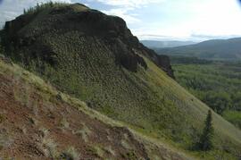
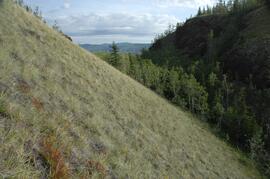
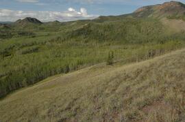
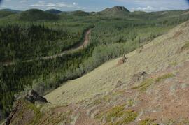
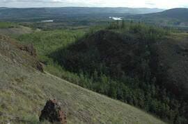
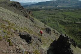
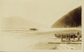
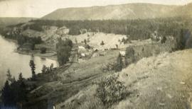
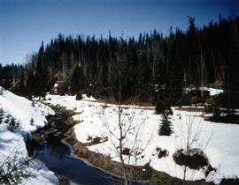
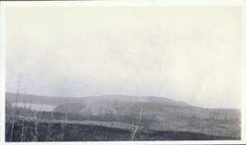
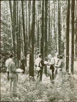
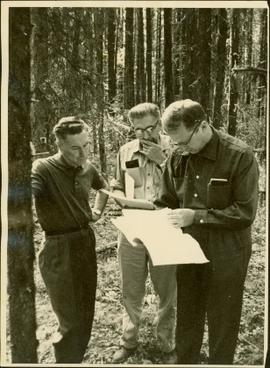
The Kluane Lake area of SW Yukon was a continuing focus of Dr. Paul Sanborn's research for more than a decade, and generated several productive collaborations. Key themes included biological soil crusts in boreal grasslands, and interactions between aeolian sediment deposition, slope processes, and fire in boreal grassland and forest soils.
Research results appeared in these publications:
Marsh, J., Nouvet, S., Sanborn, P., and Coxson, D. 2006. Composition and function of biological soil crust communities along topographic gradients in grasslands of central interior British Columbia (Chilcotin) and southwestern Yukon (Kluane). Canadian Journal of Botany 84: 717-736. https://doi.org/10.1139/b06-026
Pautler, B.G., Reichart, G.-J., Sanborn, P.T., Simpson, M.J., and Weijers, J.W.H. 2014. Comparison of soil derived tetraether membrane lipid distributions and plant-wax δD compositions for reconstruction of Canadian Arctic temperatures. Palaeogeography, Palaeoclimatology, Palaeoecology 404: 78-88. https://doi.org/10.1016/j.palaeo.2014.03.038
Sanborn, P. and A.J.T. Jull. 2010. Loess, bioturbation, fire, and pedogenesis in a boreal forest – grassland mosaic, Yukon Territory, Canada. 19th World Congress of Soil Science, Soil Solutions for a Changing World 1 – 6 August 2010, Brisbane, Australia. http://www.iuss.org/19th%20WCSS/Symposium/pdf/0120.pdf
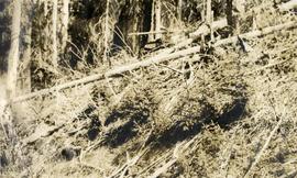
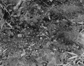
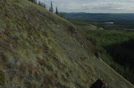
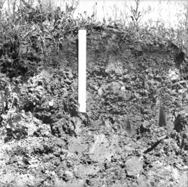
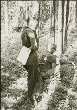
The 2003 field work with Darwyn Coxson was a pilot study to assess the types and distribution of biological soil crusts in boreal grasslands in the Kluane Lake area. Eight sites were visited at which the team sampled the crust and the uppermost A horizon immediately underneath it. Note that site numbers Y03-03, -04, -05, -06, -07, -09, -10 and -12 were indicated as sites 3, 4, 5, 6, 7, 9, 10 and 12 in Table 1 of Marsh et al. (2006). Additional crust sampling was conducted at two additional sites (“Peninsula”, “Silver City”) in 2004; details of sampling methods and site locations are in Marsh et al. (2006).
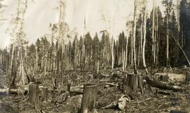
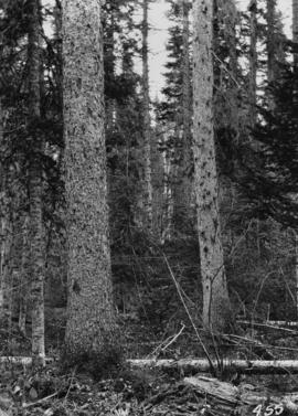
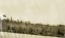
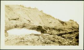
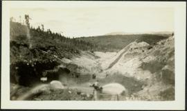
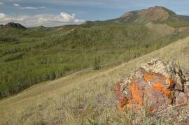
Results from 2009 field work were presented in Sanborn and Jull (2010), along with soil charcoal radiocarbon dates from 2003-2008 sampling which were used to reconstruct fire history in the Kluane Lake area. The 2003 (a single site at Silver City), 2004, and 2008 field work consisted of a reconnaissance of grassland and forest sites across a range of aspects and slope positions in order to recover buried soil charcoal.
With support from the Muskwa-Kechika Trust Fund as a Seed Grant, Dr. Paul Sanborn carried out a pilot study of soils in relation to prescribed burning in the Northern Rocky Mountains, in collaboration with Perry Grilz, then a Range Officer in the Ministry of Forests. Sanborn and Grilz conducted 3 days of field work in July 2001. Sanborn wanted to test the utility of plant-derived opal (phytoliths) as a soil indicator of vegetation history, in the hope of distinguishing natural grasslands from those created by anthropogenic burning.
While at the Ministry of Forests, Dr. Paul Sanborn carried out two retrospective studies which examined soil chemical properties at long-term silvicultural research sites where different vegetation types had been created, either as planned or unplanned experiments. These studies were Experimental Project (EP) 660 and a research project at the Archie Creek site.
Caption describing photograph: "Soil (sod) development over lacustrine deposits. Depth to carbonated layer (1922 fire) 2.5", depth to parent material 6". Note blocky structure of deposit (clay). Root penetration to 1'. Root penetration of willow and aspen to 1.5'. Blocky structure from fluctuating water table, gentle slope to land form."
Photograph depicts a view of a small village near a river, a narrow dirt road boarders the river.
Group of five miners stand in mining area on left. Woman, man, and young girl sit and stand on far right in more formal attire. Mining tools and equipment throughout.
Printed annotation on recto of photograph: "Société Minière de B.C., Atlin B.C. July 28th, 1901, A.C. Hirschfeld, No. 707".
Photograph depicts a snowy mountain landscape in the Canadian Rockies where Prentiss Gray found his prized mountain goat.
Photograph shows snow melt at Aleza Lake Research Forest in spring season.
Photograph depicts an open air work or woodshop covered with snow, surrounded by lumber and steel drums.
Item is a photograph of Ray Williston and John Liersch in a small wood area southwest of Prince George.
Item is a photograph of from left, Ralph Robbins and Jack Paine of the BC Forest Service, Ray Williston, Chief Forester for Canadian Forest Products Tom Wright, Deputy Minister of Forests Finley McKinnon, Canadian Forest Products Vice-President in Charge of Development John Liersch, and BC Chief Forester John Stokes investigating small wood in an area near Prince George.
Item is a photograph of Mr. Williston, Chief Forester John Stokes and Tom Wright of Canadian Forest Products examining an area near Prince George in order to determine the timber area required for a Pulp Harvesting License for a proposed pulp mill that would depend completely on waste wood.
Photograph depicts reeds and marsh grasses in the foreground, a beaver house at center of photograph with open water and treed shoreline in the distance.
Photograph depicts the bow of a boat in the foreground, a wide shallow channel extending beyond the boat perhaps opening to a lake beyond. Treed forest on the far shore, a lone mountain peak in the distance.