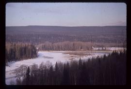
Image depicts an old log cabin with the sign "Robin Hood Flour" on it at an uncertain location. It is possibly at the 153 Mile House.
Image depicts what is possibly the Robson River.
Image depicts a river, possibly the Robson River.
Image depicts what is possibly the Robson River.
Photograph depicts Roche Myette along Davona Creek near a campsite.
Image depicts the peak of the Rocher de Boule mountain from Hazelton, B.C.
Carvings visible on a moss covered rocky outcrop. Handwritten annotation in pencil on verso reads: “Rock carvings. Copper Mountain, Al”.
Image depicts ridge-like rock formations at an uncertain location, though possibly somewhere near the Fraser River.
Photograph depicts men on river scow, large rock island or peninsula protruding into river behind them. Trees on opposite shore in background, large rock in foreground. Handwritten annotation on verso of photograph: "Grand Canyon. Fraser River. Big Rock.", on recto of copy print: "1911."
Photograph of a large crowd gathered at the McBride train station. Printed annotation on recto reads: "'Rocky Mountain Rangers Band, McBride, B.C.'"
Image depicts a heavily forested area located in the Rocky Mountain Trench, possibly near Dome Creek or Lamming Mills, B.C.
Image depicts a view of the Rocky Mountain Trench.
Image depicts the Rocky Mountain Trench from McBride, B.C.
Image depicts a view of an area somewhere near McBride in the Rocky Mountain Trench.
Image depicts the Rocky Mountain Trench from McBride, B.C.
Image depicts a view of the Rocky Mountain Trench somewhere near McBride, B.C.
Image depicts a view of McBride in the Rocky Mountain Trench.
Image depicts a view of the Rocky Mountain Trench somewhere near McBride, B.C.
Photograph depicts a Rocky Mountain vista seen across a forested plateau.
Image depicts the rocky shore of an unidentified body of water, possibly near Meldrum Creek, B.C.
Image depicts a row of houses in Upper Fraser, B.C. Map coordinates 54°06'51.6"N 121°56'26.3"W
Photograph features a sign in the middle of a field at the Royal Canadian Air Force base in Whitehorse, YT that reads: "Taking Photographs Prohibited". Handwritten photo album caption below this photo reads: "Our Authority". See also items 2006.20.12.39 & 2006.20.12.43.
Royal Canadian Air ForceImage depicts a small foot bridge at an unknown location. The slide is simply labelled "Rudi's Bridge."
Image depicts several old, ruined cars and an unknown individual in Island Cache.
Image depicts a small, ruined shed somewhere in the Okanagan Kettle Valley.
Photograph depicts a landscape shot of rushing water with a forested area in the background.
Photograph depicts two men saddling several horses.
Image depicts sand beds with a shovel present for size reference. The slide places it at the "BCR site," possibly in Prince George, B.C.
Photograph depicts creek barely visible at bottom of steep valley in cliffs. Trees and underbrush in foreground. It is believed that this photograph may have been taken near Mt. Robson. Handwritten annotation on recto of photograph reads: "Sand Creek."
Photograph depicts small log buildings and loaded wagons in cleared dirt area. Building on far left has the sign "POOL HALL" posted on front . Treetops, lumber piles, and hills in background. Mountains can be seen in distance. Handwritten annotation on verso of photograph reads: "Sand Creek. B.C."
Group of eleven men and women stands and kneels in front of fence, field and hills in background. Sarah stands fourth from left, Bert stands on far right. Handwritten annotation on recto of photograph: "Murphy's place ATLIN." Similar group also featured in items 2009.5.2.274 - 2009.5.2.294.
Sarah and Bert stand with unidentified woman in cleared area on hilltop, forest and hills in background.
Sarah Glassey stands behind woman seated on ground, lake and hills in background.
Sarah sits between four men on large tree trunk suspended over canyon in unidentified area, cliffs and hill in background. Man holing Sarah's hand on her left is believed to be a Mr. Murray, also featured in item 2009.5.2.175.
Sarah Glassey stands looking down into what appears to be a camera, forest on hillside in background.
The pair stands on grassy shore, Sarah on right. Trees, water, bridge, and opposite shore visible in background. Handwritten annotation on recto of photograph: "Sarah + Doris." Both woman are believed to be members of group featured in items 2009.5.2.274 - 2009.5.2.291.
The pair stands on grassy shore, Sarah on right. Trees, water, and bridge visible in background. Handwritten annotation on recto of photograph: "Sarah + Vi." Both woman are believed to be members of group featured in items 2009.5.2.274 - 2009.5.2.291.
Hand coloured photo of a clearing in Prince Rupert with a sawmill in the distance. Printed annotation on recto reads: "Prince Rupert, B.C. : Saw Mill Grand Trunk Pacific Railway." Artist's stamp in the lower right corner reads: "103112 J.V."
Image depicts logs being stripped of their bark at a saw mill in Prince George, B.C.
Image depicts a saw mill, possibly Lakeland Mills, with a beehive burner and numerous piles of logs in the foreground, in Prince George, B.C.
Image depicts a saw cutting a log in half at a saw mill in Prince George, B.C.
Image depicts numerous buildings at an uncertain location. A beehive burner and what appears to be a large pile of wood is visible in the background.
Image depicts a scenic view of a section of land at an unknown location.
Image depicts a scenic view of a mountain and forest at an uncertain location.
Image depicts a relatively flat section of land with hills in the distance; the location is uncertain.
Image depicts a view of a forested area and a frozen river at an unknown location.