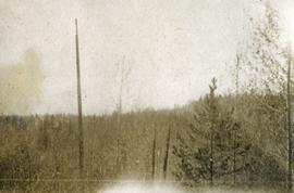
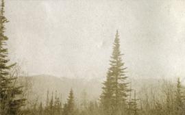
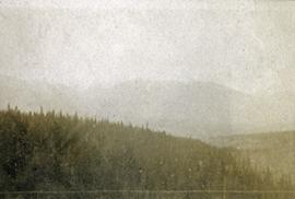
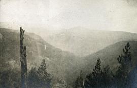
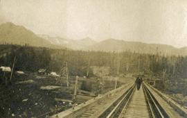
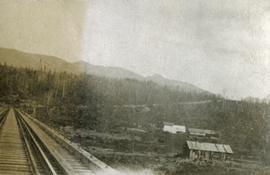
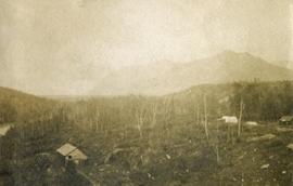
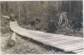
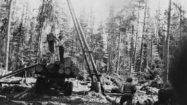
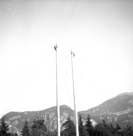
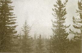
Photograph depicts tree tops and sky.
Photograph depicts a view past tree tops to a snow capped mountain range.
Photograph depicts looking beyond a treed mountain ridge to snow capped mountains in the distance.
Photograph depicts a view of a forested mountain valley, looking toward a peak.
Photograph depicts a man walking toward the photographer on a railroad track. Along side the track is newly cleared land with some building and tents. Forested hills and mountains in the background.
Photograph depicts looking down a railroad track on the left, a few scattered shanties in the right foreground, freshly cleared land, forest and a mountain range in the distance.
Photograph depicts newly cleared land with three or more buildings. Forest and mountains in the background.
Photograph depicts a view from above, looking down on the canyon. Handwritten annotation below photograph reads, "Looking down the canyon N. H. creek".
Image depicts the post office in Longworth, B.C.
Image depicts several old shacks and some railway tracks running through Longworth, B.C.
Image depicts the Fraser River and a mountain in Longworth, B.C.
Image depicts two unidentified individuals standing next to the train station, and two railway tracks running through Longworth, B.C.
Image depicts numerous piles of wood in Longworth, B.C.
Image depicts four unidentified individuals walking along the bank of the Fraser River in Longworth, B.C.
Image depicts a house surrounded by trees and a mountain in the background; it is most likely located somewhere in or near Longworth, B.C.
Slightly elevated photograph of Prince Rupert buildings. A lone vessel is visible in the background. Printed annotation on recto reads: "Courtesy of Can Nat'l Rys. Prince Rupert. B.C." Handwritten annotation on verso reads: "Dear Elma. We reached Prince Rupert (in the picture) today. Friday we arrive at Skagway and the glaciers. Having a fine trip- good weather and a good crowd. Love from Claire." Postcard is addressed to: "Mrs. Claude Millersh, River Forest, Guerneville, Sonoma Co., California." Postcard is affixed with a two cent American stamp. Postmark on verso reads: "Ketohikan Alaska. Jun 28 3 PM 1928."
Part of a set of 41 original black & white photographs [1908-1933-?]) of the Grand Trunk Pacific Railway line in BC depicting surveying crews, town sites (Prince Rupert and its port, Hazelton and Fort George), and First Nations Peoples.
Photograph depicts a lone mountain goat climbing up a rocky, striated slope.
Photograph depicts one unidentified man surveying a landscape from a snowy mountain peak with other mountain ranges in the background.
Photograph depicts a view of Lone Butte, BC. The butte formation of the same name (Lone Butte) is visible in the background; a ranch or residence is visible in the foreground. Wyness notes that Lone Butte was the "last one [they] tied in". "Tying in" is a land surveying technique. Since the photograph is dated October 1936 and Wyness described the survey trip as lasting June 5 - October 8, 1936, that implies that Lone Butte was the last location they surveyed on this trip.
Image depicts the Lone Butte Hotel in Lone Butte, B.C.
Photograph depicts a lomen planer in operation at Peden Hill Sawmill lumber yard. Other workers and stacks of timber are nearby.
Image depicts a pile of old logs on the bank of the Fraser River with mountains in the background. In the foreground, a set of railway tracks run through an uncertain location, likely Upper Fraser, B.C.
Photograph depicts a snow covered pile of logs. Handwritten annotation on verso reads: "Logs. on Railway".
Annotation on slide: "Summit Lake, March 1992".
Photograph depicts dumping logs at Gold River on the west coast of Vancouver Island.
Image depicts numerous piles of logs, and two unidentified individuals operating an excavator with a "thumb" attachment during the demolition of the Upper Fraser town site. Map coordinates 54°06'51.6"N 121°56'26.3"W
Photograph depicts a log cabin with a sod roof that was used as a cow shelter on Dot Ranch. The ranch was probably built by pioneers pior to 1900.
Photograph depicts the unloading of logs from rail cars into the Mamquam River Blind Channel in Squamish (then Newport). The valley bottom around Squamish was logged from Mamquam River north to across the Cheakamus River before the construction of the Pacific Great Eastern Railway.
Photograph depicts three men sitting on large logs on a logging truck. The men are believed to be, from left to right: unknown, Al Lassmann, Jack Phelps.
Photograph depicts logging wheels found on the Princeton to Merritt highway at Laird, Dry, or Allison Lakes.
Five logging trucks parked side by side, their drivers standing beside them. Handwritten annotation on bottom recto of photograph: "Logging Trucks - Halfway River, B.C. 1936".
Fully loaded logging truck driving along a wood plank logging road. Another road under construction is also visible through forest in background.
Photograph depicts a loaded logging truck on corduroy log road near Peden Hill sawmill. The truck has three passengers--a man and two women--sitting on top of the loaded logs. The leftmost passenger is Mrs. Fred Tesluk; Fred Tesluk co-owned the Peden Hill mill with Cornel Neronovitch. Cornel Neronovitch stands at the right of the photograph, in front of the truck.
Fully loaded logging truck driving along a switchback, wood plank logging road.
Handwritten annotation in pencil on verso reads: “Truck Logging / Giscome BC.”
Photograph taken north of Gold River, at the Tahsis Ltd. Tree Farm, on a logging road that led to Port McNiel. Crossing the Muchalat River. The bridge was disused and blocked off.
Typed caption glued to album page directly below photograph reads: "41. Looking South from Block 171 Nechac[k]o River at a distance & logging operations south of Fort Fraser." Photograph depicts a cleared section of land in foreground and a wooden building and three tents situated beside the Nechako River in midground. Photographer: Dominion Stock & Bond Corporation.
Photograph depicts logging on a side road on the Sechelt Peninsula about 2 miles southeast of Halfmoon Bay.
Photograph depicts a logging museum in Ladysmith on Vancouver Island.
Photograph depicts logging equipment at Koksilah Station, 2 miles south of Duncan, on the Esquimalt and Nanaimo Railway on Vancouver Island. The view is looking south.
Photograph depicts a primitive logging caboose. Believed to have been built by or for the Esquimalt & Nanaimo Railway in 1898.
Photograph depicts a logging bridge over Lois River between Saltery Bay and Lang bay, south of Powell River.
Image depicts an area undergoing logging somewhere in Prince George, B.C.
Image depicts a logging area somewhere near Prince George, B.C.
Photograph depicts two men using a gin pole, winch and jammer to load raw logs onto a logging truck, likely near Peden Hill sawmill.
Photograph depicts a logger's sports competition held in Squamish.