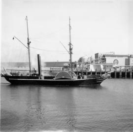
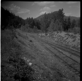
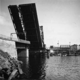
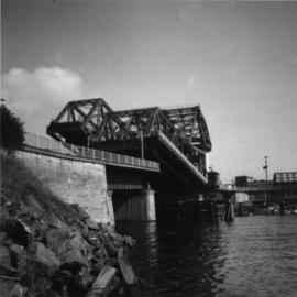
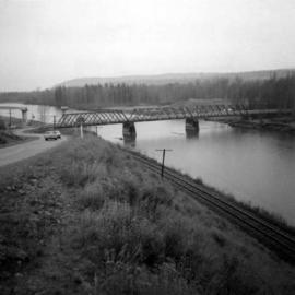
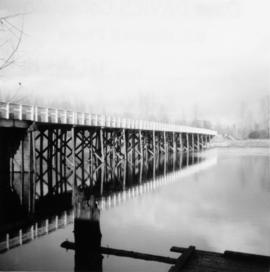
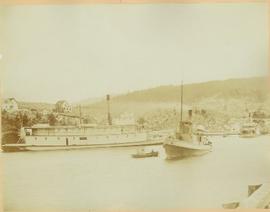
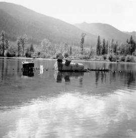
Photograph depicts a lake steamer called "Proctor" which ran from the CPR rail terminal to Trout Lake City.
Photograph depicts a replica of the "SS Beaver" entering the Inner Harbour of Victoria.
Photograph depicts a replica of the S.S. Moyie built and photographed at Burrard Shipyard & Marine Ways Ltd. on 1729 West Georgia St., Vancouver. It was launched on June 15, 1965.
Photograph depicting a residential building surrounded by trees in an unknown location.
Photograph depicts a restored 1929 Ford.
Photograph depicts a restored pump car outside a pub on Permbeton Avenue, North Vancouver.
Photograph depicts a train passing over restored track after a derailment in Savona.
Photograph depicts a retired Courtenay fire engine in front of a private house on the south side of the road from Lantzville to Hammond Bay, about 3 miles east of Island Highway.
Postcard depicts the Revelstoke Railway Museum. "Take a run down the track of Canadian History at the Revelstoke Railway Museum, located in the beautiful Columbia Valley. Museum exhibits trace the pople and events involved in the development of the CPR. Highlights include Steam Locomotive 5468 and a unique gift shop."
Consists of 165 black and white photographs depicting Northwest Coast communities including Bella Bella, Rivers Inlet, Port Simpson, and Prince Rupert between approximately 1900 and 1920. Also includes postcard images of ships and boats on the North Coast belonging to the Large family, from Reverend Large's son Dr. R.G. Large. Also includes 39 colour slides ca. 1960 of ship scenes and weather balloon launches from the Dr. R.G. Large family.
Large, R.W., Rev.Photograph depicts the Rhone CPR depot located at mile 24.8 on the Carmi Subdivision. There was no evidence of station buildings at any time, and it just had a passing point and some track maintenance shanties. The view is looking north.
Photograph depicts sternwheeler, smaller boat, and canoe in foreground. Second sternwheeler named the 'Caledonia' can be seen anchored to shore in background. Town buildings stand on hill in background. Photo believed to have been taken in Port Simpson, B.C.
Image depicts a ferry on a river, possibly the Fraser River in the Lillooet area.
Photograph depicts tree-covered cliffs on opposite shore, river in foreground.
Water and dock in foreground, trees and cliffs in background.
Handwritten annotation on verso “’Boat Hammond at South Fort Geroge”.
Lofty view of stern wheeler in river, snow capped mountains in background. Printed annotation on recto reads: “R.M.S. B.C. Express in Upper Canyon Fraser River.”
Postcard image of RMSS "BC Express" in Grand Canyon, Fort George
Image depicts a road with what appears to be a junkyard to the right of the image, likely located somewhere in Seton Portage, B.C.
Image depicts a mountain located somewhere along the Skeena River, and a road alongside it.
Photograph depicts the road and rail bridges at New Westminster, BCView is from the north and facing upstream.
Photograph depicts a car parked on the road between Kaslo and New Denver, on the site of a former railway right-of-way.
Photograph depicts the road bridge crossing the south section of the north arm of the Fraser River at Fraser St. The view is from the north bank of Lulu Island.
Photograph depicts a road bridge at Squamish B.C., looking north onto the road leading into the village.
Photograph depicts a road bridge at Squamish B.C. from the north bank.
Photograph depicts a bridge for road vehicles. Also visible is a single track of the CPR that went from Esquimalt to Nanaimo.
Photograph depicts a bridge for road vehicles. Also visible is a single track of the CPR that went from Esquimalt to Nanaimo. Both were opened to allow a large tug to proceed seawards.
Photograph depicts the road bridge crossing over the Kootenay River at Fort Steele, 10 miles northwest of Cranbrook, looking downstream. Two piers of a new bridge can be seen behind the present one. The railway is from Golden to Fernie and built in approximately 1913.
Photograph depicts a road bridge that led from Fort Langley to a ferry slip on an island.
Photograph depicts a road bridge in Quesnel.
Photograph depicts the road bridge over Toby Creek, just north of Invermere or 75 miles north of Cranbrook, looking at upstream piers.
Photo depocts a road bridge in the Inner Harbour of Victoria.
Photograph depicts a road crossing somewhere on the "loops" on the Princeton to Jura line. Looking downgrade at a loop.
Photograph depicts the uppermost crossing before Jura. Davies noted that though it was not listed on any timetable, it was believed that there was a waiting shed on the left side of the track beyond the road. Note the generous width of the railway property beyond the road that was possibly for putting in a level spur.
Photograph depicts the uppermost crossing before Jura.
Photograph depicts a road crossing leading to the Forestry Department campsite at the south end of Hydraulic Lake. The location is about 1 mile south of McCulloch depot or at about mill 75.5, on the Carmi Subdivision. The rail here is 85 lbs. and dated 1940. The view is looking west.
Photograph depicts a road crossing somewhere on the "loops" on the Princeton to Jura line.
Photograph depicts a road roader at work doing black top patching and that belonged to the Pavements Department of the City of Vancouver. Built by Aveling Barford Ltd., Grantham, Lincs, England.
Image depicts the dirt road leading to Keithley Creek.
Image depicts a road leading to Prince Rupert, B.C.
Image depicts the road to Skagway, Alaska. Possibly located on the Klondike Highway in British Columbia with Tutshi Lake on the left.
Photograph depicts a road trestle bridge for cars about halfway between south Wellington and Nanaimo Lake, southwest of Nanaimo.
Photograph depicts road vehicles parked outside of the CPR depot in Salmon Arm.
File consists of documentary photographs taken by David Davies of horse drawn vehicles in British Columbia.
File consists of documentary photographs taken by David Davies of motorized vehicles in British Columbia.
Photograph depicts the making of a rock cut on the Pacific Great Eastern Railway line at the Lillooet end of Seton Lake during railway construction.