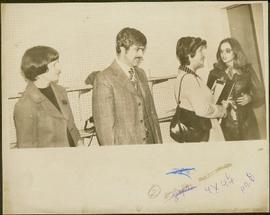
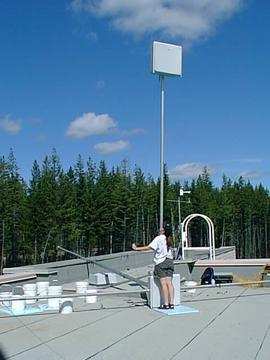
Campagnolo holds clipboard.
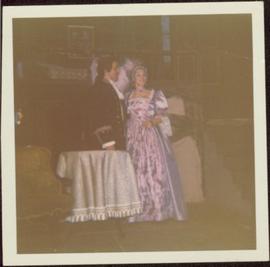
Costumed gentleman standing next to lady wearing a formal purple gown. Handwritten annotations on verso read: “To Angie, Love Donna Penner,” and “another of costumes I made”.
Preceding notation on UNBC Chancellor letterhead: “my theatre days, Ionasphere group. I made personally or designed (for Blue - Rosemary Gilbert) all these costumes, May Diver - Mary Stuart by Friedrich Von Schiller, 1972” (see also items 2009.6.1.11 - 2009.6.1.17).
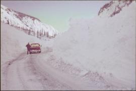
Man stands beside pickup truck on highway, hills in background.
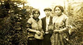
Photograph depicts Jack standing between two women. The women are wearing woven baskets, berry bushes are in the background. Handwritten annotation below photograph reads, "Berry pickers also Jack".
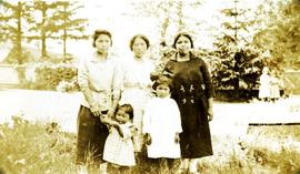
Photograph depicts three women and three girls, possibly in Nass Harbour Handwritten annotation below photograph reads, "Native ladies".
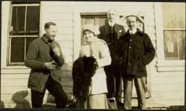
Photograph depicts a woman holding fur, standing beside three men on steps to unidentified building. Door and windows in background.
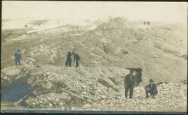
Photograph depicts a woman in long coat and hat, standing with men in front of what appears to be a glacier. Four other individuals can be seen in distance on glacier.
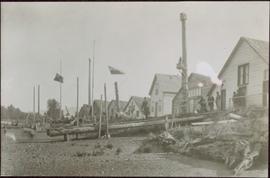
Shoreline perspective of an unidentified coastal village situated on B.C.’s north coast. European style houses run parallel to a rocky shore. Seven men and one child stand within this frame and totem poles and a mortuary pole are also visible along the shoreline.
Part of a set of 41 original black & white photographs [1908-1933-?]) of the Grand Trunk Pacific Railway line in BC depicting surveying crews, town sites (Prince Rupert and its port, Hazelton and Fort George), and First Nations Peoples.
Photograph consists of an old wagon and another unidentified piece of old equipment in a grassy field.
Unknown buildings can be seen in background.
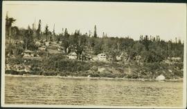
Photograph depicts many buildings among forest trees on hillside of opposite shore. River in foreground.
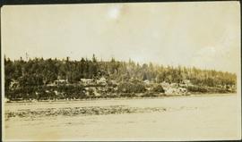
Photograph depicts many buildings among forest trees on hillside of opposite shore. River in foreground.
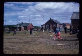
Photograph depicts baseball game, batter in mid-swing,and buildings visible in background. Handwritten annotation on recto of mounted slide reads: "Base ball game in Lejac". See also items 2006.20.1.199 - 2006.20.1.202 for images featuring similar content.
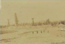
Four women and one child stand on shore in foreground. Village buildings and totem poles (crest poles?) stand in background against forest.
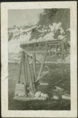
Photograph depicts bridge construction approaching unidentified river on opposite shore, unfinished pier in foreground. Steep riverbank in background.
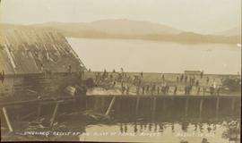
Photograph of a half-demolished building attached to a large dock. A large group is milling around the damage. Debris litters the water. Annotation on recto reads: "Undesired result of big blast at Prince Rupert. August 13 1908. Allen Photo."
Photograph depicts the same person who owned the service station building electric generator house in Trout Lake. He also built an undershot water wheel that was driven by Lardeau Creek.
File contains images depicting the underground mine at Cassiar, showing structural damages, repaired damage ground support, and mining and repair processes.
The file contains a photo inventory entitled “Underground Mine Structural Inspection, Rock Mechanics Dept. Foto Documentation” with a complete file inventory linking the picture number to a location, title, and dated film. This photographic documentation was assembled for the purposes of liaising with a underground mining consultant located in South Africa.
- Images document structural ground support including steel cables, support arches, metal mesh, shotcrete, rockbolts, wooden beams.
- Images show ground support damaged through ground movement, but some depict newly installed or repaired support.
- Images depict ventilation ducting that was crushed or torn.
- Mining processes depicted include miners installing a rock breaker, miners paving the adit floor with concrete, miners inspecting a damaged section of mine, miner loading drill or blastholes with ANFO (ammonium nitrate / fuel oil mixture) explosives, and long hole drilling.
- Technical elements of the underground mine depicted include a mining device and ore in a chute (annotated ‘1290 crusher’), the conveyor, ‘LH drill’, ore processing machine annotated ‘1350 breaker’, and an electrical box titled ‘Weighometer’.
- Specific locations shown include ore draw points, ore passes, access drifts, a hatch and door titled “Fuel station 1415”, and a dead end drift with a stack of equipment and an orange cable annotated “1335 access electrical stations”.
This file contains various aspects of the underground mine.
- Photos depicting damage to the underground mine such as fallen rocks, cracked shotcrete, twisted rock bolts and metal mesh, exposed and damaged steel structural frames, and repairs underway.
- Steel cables, chains, support arches, and custom welded rebar frames used in the structural reinforcement of the underground mine.
- Several engineering tests related to the structural damages are depicted.
- Two sets of images show a Porta Power hydraulic tool with a ready rod attached, a hand pump, as well as images of a technician testing the holding power of a rock bolt.
- Set of images documents a technician drilling cores and installing extensometer anchors, as well as grouting the anchors and connecting an extensometer. Technicians are shown inspecting damages with a ruler and rockhammer for scale.
- A set of images showcase the threaded rebar, nuts, and face plates used for rockbolts.
- Utility vehicles, yellow vent ducting, and utility pipes are visible in several images.
- Also include is an image of a man in office space, foggy night scene with a telephone pole, office desk, stack of supplies including concrete, steel cable, and spray paint, and several images of a broken piece of ore and concrete outside the mine portal.
- Several images depict miners working in the bucket of a scoop tram.
- Photos of the stramler feeder breakers, which was used in the underground mine.
- Images of ground support verifications where the deficiency of the exhaust ramp was investigated. This collection has various annotations explaining the broken shotcrete and the wire mesh installed.
- A collection of photographs depicting tunnel shotcrete failures. Each photograph has an accompanied textual annotation.
- Photos of MMD #750 Sizer equipment - assumed used in Underground Mine.
- Photos of pump used in 1335 level, wheel fan for ventilation removed from 1350 level,
- A collection of ground fall event 29 March 1989 - with annotations depicting damage
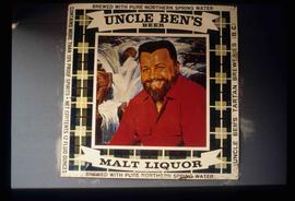
Image depicts an advertisement for an "Uncle Ben's Beer Malt Liquor" in the Willow River General Store. Map coordinates 54°04'23.7"N 122°28'26.9"W
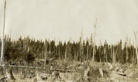
Original photographic print included in "Northern Interior Forest Experiment Station: Report of Preliminary Investigations" by Percy Barr.
File consists of photographs taken by Paul Sanborn during the May 9, 2002 UNBC/UBC Aleza Lake Research Forest Field Tour for UNBC and UBC faculty members.
The item is an exterior photograph of a stairwell in one of the outside courtyards at the University of Northern British Columbia, Prince George.
File consists of photographs of UNBC Visitors. Includes images of astronaut Roberta Bondar (1992), Gordon Wilson (1992), Timothy Findley (1993), and Yevgeny Yevtushenko.
The item is a photograph depicting nine UNBC students and a professor listening to a man discussing the train tracks they are standing next to. Students and professors are part of a research project in the Upper Fraser region.
The item is a photograph depicting six UNBC students looking over a bridge. Students are part of a research project in the Upper Fraser region.
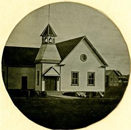
The item is a photograph depicting sixteen UNBC students and professors walking in front of an old wooden building and weathered church. Students and professors are part of a research project in the Upper Fraser region.
The item is a photograph depicting four students eating lunch on a log. Students are Gail Foudahl, Tracy Summerville, Greg Halseth, and Anita Buljevic. Attached note with photograph states, "Student Anita Buljevic - Xmas 99, Gail Foudahl, Tracy Summerville, Greg Halseth."
The item is a photograph depicting UNBC students and professors walking away from the photographer. Students and professors are part of a research project in the Upper Fraser region.
The item is a photograph depicting nine UNBC students an old, weathered church. Students and professors are part of a research project in the Upper Fraser region.
File consists of notes, clippings, and reproductions relating to research of the Upper Fraser as part of the UNBC Upper Fraser Historical Geography Project. Includes photographs depicting students and professors researching in the Upper Fraser region (Dec. 1999).
File consists of photographs of UNBC Temporary Library 1992.
Photographs depict temporary Library facilites, patrons and staff.
Photographs depict UNBC temporary facilites [7 contact sheets of 15 images].
Photographs depict UNBC temporary facilites.
File consists of photographs of UNBC Sign Unveiling Sept 1993.
File consists of photographs of UNBC in September 1998. Includes images of: Learning Skills Centre Tutors; Student Success week; Volleyball; Northern Backyard BBQ IV; Jane Young on Hemp Research; Pacific Western Brewing donates Computer Lab; Liberal MPs Visit; Student Tara Brett; and the unveiling of gathering of the clans mirror in the library.
Fonds consists of maps, plans, and drawings collected by faculty in the UNBC School of Planning and Sustainability. The majority of these maps reflect the planning history of the City of Prince George and include large format, hand-drawn plans created by the City Planning Department from the 1970s and 1980s. Maps from City of Prince George Official Community Plans are also included.
File consists of photographs of the UNBC Scholarship Ceremony on 23 Jan. 2004.
File consists of photographs of the UNBC Scholarship Ceremony on 23 Jan. 2004.
File consists of photographs of the UNBC Scholarship Ceremony.
File consists of photographs of the UNBC Scholarship Ceremony.
File consists of photographs of the UNBC Scholarship Ceremony.
File consists of photographs of UNBC Scholars on 23 Jan. 2004.
