Image depicts an old, boarded up hotel in Stewart, B.C.
Image depicts an old house with a torn up roof. The location is uncertain.
Image depicts an old house missing windows and doors at an uncertain location.
Image depicts an old house in Penny and a woman, possibly Sue Sedgwick, standing in front of it. The location is uncertain.
Image depicts an old house missing windows and doors in the foreground, and a bunkhouse in the background, in Sinclair Mills, B.C. Map coordinates 54°01'17.4"N 121°40'53.0"W
Image depicts what appears to be an old mill at an unknown location.
Photograph depicts bulldozers, car, and fuel tanks in front of two-door garage on edge of mine area. Unidentified machinery can be seen behind garage. Mine valley crosses midground, western mountain range in background. What appears to be framing measurements are annotated on verso.
Image decpicts the old road to the townsite in Giscome, B.C. Map coordinates 54°04'19.7"N 122°22'04.7"W
Image depicts an old slump type of landslide. The slide labels it as being near "McAlister."
Image depicts an old trestle along the White Pass railway.
Image depicts an old trestle along the White Pass railway, and the White pass Train on the left of the image.
Image depicts a bridge over the Omineca River near Germansen Landing, B.C.
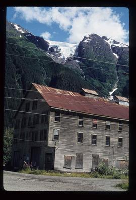
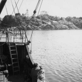
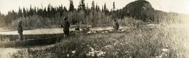
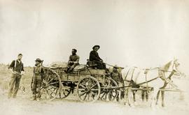
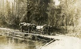
File consists of research material relating to the Omineca Gold Rush which was a gold rush in British Columbia in the Omineca region of the Northern Interior of the province. Gold was first discovered there in 1861, but the rush didn't begin until late in 1869 with the discovery at Vital Creek. There were several routes to the goldfields: two were from Fort St. James, one of which was a water route through the Stuart and Tachie Rivers to Trembleur Lake to Takla Lake and the other was overland, called the Baldy Mountain route. A third route came in overland from Hazelton on the Skeena River and a fourth route used the Fraser River and crossed over the Giscome Portage to Summit Lake, through McLeod Lake, and up the Finlay River to the Omineca River. Materials include one large photograph from the BC Provincial Archives of Machanry of the SS Enterprise at Tremblay Lake in June 7th, 1913. Other materials include newspaper clippings and two photographic negatives of the machinery of the SS Enterprise.
Image depicts Haida Gwaii.
Image depicts an unknown individual in a canoe on Indianpoint Lake.
Image depicts four individuals canoeing on Lanezi Lake.
Image depicts two individuals canoeing on Lanezi Lake.
Photograph depicts a view near Nootka, looking north towards Bligh Island. Photo taken from the M.V. Uchuck III.
Photograph depicts a view of Friendly Cove, near Nootka, on the west coast of Vancouver Island. View is taken from the M.V. Uchuck III.
Image depicts several individuals walking on a trail somewhere near Raven Peak.
Image depicts a view of Takla Lake.
Image depicts a view of Takla Lake, "looking north-west."
Image depicts a view of Takla Lake, "looking south-east."
Image depicts a mountain and Takla Lake.
Image depicts the "north-west arm" of Takla lake.
Image depicts the "west arm" of Takla Lake.
Image depicts a cabin on the "west arm" of Takla Lake.
Photograph depicts three boats on the edge of a small river. Two men attend each boat. Wild grasses with a skiff of snow in the foreground, river, forest and a low forested bluff in the background.
Front view of two men sitting on a pile of supplies with a mountain in the background. Printed annotation on recto reads: "On the Divide Enroute to Naas #96."
Photograph depicts several men standing on the river bank. Possibly A.H. Holland in center of photo.
Photograph depicts five men with a loaded wagon, pulled by a team of two horses.
Photograph depicts four men with a loaded wagon, pulled by a team of two horses. The wagon is approaching a small bridge on a dirt road. There is a forest in the background, a small stream in the foreground.
Photograph depicts two canvas tents set up near the shore of a small lake or stream. There is a wooden structure on the opposite side of the water. Rough cleared land in the foreground, forested hills and low mountains in the background.
Photograph depicts thickly forested area.
Image depicts a lake somewhere along what is possibly the Atlin Road to Atlin, B.C.
Photograph depicts man (presumably A.H. Holland) with survey pole standing next to loaded pack horse.
Photograph depicts a man standing on the edge of a trail looking to the treed hills in the distance.
Image depicts an open field and numerous buildings, including a church in Giscome, B.C. Map coordinates 54°04'03.2"N 122°22'04.6"W
Image depicts a field in Giscome, B.C. On the right side of the image, in the background, is a grey strip that appears to be a mine, possibly the quarry at Eaglet Lake in Giscome, B.C. Map coordinates 54°03'52.9"N 122°22'10.0"W
Image depicts an open field and Giscome, B.C. in the background. Map coordinates 54°03'52.9"N 122°22'10.0"W
Image depicts an open mining pit at an uncertain location; it is possibly Gibraltar.
Photograph depicts grassy vegetation, open range land.
Photograph depicts a muddy road in the middle of open range land with low treed hills in the distance.
Photograph depicts a large corral surrounded by open range with low hills in the distance.