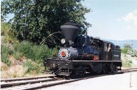
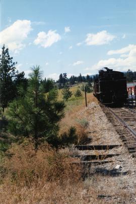
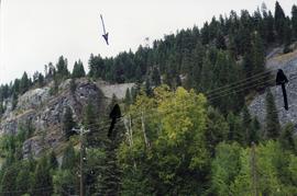
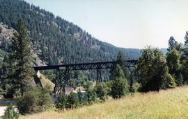
Postcard depicts Kicking Horse Canyon, Field, BC on the CPR line.
Postcard depicts Kicking Horse Canyon in the Canadian Rockies.
Postcard depicts the Kicking Horse Canyon. As seen from the Golden-Field Highway. Along the CPR line.
Postcard depicts Kicking Horse Canyon.
Image depicts a van on a narrow road, likely the Kettle Valley Trail.
Image depicts a woman walking along a trail somewhere in Kettle Valley, B.C.
Photograph depicts a home built open car of the Kettle Valley Steam Railway.
Photograph depicts a locomotive belonging to the Kettle Valley Railway Heritage Society in Summerland.
Photograph taken at the temporary upper terminus at the Prairie Valley station (near the Rodeo Grounds). The tourist train originally started with 4 kilometers of track, but in September 1996, it increased to 10 kilometers by continuing past Summerland to the Rodeo Grounds. Turn-around siding was also installed beyond the new terminus. The first train went over the new track on August 22, 1996. Summerland was down grade to the right of the photo.
Photograph depicts a shay rounding around its train at the temporary south terminus at Canyon View Road Crossing, 200 yards from Trout Creek Bridge.
Photograph taken from a grade crossing that went into the Rodeo Grounds in Summerland. Locomotive belonged to the Kettle Valley Railway Heritage Society.
File consists of documentary photographs taken by David Davies of the Kettle Valley Railway line from Merritt to Midway, British Columbia.
File consists of documentary photographs taken by David Davies of Kettle Valley Railway equipment found in Brookmere, British Columbia.
Image depicts a view of Kettle Valley, with a bridge of the old Kettle Valley Rail Road visible on a slope.
Image depicts a woman walking along the trail of the Kettle Valley Rail Road.
Image depicts the trail of the old Kettle Valley Rail Road.
Image depicts a man standing on the old Kettle Valley Rail Road.
Image depicts the old Kettle Valley Rail Road.
Image depicts several unknown individuals standing on the old Kettle Valley Rail Road.
Image depicts the Okanagan Kettle Valley, with the Kettle Rail Road faintly visible among the trees
Image depicts the trail of the old Kettle Valley Rail Road.
Image depicts a woman standing on the old Kettle Valley Rail Road.
Photograph taken at Kettle River Bridge. Immediately on the far side of the river, the track did a sharp turn to the side of Christina Lake.
Photograph taken at the Kettle River Bridge on the former Boundary Subdivision about 12 miles due east of Grand Forks. Visible is a deck truss and dock plate girder spans that were believed to have originally a covered bridge.
Photograph depicts ore haul truck at dump in mine, driver visible, mountain range in background. Handwritten annotation on recto of photograph: "Kenworth - Model 802 dumping stripping waste at 6565 Elevation", on verso: "1961".
Image depicts a boat dock on the Nechako Reservoir at Kenny Dam.
Image depicts a boat on the Nechako Reservoir at Kenny Dam.
Photograph taken on the Kelowna "main" line, which was perhaps half of a mile south of the Lumby Junction on the very outskirts of Vernon.
Photograph taken at the Kekuli Bay Provincial Park and boat launch. Image captures the view of all 25 speeders on an Okanagan tour of "Motor Car Operators West" (a U.S. group with western Canadian additions). On this segment, Davies travelled in the fifth speeder from the front.
Photograph taken at the Kekuli Bay Provincial Park and boat launch. On the speeder meet, there was always a semi-official photograph of the whole group and this was the selected spot. Here, no power boats could take the see-saw.
Image depicts a blue truck and a camper in the wooded area surrounding the townsite of Keithley Creek, B.C.
Image depicts the townsite of Keithley Creek, B.C.
Postcard depicts Kamloops station at about 1895.
Photograph depicts Kamloops Auxiliary car #3. CN #54960 visible on the repair track after its roof renovation was completed.
Photograph depicts siding at the Kalamalka flag stop.
Photograph taken on the shores of Kalamalka Lake.
Photograph taken at the Kalamalka flag stop and siding that took up to 40 cars. A section house used to exist there, Davies notes. Virtually there was no public access in former days, so the siding was most likely used as a storage place for Kelowna fruit. A private speeder is found in the shadows on the main line.
Photograph taken at the station in Jura. Depicts a waiting shack that used to be around the bend on the left side of mile 60.1. Until the 1970s, there were three tracks at the location. Track on the left side was the running line. Middle trackage was passing siding, while track on the right (lifted at the time the photograph was taken) was a spur/siding that held 33 cars. The helper locomotives were from Princeton, but were being disengaged in Jura.
Photograph taken at the station in Jura. Looking towards the beginning of a passing loop in Jura.
Postcard depicts the junction of Fraser River and Thompson River, near Lytton, BC
Boat floats close to shore in foreground, forest and hills on opposite shore in background. Joyce is the daughter of Bertha and W.E. Collison, and the granddaughter of Marion and Archdeacon W.H. Collison.
Handwritten annotation on verso reads: "Upper Nass River Sept. 1933. Joyce with Tom Moorhouse & the medical officer".
Photograph depicts the joint CPR and CN depot at Vernon. The depot office had three employees working inside. Vernon is at mile 46.2 from Sicamous, on the Okanagan Subdivision of the CPR. It has daily way freight.
Photograph depicts the joint CPR and CN depot at Vernon. It shows a general view of the trackage, opposite the former depot, which is now attractively used for other purposes. The caboose on the left is CP # 437369, built in July 1949, and fairly recently painted.
Photograph depicts the joint Car and Cn depot at Vernon. The photo shows CPR caboose #437369, which was built in July 1949. It is used on a regular basis for local freights.
Photograph depicts part of the Vernon yards just south of the principal round crossing. A box car without wheels on a sunken warehouse spur is visible.
Photograph depicts a daily freight car and a few CPR locomotive switching cars.