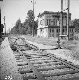
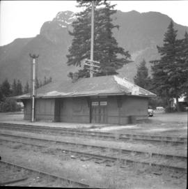
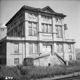
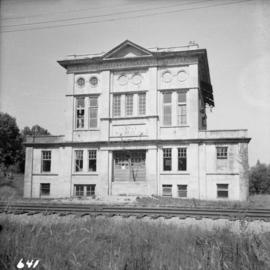
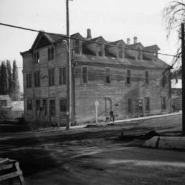
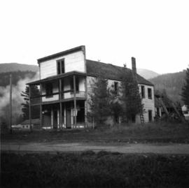
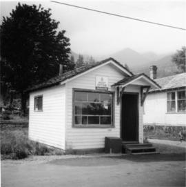
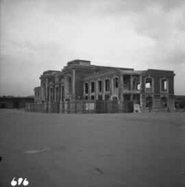
Photograph depicts the demolition of a Great Northern Railway depot in Vancouver.
The item is a photograph depicting the demolition of a house on 12th Avenue to make room for the Parkwood commercial area.
The item is a photograph of the rubble created after the demolition of Parkwood Mall in Prince George. The Bay can be seen in the background.
The item is a photograph of various people gathered for the demolition of Parkwood Mall.
The item is a photograph of the cleared lot on 15th Avenue and Victoria Street, Prince George.
The item is a photograph of the demolition of Parkwood Mall on 8 April 1997.
Photograph depicts the Department of National Defence Armoury headquarters of the British Columbia regiment.
Photograph depicts a depot and derelict electricity substation at Coghlan, 9 rail miles east of Langley, looking west.
Photograph depicts a derelict barn displaying frame construction.
Photograph depicts a derelict building in Ladysmith on Vancouver Island built approximately between 1900 and 1905.
Photograph depicts a possibly derelict hotel in Slocan City, 25 miles northwest of Nelson. Slocan City was once famous for its silver, lead etc. mines.
Photograph depicts a derelict building on the old Main St in Slocan City, northwest of Nelson.
Photograph depicts the derelict CPR depot at Hope, part of the former Kettle Valley line. A spur of about 3 miles still exists between the Odlum junction with the main line on the north side of the Fraser River and this depot, and continues southeast to a point near the CNR. It is not abandoned, but little used. The Hope yard has a 47 car capacity.
Photograph depicts the derelict electricity station of the B.C. Electric Railway at Cloverdale.
Photograph depicts a derelict substation on the B.C. Electric Railway at Coghlan, 9 rail miles east of Langley. Though marked "Langley", the building is sited as stated.
Photograph depicts the derelict Langham Hotel at Kaslo, B.C. on Kootenay Lake.
Photograph depicts a derelict locomotive shed at Union Bay on Vancouver Island. It is a Canadian Colliery Resources Ltd. shed, last used 15 Aug. 1960. Operations finished that day and disposal of all the equipment followed.
Photograph depicts a derelict shop on what was the Main St. of Slocan City.
Photograph depicts the Deroche post office that was well patronised for mail and newspaper distribution.
Photograph depicts a deserted cabin on the Indian Reserve above the PGE track at the northwest corner of Seton Lake. It probably had been occupied up until the last 5 years.
Photograph depicts a deserted cannery at Nootka, on west Vancouver Island.
Image depicts a dilapidated house in Sinclair Mills, B.C.
Image depicts two dilapidated houses in Sinclair Mills, B.C.
The photograph depicts a dilapidated log cabin in a forest during autumn.
Image depicts an old house for sale surrounded by overgrown bushes in Upper Fraser, B.C. Map coordinates 54°07'15.0"N 121°57'02.0"W
Image depicts an old building with a sign labelling it as a "Dining Lounge," it is possibly in Prince Rupert, B.C.
Photograph depicts group of nine men standing on lawn in front of building known as "House 130" or "Director's Lodge". Left to right: Andre Beguin, unknown, Charles Rainforth Elliot, Jack Christian, W. Harold Connell, Plato Malezemoff (from Newmont Mining), Tam Zimmermann, Ken A. Creery, Fred Martin Connell. Daffodils and tulips planted in foreground, trees and mountains in background. Most men featured in photo are believed to be members of Cassiar's Board of Directors; Beguin was a General Superintendent.
Photograph depicts group of eight men standing on lawn in front of building known as "House 130" or "Director's Lodge" (see item 2000.1.1.3.19.88). Left to right: Nick Gritzuk, Charles Rainforth Elliot, Jack Christian, W. Harold Connell, Plato Malezemoff (from Newmont Mining), Tam Zimmermann, Ken A. Creery, Fred Martin Connell. Daffodils and tulips planted in foreground, trees and mountains in background. Most men featured in photo are believed to be members of Cassiar's Board of Directors.
Photograph depicts group of eight men standing on lawn in front of building known as "House 130" or "Director's Lodge". Left to right: Nick Gritzuk, Charles Rainforth Elliot, Jack Christian, W. Harold Connell, Plato Malezemoff (from Newmont Mining), Tam Zimmermann, Ken A. Creery, Fred Martin Connell. Elliot appears to be comparing height with Gritzuk. Trees and mountains in background. Most men featured in photo are believed to be members of Cassiar's Board of Directors.
Photograph depicts group of eight men standing on lawn in front of building known as "House 130" or "Director's Lodge". Left to right: Nick Gritzuk, Charles Rainforth Elliot, W. Harold Connell, Jack Christian, Fred Martin Connell, Ken A. Creery, Plato Malezemoff (from Newmont Mining), Tam Zimmermann. Gritzuk appears to be pointing at photographer. Trees and mountains in background. Most men featured in photo are believed to be members of Cassiar's Board of Directors.
Photograph depicts group of eight men standing on lawn in front of building known as "House 130" or "Director's Lodge". Left to right: Nick Gritzuk, Charles Rainforth Elliot, W. Harold Connell, Jack Christian, Fred Martin Connell, Ken A. Creery, Plato Malezemoff (from Newmont Mining), Tam Zimmermann. Trees and mountains in background. Most men featured in photo are believed to be members of Cassiar's Board of Directors.
Photograph depicts group of eight men standing on front steps of Cassiar's Main Office building. Top, left to right: Ken A. Creery, John Drybrough. Middle, left to right: John E. Kennedy, Tam Zimmermann. Bottom, left to right: Fred Martin Connell, George Washington Smith, W. Harold Connell, Charles Rainforth Elliot. Windows and doors to office in background, flowers in bottom right foreground. Photo believed to have been taken on the same day as items 2000.1.1.4.3.4 - 2000.1.1.4.3.6.
Photograph depicting a dirt field surrounded by green trees.
Image depicts a dirt road and a possibly abandoned building at an uncertain location.
Photograph depicting a dirt road winding between grass and trees in Soda Creek.
Photograph depicts dirt tracks in a field in front of a body of water.
File contains slides depicting areas around the Discovery Passage.
Photograph features Terrace Gardens.
Photograph depicts settlement across frozen lake. Trees cross midground, mountains stand in background. Handwritten annotation on verso of photograph reads: "Distant view of Tete Jaune B.C.", on recto of photograph: "I marked about where you loaded your boat the telephone pole is down the road toward 53. Tete Jaune Mile 52."
Photograph depicts a disused cabin that was perhaps abandoned in the late 1950's.