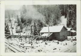
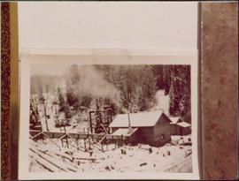
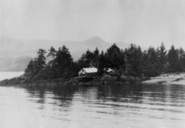
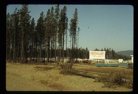
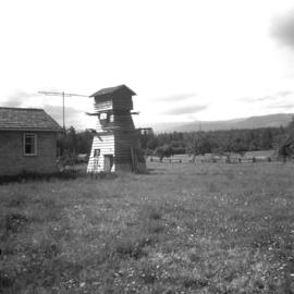
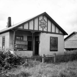
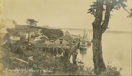
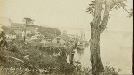
Image depicts an old building which has collapsed into a pile of wood, possibly in Quesnelle Forks.
Image depicts numerous abandoned and ruined cabins at Quesnelle Forks.
File contains slides depicting Quesnelle Forks, B.C.
Image depicts numerous old and ruined cabins in Quesnelle Forks.
Photograph depicts two wooden buildings in a snow covered forest environment. Photo is adhered to paper backing, upon which handwritten annotation on recto reads: “Quesnelle Quartz mining Company Hixon, B.C. Taken in mid nineteen thirties. Powerhouse from rear. Present day (1973) logging road would run through powerhouse at immediate rear of it at which you are looking. Tom Marsh Box 156 Squamish BC V0N 3G0 December 1978”
Photograph depicts two wooden buildings in a snow covered forest environment. Photo is adhered to paper backing, upon which handwritten annotation on recto reads: “Quesnelle Quartz Mining Co. Hixon BCTaken in mid 1930ies. Power house from rear. Present day (1973) Logging road would run through powerhouse at immediate rear of it at which you are looking. Tom Marsh Box 150 Squamish BC 1978.12”
Annotated overview of the Quesnel Quartz Mine Camp, with buildings numbered and a corresponding legend provided. Annotation on recto of photograph states: "1. BRIDGE OVER CREEK 2. BLACKSMITH SHOP 3. POWEROUSE 4. HEADFRAME OVER 200' SHAFT 5. OFFICE 6. WATER TANKS FROM POWERHOUSE 7. BUNKHOUSE 8. TRUCK 9. COOKHOUSE BEHIND #6 CANNOT BE SEEN" Additional annotation associated with photograph states: "We were always able to find the cookhouse even though hidden in this picture. Taken about 1935 by Russell Ross Supt. Quesnel Quartz Mine"
Side perspective of the Quesnel Lake Lodge. The building is in very good condition, and is surrounded by many trees. Printed annotation on recto reads: "Quesnel Lake Lodge, Likely, B.C."
Image depicts the train station in Quesnel, B.C.
Image depicts a sawmill somewhere in Quesnel, B.C.
Image depicts the original main street of Quesnel, B.C.
Image depicts the Hudson Bay Store in Quesnel, B.C.
Image depicts the Hudson Bay store in Quesnel, B.C. It was built in 1859.
Image depicts the Bohanon House in Quesnel, B.C.
Image depicts numerous unknown individuals at the Bohanon House in Quesnel, B.C.
Photograph depicts railway track previously owned by BCER. It led onto the east end of Lulu Island and then to Annacis Island. Looking from the Naew West River Walk to the Queensborough bridge that was protected by signals and had a high chain link fence to deter pedestrians. It was likely that the rail was only used at night. Originally built by Canadian Northern Railway to reach Steveston, circa 1917.
Photograph taken at the University of Northern British Columbia in Prince George, B.C. Campagnolo and Weller wear full regalia, and RCMP officers can be seen in crowd.
Photograph depicts the Queen Charlotte Islands museum site overlooking Skidegate Inlet and next to a gravel beach.
Image depicts Quadra Ventures Industrial Lodge in Tumbler Ridge, B.C.
Photograph depicts a pump house on the Island Highway, north of Qualicum Beach, Vancouver Island.
Image depicts a pulpmill, likely Northwood, in Prince George, B.C.
Photograph depicts a Public Weigh Scale that was operated in Vancouver, on Main Street, opposite the CN Depot.
File consists of documentary photographs taken by David Davies of public railways, mainly belonging to the Canadian Pacific Railway in British Columbia.
Photograph taken during European Sports Tour with Team Canada.
Image depicts the Prince George Public Library from 7th Ave.
Image depicts the Prince George Public Library.
Photograph depicts the Provincial Government Mine Rescue Station established in 1913 in Nanaimo, B.C. It is in the south side of the city.
Image depicts the Provincial Government Building located in Stewart, B.C.
The item is a slide depicting a white house from the front. House is a proposed heritage building.
File consists of notes, clippings, and reproductions relating to proposed heritage buildings in Prince George. Includes: "A heritage to remember" typescript document prepared by the Prince George Joint Heritage Advisory Committee (Dec. 1983); "Heritage aspects of 886 Vancouver Street" typescript letter sent to Alderman Monica Becott from Kent Sedgwick (2 May 1991); and "House at 1677 - 7th Ave". typed letter to Ed Chanter from Kent Sedgwick (9 Sept. 1994). Also includes photographs depicting houses at the addresses 1651 Fifth Avenue, 1085 Vancouver Street, 983 Vancouver Street, 1675 Fifth Avenue, 1643 Fifth Avenue, 886 Vancouver Street, 1734 Twelfth Avenue (1991).
Conveyor sits on tall steel framework, encased in steel sheeting, and stands to right of snow-covered slope. Propane tank sits on log structure below conveyor. Snowy mountains in background. See also item 2000.1.1.2.373. Handwritten caption below this photo reads: "Project completed - at 52˚ temp."
Item is a photograph of Princess Margaret with Mr. Williston on her right.
Photograph of the Prince Rupert wharf. A small vessel is docked, and a large tree is in the foreground. Annotation on recto reads: "Prince Rupert Wharf & Harbor[sic]. Allen Photo."
Photograph of the Prince Rupert wharf. A small vessel is docked, and a large tree is in the foreground. Annotation on recto reads: "Prince Rupert Wharf & Harbor. Allen Photo." Handwritten annotation on verso reads: "766[?]"
Photograph of the Prince Rupert wharf. A small vessel is docked, and a large tree is in the foreground. Annotation on recto reads: "Prince Rupert Wharf & Harbor. Allen Photo."
Lofty view of the buildings along the Prince Rupert wharf with workers unloading a vessel. Water and mountains can be seen in the background. Printed annotation on recto reads: "Prince Rupert Wharf."
Street level view of the United Church in Prince Rupert BC. Printed annotation on recto reads: "Photo J.W. United Church Prince Rupert."
Photo of entire ship building plant, including several vessels in the foreground. Hills are visible in the background. Annotation on recto reads: "Prince Rupert Ship Repair and Ship Building Plant. Prince Rupert BC. Frank E Kirby, William T Donnelly, Engineers. 17 Battery Place. NYC."
Street view of Prince Rupert storefronts. A high cliff can be seen in the background with several large houses perched atop it. Printed annotation on recto reads: "Prince Rupert Residences on the Cliff which runs thru the Heart of the City." Handwritten annotation on verso reads: "8-18-24 I am still on the go but heading for home when [illegible] to be by Soft cot. Here seen some great scenery in Canada. Trains by boat to-night for Vancouver. Nan felt better. Love for all Chas[??]." Handwritten address on verso reads: "Mrs. Friderich Eley R [illegible] 3 Santa Ana Calif. U.S.A." Postmark stamped on verso reads: "Prince Rupert BC. 10 PM Aug 18 1924."
Item is a photograph of the post office in Prince Rupert taken between 1906 and 1908.
Item is a print of a photograph of a building described on verso as the Post Office [?] in Prince Rupert in 1908.
Image depicts a view of the port in Prince Rupert, B.C. The slide is labelled "superport."