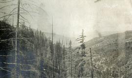
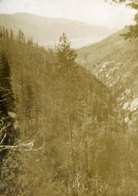
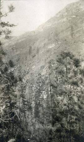
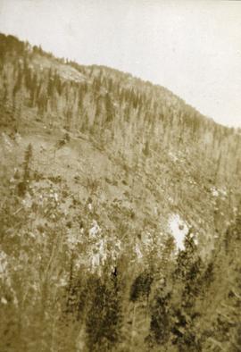
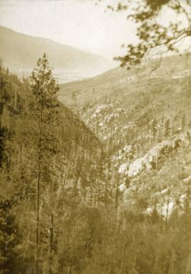
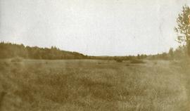
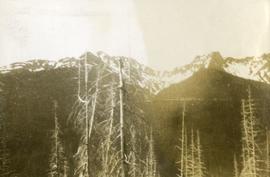
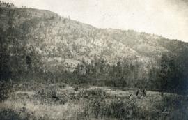
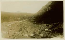
Photograph depicts looking across a muskeg meadow.
Photograph depicts a view looking across an expanse of water toward treed mountains with snowy peaks.
Photograph depicts an expanse of water, on the shore are low treed hills and snow peaked mountains in the distance.
Photograph depicts snowy mountain tops viewed from the forest and valley floor.
Photograph depicts a meadow in the foreground, trees in the midground and sparsely treed hills in the background.
Photograph depicts looking down Morrissey Creek Valley to Kettle River.
Photograph depicts looking down on a sparsely forested mountainside.
looking down steep forested valley.
Photograph depicts sparse vegetation near Grand Forks, BC
Photograph depicts a view of a hillside near Morrissey Creek near Grand Forks BC.
Photograph depicts a steep sparsely forested slope with a view to a wider valley beyond.
Photograph depicts a view looking toward the mountain top up a sparsely forested steep mountain slope.
Item is a photograph of a copy print, resulting in a low quality photographic reproduction. Reproduced as a print, slide, and a negative. Location of original photograph is unknown.
Photograph depicts colour-coded model of mine in display case. Legend partially legible in image: "TALUS / VOLCANICS / WASTE SERPENTINE / AAA ORE / AA ORE". Handwritten annotation on recto of photograph: "Cassiar B.C. June 1970 by Tom Kiefer".
Photograph depicts what appears to be a small model of projected bench mining on McDame mountain. The model stands outdoors on small wood table, car partially visible in background. Annotation printed in border on verso of photograph: "1955."
File consists of photographs mostly depicting trees, forests, and logs. Some photos include Harry Coates. One set of photographs shows Harry Coates accepting an award.
Photograph depicts a open mining site at the base of a mountain, forested landscape visible in background and unidentified mining equipment visible in the midground.
Photograph depicts three men panning in stream, sluiceway behind them. Rocky banks in foreground, forest in background.
Unidentified mining excavation equipment (might be a type of drill) located in front of a forested landscape.
Photograph is a printed postcard depicting an unidentified mining building situated on a hillside surrounded by mining debris. Possibly located in Stewart B.C.
Photograph depicts lumber piles and what appears to be a very long sluicing trough along Otter Creek. Forest and hills in background. Handwritten annotation on verso of photograph: "Otter Creek 6/6/37". See also item 2009.5.2.70.
Photograph depicts a car, two bulldozers and some steel drums at the side of a mining access road in the winter.
Photograph depicts the Cassiar mine, switchback road in foreground, mountain range in background. Pit is visible behind the West peak. The new mine garage can be seen on West peak just above "#7 switchback" in centre of image.
Photograph depicts the Cassiar mine, switchback road in foreground, mountain range in background. Pit is visible behind the West peak. The new mine garage can be seen on West peak just above "#7 switchback" in centre of image. Photograph was taken from the air, portion of plane visible in top left of image.
Photograph depicts the Cassiar mine above valley, north mountain range in background. Tramline station and crushing plant visible to west of pit. Photograph was taken from the air, portion of plane visible in top left of image.
Photograph depicts the Cassiar mine to right of mine valley, north mountain range in background. Tramline station visible on west of open pit, and the new mine garage can be seen behind the West peak.
Photograph depicts the Cassiar mine above valley bellow, north east mountain range in background. Photograph was taken from the air, portion of plane visible in top left of image.
Photograph depicts the mine valley in foreground below Cassiar Mine, north east mountain range in background.
Photograph depicts the Cassiar mine in foreground, north east mountain range in background. Tramline station and crushing plant visible in foreground in front of pit. Photograph was taken from the air, portion of plane visible in top left of image.
Photograph depicts the Cassiar mine in foreground, north east mountain range in background. Tramline station and crushing plant visible in foreground, west of pit. Photograph was taken from the air, portion of plane visible in top left of image.
Photograph depicts the Cassiar mine, switchback road in foreground, mountain range in background. Pit is visible to right of West peak. The new mine garage can be seen on West peak just above "#7 switchback" in centre of image.
Photograph depicts the Cassiar mine in left area of mountain range. The new mine garage can be seen on West peak on far left.
Photograph depicts the Cassiar mine in mountain range. Crushing plant and tramline station visible in foreground, and new mine garage can be seen on West peak on far left.
Photograph depicts the mine road in valley bellow mine. Cassiar plant and tailings pile in foreground. Handwritten annotation on recto of photograph: "Oct. 25 / 65 4:25 PM."
Photograph depicts the primary crushing plant in foreground. Mine road can be seen below, and plant is visible in distance. South mountains in background. Handwritten annotation on recto of photograph: "1961-1962".
Photograph depicts buildings near West Peak of Cassiar mine. Haul trucks parked near old mine garage in background, new mine garage and unknown buildings in foreground. Mine valley crosses midground, expansive western mountain range in background.
File contains photographs featuring:
- the pit mine: fault line, geology, snowdrifts, plowed snow, blast patterns marked by orange cones, mist, and surrounding mountains.
- Pit mine is depicted by aerial photographs and a profile diagram.
- Several photographs also depict what is speculated to be the portal to the underground mine adit in the early phases of development.
- One photograph depicts the shop building in the pit mine, used for maintenance of mining equipment and to house the primary crusher.
- Several photographs show office interiors and personnel and it is speculated that these photographs were taken in the upper floor of the shop building.
- Several photographs depict small sinkholes in the pit mine.
- Mining equipment depicted includes pickup trucks, front end loaders (including a Cat 988), ore haulage trucks, scoop trams, D8 Caterpillar dozer, grader, mining drill rig, jumbo drill, rock hammer, P&H excavator, and wireline extensometer. Photolab envelopes accompanying these materials were annotated “R. Tyne” and “falling ground”. Slide sleeves were annotated “Mine Nov-Dec 1975”, “AERIAL SHOTS OF MINE 1976” and “Phase 8 Dec 1975”.
- Photographs of a Gardner Denver blasting drill at the mine and other ground drills working
- Photograph of proposed power line to #1 switchback in 1975,
- Collection of photographs of a Wsbco truck with corresponding mechanical transfers of those photographs.
- Also photographs a Gardner Denver drill and a Bucyrus Erie drill that was rented to Cassiar Mine in 1974. This collection includes a depiction of an accident with these drills.
- An additional collection of photographs of #709 Drill that was involved in minor accident. A pipe was either damaged or was the cause of the accident.
- Negative collection of photographs with corresponding notes of descriptions.
- Photographs of G.D. 80 Drill - Blasthole drill at work in the open pit.
- Photographs part of Month End Reports from January - June 1980
- Photographs of portable toilets used on Mine site.
- Photograph collection of mine garage January 21, 1988
- Photograph collection of what is believed to be the inside of the mine garage and various storage units and equipment. Marked "Receiver File" in original enclosure.
- Photos of Crane in 1984.
- An Album of 192 photographs of machinery in March of 1976 working at the mine site. Some of the equipment from either the plantsite or the mill is also depicted.
File contains photographs depicting machinery, individuals, buildings, and mining processes at the open mine on McDame Mountain, Cassiar, B.C. Some photos depict benches from open strip mining, and two images feature models of the mine (1955 and 1970). Machinery depicted includes shovels, bulldozers, tractors, ore haul trucks (Kenworth, International Harvester, and Wabco), air track drills, blasthole drills, and Ingersoll-Rand Drill. Identified individuals include Fred Murray, R.R. [Kiresan?], C.E. Bronson, Bill Giachino, and "Sam".
Photograph depicts the pit mine, and road in valley below. Town of Cassiar can be seen in distance at foot of south mountain range.
Photograph depicts the town of Cassiar in distance behind pit mine in foreground. South mountain range in background. Photograph was taken from the air, portion of plane visible in top left of image.
Photograph depicts the pit mine, and road in valley below. Town of Cassiar can be seen in distance at foot of south mountain range.
Photograph depicts chute from distance. Annotation on verso of photograph: "CASSIAR ASBESTOS CORP. LTD. MINE AND ORE CHUTE ON McDAMES MOUNTAIN".