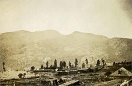
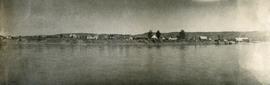
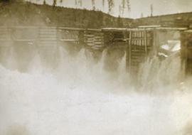
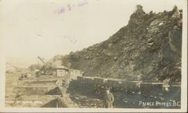
Photograph of a line of rail cars along a track next to a blasted pile of rubble. Printed annotation on recto reads: "Photo by McRae Bros. Prince Rupert." Handwritten annotation on verso reads: "Hello Charly. I have been dead for 2 month and just woke up tell the folks out home I am doing[??] fine. don't know when I will be down again Remember me to the good little woman, and weave[??] all Well. you're[??] friend Stan C." Postcard is addressed to: "Mr. Charles Chislett 96 Colonist Printing Co. Broad Street Victoria B.C." Verso is affixed with a one cent Canadian stamp. Postmark reads: "Prince Rupert B.C. [illegible date]."
Annotation on slide: "20 cm radial growth on released subalpine fir, Summit Lk trial".
Photograph depicts several buildings lining the river bank at Quesnel BC.
Photograph depicts a view of buildings lining the river bank, a steamship is anchored near shore.
Photograph depicts a long row of buildings bordering a river.
Photograph depicts a long row of buildings bordering a river. A scow is anchored near the river bank.
File consists of photographs of forestry related activities.
Caption describing photograph: "Pulpwood Logging Operations on P.T.S. X91960, Swamp Lake, Prince George Pulp and Paper Ltd. Close-up of rubber-tired skidder at landing." Harry Coates holds a measuring tape against a felled tree to show trunk diameter.
Caption describing photograph: "Pulpwood Logging Operations on P.T.S. X91960, Swamp Lake, Prince George Pulp and Paper Ltd. Close-up of Pre-loading Trailer and Typical Load of pulp wood."
Caption describing photograph: "Pulpwood Logging Operations on P.T.S. X91960, Swamp Lake, Prince George Pulp and Paper Ltd."
Image depicts a pulpmill, likely Northwood, in Prince George, B.C.
Photograph depicts a ptarmigan in the foreground, two men on foot, leading a packhorse across a meadow.
Photograph depicts the proposed site for a hydro power project on Klemtu Lake with rock sill outlet to creek.
Series consists of promotional materials including materials from outreach events such as posters and presentation slides. Series also includes promotional ephemera such as bookmarks, stickers, and informational pamphlets describing the McGregor Model Forest and the larger Canadian Model Forest Network.
File contains photographs taken for promotional purposes.
- Two photos depict a Cassiar display at an unknown event in 1963.
- Eight photos were professionally taken for use in the 1978 Cassiar Asbestos Corportaion Ltd. Annual Report, and possibly other publications. These photos depict a skyscraper and products made with asbestos.
- Additionally, two hand painted postcards of McDame Mountain and Christmas Tree House are included that may have been used for promotional reasons. Also, four slides of a display, "Story of Asbestos."
- five photographs of unofficial tour of Cassiar via airplane in the 1970s.
Item is a photograph of a copy print that has been reproduced as a slide, resulting in low photographic quality. Location of original photograph unknown.
Item is a photograph of Princess Margaret on July 17, 1958 at an event staged in the Prince George railway yards. Alex Moffat dressed as a prospector demonstrates panning for previously salted gold nuggets, which were later given to the Princess.
Item is an aerial photograph of log rafts, log booms, and a mill.
Photograph depicts a view from the water looking into Prince Rupert harbor.
Photograph depicts a view from the shore looking out into Prince Rupert harbor.
Photograph depicts view of Prince Rupert harbor from a deck.
Photograph depicts silhouette of Prince Rupert BC buildings and the view looking beyond to the water.
Image depicts the Prince George Sawmill from the Northwood Bridge.
Image depicts Prince George Sawmill taken from across the Nechako River looking southwest. Map coordinates 53°56'00.0"N 122°44'29.7"W
File consists of clippings, notes, reproductions, and letters relating to the Prince George Experimental Farm. Includes "District 'C' Farmer's Institute" letter correspondence between the director of development services and Marlene Schwartz (19 July 1999) and "RE: Century Farms Project" letter from Kent Sedgwick to the Ministry of Agriculture, Fisheries & Food (13 Sept. 1994). Also includes photographs depicting the experimental farm in Prince George, including the house on the property, a barn with a rainbow painted on the front, and the barn at multiple angles (Aug. 2001).
Image depicts Prince George, possibly with the Northwood Pulpmill in the background.
File consists of 23 posters of two sizes about the McGregor Model Forest Association and the Model Forest Network. Many of the posters are laminated and have Velcro attachments on the back for use during presentations or conferences. The information presented is varied, but includes vision statements, maps, Phase III themes and activities, recent successes, programs, information about various projects, maps illustrating model forests across Canada, phase and project objectives, information on the TFL-30 project, and information about the computer program developed by the McGregor Model Forest Association. Some simple posters advertising both the MMFA and the Canadian Model Forest Network are featured.
Photograph depicts Prentiss Gray sitting on a log skinning his trophy mountain goat.
Annotation on photograph verso: "View from Jtn of A Road and Main Road to NE. Pre-logging. 15/1/92. Summit Lake Selection Trial"
File contains handwritten cross section book, original studies with handwritten measurement charts and black and white photos, loose pages of original correspondence, handwritten diagrams and measurement charts, loose handwritten tally sheets, black and white photographs, hand coloured plot diagrams, photocopies of aerial photographs, and original correspondence for Plot 160.
File contains handwritten notes, original diagrams, charts, studies, and black and white photos relating to Plot 108.
Photograph depicts a power dam near Cascade, BC.
Caption describing photograph: "Potentially commercial Black Spruce stand. Fully developed peat (3-8') over impervious clay. Ledum B. Glandulosa. Mile 3 Hart Highway. Ht 55', 5-10" DBH. Age 85 years. Frames 1-5"
Annotation on photograph verso: "South of plots 27, 21. 15/1/92. (Post-logging). Summit Lake Selection Trial"
Annotation on photograph verso: "South of plot 27, N of 18, 20. 15/1/92. Post-logging. Summit Lake Selection Trial"
Annotation on photograph verso: "View south of unit 27 Post-logging. 15/1/92. Summit Lake Selection Trial"
No caption provided with photograph negative. Appears similar to 2007.1.30.2.011, which has the following caption: "Poor quality Spruce left after diameter cutting. Note insect killed trees and leaning tree. Sparse stocking. Very poor increment. Devils Club site. Silty clay. No post logging regeneration. Continous understory of alder and willow. West Branch, F.E.S. Aleza Lake."
Caption describing photograph: "Poor quality Spruce left after diameter cutting. Note insect killed trees and leaning tree. Sparse stocking. Very poor increment. Devils Club site. Silty clay. No post logging regeneration. Continous understory of alder and willow. West Branch, F.E.S. Aleza Lake."
Photograph depicts four men standing on a canoe, loaded with supplies. Calm river water in the background, bluffs in the background.
Photograph depicts two persons holding long poles, standing on a canoe on the Nechako river. The water vessel appears to be very near a falls. Image is out of focus.
Photograph depicts a few scattered buildings and railway siding in the foreground, sparsely forested mountain in the background.
File consists of several maps indicating the locations of plots and 3 detailed maps of specific plots. File also includes photographs of cleared forests and a "P.G. District Demonstration Plots: Establishment Report".
File consists of photocopied plot layouts from an unknown original source and 39 photographs taken during experiments.
Annotation on slide: "Plot 3, Summit".