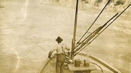
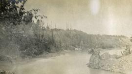
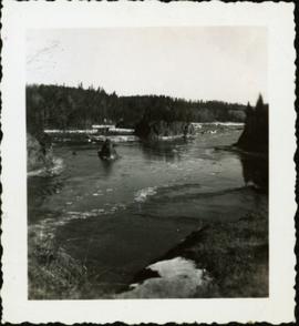
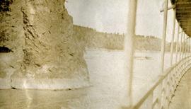
Print preview Close

Showing 27992 results

Archival description
17269 results with digital objects Show results with digital objects
Fort George Canyon
2012.13.2.03.05.18 · Item · 1986
Part of J. Kent Sedgwick fonds

The item is a photograph depicting the Fraser River running through Fort George Canyon. Annotation on revers side of the photograph states, "6."

Fort George Canyon
2012.13.2.03.05 · File · 1982-2007
Part of J. Kent Sedgwick fonds

File consists of notes, clippings, and reproductions relating to the Fort George Canyon. Includes: "City of Prince George" typescript letter from Kent Sedgwick to Mr. Ron Drane, Manager of Pine Centre (7 June 1984) and "Fort George Canyon Hiking Trail" pamphlet published by the Fraser-Fort George Regional Museum (July 1984). Also includes photographs depicting the Fort George Canyon and men hiking the trail (1985).

Fort George Canyon
2012.13.2.03.05.03 · Item · 1986
Part of J. Kent Sedgwick fonds

The item is a photograph depicting Fort George Canyon looking west down the Fraser River. Annotation on reverse side of photograph states, "looking west 1."

Fort George Canyon
2012.13.2.03.05.04 · Item · 1986
Part of J. Kent Sedgwick fonds

The item is a photograph depicting Fort George Canyon looking north up the Fraser River. Annotation on reverse side of photograph states, "looking north upstream 2."

Fort George Canyon
2012.13.2.03.05.20 · Item · 1986
Part of J. Kent Sedgwick fonds

The item is a photograph depicting the Fraser River running through Fort George Canyon. Annotation on revers side of the photograph states, "6."

2009.5.3.28 · Item · [ca. 1912]
Part of Taylor-Baxter Family Photograph Collection

Photograph depicts the early settlement of Fort George. The buildings to the left of the fence are believed to be owned by the Hudson's Bay Company. The land to the right of the fence belonged to the Fort George Reserve, the home of today's Lheidli T'enneh Band who relocated to a reserve at Shelley when this reserve was sold in 1912. Handwritten annotation on verso and recto of this photograph reads: "Fort George from opposite side of Fraser River".

Fort George Park
2012.13.1.3.113 · Item · 12 Oct. 1989
Part of J. Kent Sedgwick fonds

Image depicts the Fort George Par, which was renamed Lheidli T'enneh Memorial Park in 2015. Map coordinates 53°54'30.2"N 122°43'57.4"W

Fort George Regional Museum
2012.13.1.3.071 · Item · Oct. 1983
Part of J. Kent Sedgwick fonds

Image depicts the Fort George Regional Museum (now known as The Exploration Place) in Prince George, B.C. Map coordinates 53°54'18.6"N 122°44'09.8"W