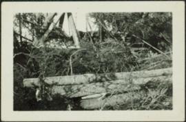
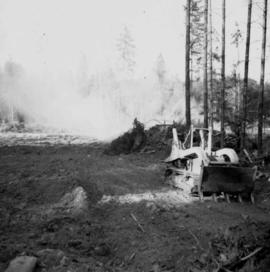
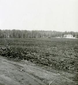
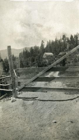
Print preview Close

Showing 27992 results

Archival description
17269 results with digital objects Show results with digital objects
Felled Trees
2012.13.1.56.06 · Item · 1973
Part of J. Kent Sedgwick fonds

Image depicts a large number of felled trees, and an unknown individual standing on the path.

Fence
2012.13.1.12.18 · Item · Sep. 1983
Part of J. Kent Sedgwick fonds

Image depicts a fence, perhaps somewhere in the Chilcotin region.

Fence
2012.13.1.12.15 · Item · Dec. 1980
Part of J. Kent Sedgwick fonds

Image depicts a fence in the Blackwater River area in the Chilcotin.

Fence
2012.13.1.12.17 · Item · Sep. 1983
Part of J. Kent Sedgwick fonds

Image depicts a fence somewhere in Anahim Lake, B.C.

Fence
2012.13.1.12.11 · Item · Aug. 1978
Part of J. Kent Sedgwick fonds

Image depicts a wooden fence at an uncertain location, perhaps somewhere in the Chilcotin region.

Fence
2012.13.1.12.12 · Item · Aug. 1978
Part of J. Kent Sedgwick fonds

Image depicts a wooden fence at somewhere in Meldrum Creek, B.C.

Fence
2012.13.1.12.16 · Item · Sep. 1983
Part of J. Kent Sedgwick fonds

Image depicts a fence somewhere in Anahim Lake, B.C.

Fence and Power Lines
2012.13.1.78.47 · Item · 1982
Part of J. Kent Sedgwick fonds

Image depicts a fence and power lines near the shore on Haida Gwaii. It is possibly a small community such as Masset.

Fenced Off Forest Area
2012.13.1.87.149 · Item · [between 1975 and 1995]
Part of J. Kent Sedgwick fonds

Image depicts two unidentified individuals standing outside a small, enclosed area somewhere in a forest. The location is uncertain.

Fences, Log Construction
2012.13.1.012 · Subseries · [between 1970 and 1985]
Part of J. Kent Sedgwick fonds

File contains slides depicting images of fences and various other forms of log construction, ranging from 1970 to 1985.

Fernie CPR station
2013.6.36.1.028.06 · Item · Aug. 1983
Part of David Davies Railway Collection

Photograph depicts the Fernie CPR station, located at mile 34.7 on the Cranbrook Subdivision, which runs from Crowsnest to Cranbrook. In coal mining days this was a busy place but now it has sidings for 153 cars and nothing else. The view is looking east.

Ferries in Prince George
2012.13.2.15.09 · File · [197-], 2005
Part of J. Kent Sedgwick fonds

File consists of notes, clippings, and reproductions relating to ferry boat service in and around Prince George. Includes material regarding the Fraser River Fort George ferry; the Isle Pierre ferry; and the Miworth ferry. File also includes photographs depicting a building at Isle Pierre in the 1970s and the ferry crossing at Isle Pierre in 2005.

Ferry
2012.13.1.50.056 · Item · 1978
Part of J. Kent Sedgwick fonds

Image depicts a structure that appears to be a type of zipline, ferry platform at an unknown location.

Ferry
2012.13.1.50.057 · Item · 1978
Part of J. Kent Sedgwick fonds

Image depicts a structure that appears to be a type of zipline, ferry platform at an unknown location.

2004.2.1.84 · Item · 1898-1920
Part of Reverend R.W. Large fonds

Photograph depicts a wooden ferry being steered by one man with two men waiting on a rocky shoreline. Annotation on verso of photograph states: "Ferry across Kishpiax at Hazelton"

Field Notebook and Photos
2016.5.1.86 · File · [196-?]
Part of Harry Coates fonds

File consists of a field notebook recording notes from experimental plots, phone numbers, and other notes. Notebook contained four photographs found together in a section of blank pages of the notebook. The photographs depict research trial seedling assessment for E.P. 668.

Field trip to Giscome Mills
2007.1.25.7.29 · Item · [between 1925 and 1936]
Part of Aleza Lake Research Forest fonds

Item is a photograph of a copy print, resulting in a low quality photographic reproduction. Reproduced as a print, slide, and a negative. Location of original photograph is unknown.