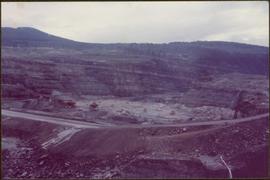
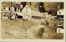
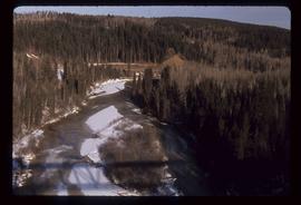
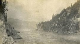
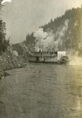
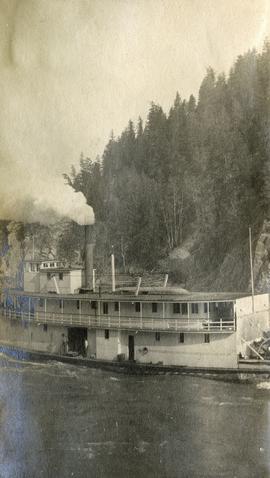
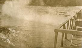
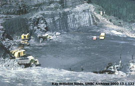
Item is a photograph of the construction of the WAC Bennett Dam.
Item is a photograph of the construction of the W.A.C. Bennett Dam
Slightly elevated street view of buildings and sidewalks being constructed in Prince Rupert, BC. Printed annotation on recto reads: "Photo by McRae Bros. Third Ave Prince Rupert, BC." Handwritten annotation on verso reads: "Dear Florence you better [illegible] will try and answer it in a few day I am well I will try and send you some cards I will stay here till in Dec Write[??] me and send me some cards I am 15 mile in the mountains Write your Bro LS Bill." Postcard is addressed to: "Miss Florence Wilson P.O. Box 1178 Worcester Mass U.S.A." A 2 cent Canadian stamp is affixed on verso. Postmark reads: "Prince Rupert BC Jul 1 10."
Handwritten annotation on recto of photograph: "FORMING & STEEL WORK AUG 19/64." Photograph depicts construction workers among machinery on high elevation of crusher site. It is believed that a front end loader and concrete mixer stand in this area. Forms for cement made of wood and rebar can be seen in foreground on left, retaining wall on right. Building top and mountain range visible in background.
Photograph depicts the steel sheeting of the crusher building underway. Three men stand on platform suspended by cables close to roof of crusher building. Three other men can be seen working on the roof of the building, one walking, one sitting, one lying on his stomach very close to the edge. All are wearing safety gear. Cassiar mountain range in background.
Photograph depicts yellow conveyor belt in foreground over gravel pit, dump truck behind in midground. Mountains visible in background. Photo speculated to have been taken at the plant or near the Cassiar airstrip. Stamped annotation on recto of photograph: "JUN. 1987".
Photograph depicts men standing on upper deck of conveyor, close to opposite shore, where lumber and buildings can be seen. Canoe in left foreground, trees and mountains in background.
Photograph depicts five men sitting on a rough, log table. Table is under a tarp, upturned pails and cooking utensils are on the table.
Photograph depicts a rough table under a canvas tarp. There are various cooking utensils on the table and hanging from the tarp support. A man stands behind the table.
Image depicts a cookhouse at an uncertain location.
Image depicts a cookhouse at Sinclair Mills, B.C.
Photograph taken from a low elevation of various businesses in Stewart, BC. Visible businesses include "The R. Boyd Young Co." and "Motel King Edward." Printed annotation on recto reads: "Cor. 5th and Columbia Sts. Stewart. B.C. Hughes #45."
Photograph taken from a low elevation of various businesses in Stewart, BC. Visible businesses include "The R. Boyd Young Co." and "Motel King Edward." Printed annotation on recto reads: "Cor. 5th and Columbia Sts. Stewart. B.C. Hughes #44."
Street view of some vehicles parked in front of commercial buildings in Prince/Fort George. Businesses include "J.P. Robertson 'The Men's Store'" and "James & Co. Clothing and Shoes." Printed annotation on recto reads: "Fort George- Corner Hammond and Central."
Image depicts a rail road bridge, possibly the Cottonwood Bridge, at an uncertain location.
Image depicts the Cottonwood Bridge.
Image depicts a view of a river from the Cottonwood Bridge.
Image depicts a forest; the image is possibly taken from somewhere near the Cottonwood Rail Road Bridge.
Photograph depicts a narrow canyon on the Fraser River.
Photograph depicts a steamboat on the Fraser River with a full view of the paddles.
Image depicts the Cottonwood Canyon.
Photograph depicts a steamboat on the Fraser River.
Photograph depicts a view of rough river waters from the deck of a steamboat.
Typed annotation on recto: "Cottonwood dugout on Tachi River Stuart Lake Section of B.C." Two people sit in dugout canoe, tree-covered banks in background.
Image depicts a section of the Heritage Trail on Cottonwood Island in Prince George, B.C.
Image depicts the Cottonwood House Historic Site along Barkerville Highway, east of Quesnel, B.C. A sign posted by the fence reads: "For over half a century the Boyd family operated this haven for man and beast. Here weary travellers found lodging, food, and drink. Here fresh horses were hitched to stage-coaches and miners bought supplies. This historic road-house, built in 1864, stood as an oasis of civilization on the frontier of a rich new land."
Image depicts the picnic site of the Cottonwood House Historic Site, located on the Barkerville Highway, east of Quesnel, B.C.
Image depicts Cottonwood Island.
File contains slides depicting Cottonwood Island in Prince George, B.C.
Image depicts Cottonwood Island.
Image depicts a crowd of people in Cottonwood Park in Prince George, B.C.
Image depicts Elmer Mercier, a former mayor of Prince George, B.C., cutting the ribbon to open Cottonwood Park's Heritage Trail.
Image depicts a the Cottonwood Island Nature Park sign and map in Prince George, B.C.
Photograph depicts large bridge and dam over a wide river, industrial structures throughout. Hills on opposite shore in background. Handwritten annotation on recto of photograph: "Coulee Dam, This is were[sic] I went this fall. Wished you had of been with me."
Photograph depicts a craggy mountain peak covered with coniferous trees and snow.
Handwritten photo captions below this item and item 2000.1.1.2.324: "ELEVATION OF SITE: 6000' " "Two views of completed Crusher Bldg." Crane numbered "151" stands above and to right of crusher building. Snowdrift in foreground, mountain range in background.
Image depicts a creek near Quesnelle Forks, B.C.
Image depicts a creek near Iron Road North, north of Woodpecker, B.C.
Image depicts a beehive burner in the community of Crescent Spur, B.C.
Image depicts the community of Crescent Spur, B.C.
Image depicts a church school in the community of Crescent Spur, B.C.
Image depicts what appears to be a small mill in the community of Crescent Spur, B.C.
Image depicts the railway running near Crescent Spur in the Rocky Mountain Trench.