2001.26.1.5382
·
Item
Part of Northwood Pulp and Timber Ltd. fonds
17269 results with digital objects
Show results with digital objects
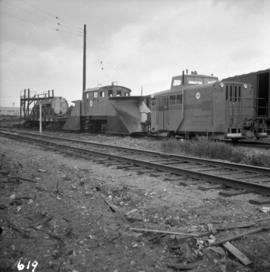
2013.6.36.1.008.26
·
Item
·
[May 1965]
Part of David Davies Railway Collection
Photograph depicts special equipment opposite a car barn of the B.C. Electric Railway, at New Westminster.
2003.13.1.2.056
·
Item
·
[19-?]
Part of Parker Bonney Photograph Collection
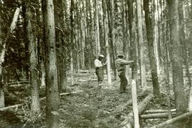
2007.1.45.27.5
·
Item
·
1935
Part of Aleza Lake Research Forest fonds
Photograph is one of five depicting EP 106.

2012.13.1.51.124
·
Item
·
June 1979
Part of J. Kent Sedgwick fonds
Image depicts the interior of the ferry at Southbank, B.C.

2012.13.1.51.123
·
Item
·
June 1979
Part of J. Kent Sedgwick fonds
Image depicts Southbank, B.C.
2000.1.1.3.13.57
·
Item
·
[ca. 1975]
Part of Cassiar Asbestos Corporation Ltd. fonds
Photograph depicts the Cassiar mine, pit partially visible behind West peak in right centre of image. South west mountain range in background.
2000.1.1.3.13.58
·
Item
·
[ca. 1975]
Part of Cassiar Asbestos Corporation Ltd. fonds
Photograph depicts the Cassiar mine, pit partially visible behind West peak in right centre of image. South west mountain range in background.
2013.6.36.1.088.21
·
Item
·
Feb. 1966
Part of David Davies Railway Collection
Photograph taken at the east end of False Creek, looking south towarsd Quebec and Ontario Streets.
2000.1.1.3.13.56
·
Item
·
[ca. 1975]
Part of Cassiar Asbestos Corporation Ltd. fonds
Photograph depicts the Cassiar valley: plant and tailings pile in left foreground, west end of town in right foreground. South mountain range stands in background.
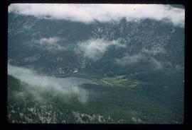
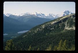
2012.13.1.46.07
·
Item
·
1980
Part of J. Kent Sedgwick fonds
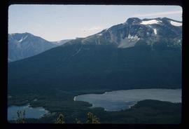
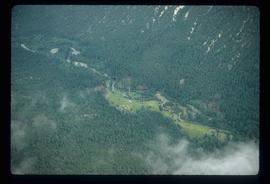
Image depicts an aerial view of what is likely Turner Lake in South Tweedsmuir Provincial Park.
2012.13.1.46.12
·
Item
·
1980
Part of J. Kent Sedgwick fonds
Image depicts an aerial view of South Tweedsmuir Provincial Park. The lake is possibly Lonesome Lake.
2012.13.1.46.18
·
Item
·
1980
Part of J. Kent Sedgwick fonds
Image depicts an aerial view of a lake in South Tweedsmuir Provincial Park. It is possibly Lonesome Lake.
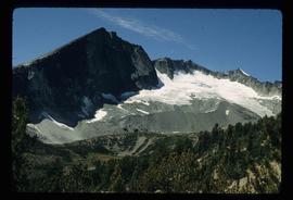
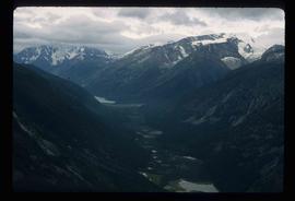
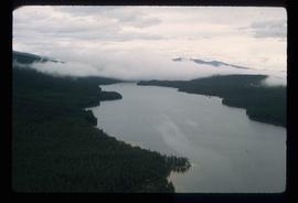
2012.13.1.46.23
·
Item
·
1980
Part of J. Kent Sedgwick fonds
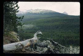
Image depicts an aerial view of Glacier Mountain in South Tweedsmuir Provincial Park.
2012.13.1.46.08
·
Item
·
1980
Part of J. Kent Sedgwick fonds
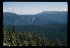
Image depicts an aerial view of what is likely Glacier Mountain in South Tweedsmuir Provincial Park. The two lakes present are possibly Vista and Junker.
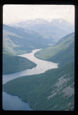
2012.13.1.46.10
·
Item
·
1980
Part of J. Kent Sedgwick fonds
Image depicts an aerial view of a "glaciated valley" in South Tweedsmuir Provincial Park. Glacier Mountain is present in the image.
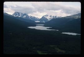
2012.13.1.46.13
·
Item
·
1980
Part of J. Kent Sedgwick fonds
Image depicts an aerial view of a chain of lakes in South Tweedsmuir Provincial Park.
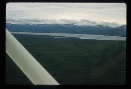
2012.13.1.46.05
·
Item
·
1980
Part of J. Kent Sedgwick fonds
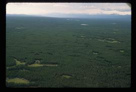
Image depicts an aerial view of South Tweedsmuir Provincial Park.
2012.13.1.46.06
·
Item
·
1980
Part of J. Kent Sedgwick fonds
Image depicts an aerial view of South Tweedsmuir Provincial Park.
2012.13.1.46.11
·
Item
·
1980
Part of J. Kent Sedgwick fonds
Image depicts an aerial view of South Tweedsmuir Provincial Park.
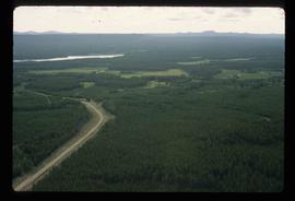
2012.13.1.46.28
·
Item
·
1980
Part of J. Kent Sedgwick fonds
Image depicts a view of South Tweedsmuir Provincial Park.
2012.13.1.46.09
·
Item
·
1980
Part of J. Kent Sedgwick fonds
Image depicts an aerial view of South Tweedsmuir Provincial Park.
2012.13.1.46.15
·
Item
·
1980
Part of J. Kent Sedgwick fonds
Image depicts an aerial view of South Tweedsmuir Provincial Park.

2012.13.1.46.21
·
Item
·
1980
Part of J. Kent Sedgwick fonds
Image depicts an aerial view of South Tweedsmuir Provincial Park.
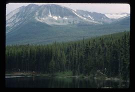
2012.13.1.46.41
·
Item
·
1980
Part of J. Kent Sedgwick fonds
Image depicts a lake and mountain somewhere in South Tweedsmuir Provincial Park.
2012.13.1.46.14
·
Item
·
1980
Part of J. Kent Sedgwick fonds
Image depicts an aerial view of a lake in South Tweedsmuir Provincial Park.
2012.13.1.46.22
·
Item
·
1980
Part of J. Kent Sedgwick fonds
Image depicts an aerial view of South Tweedsmuir Provincial Park.
2012.13.1.46.27
·
Item
·
1980
Part of J. Kent Sedgwick fonds
Image depicts a view of South Tweedsmuir Provincial Park. An unidentified man stands on the side of the image.
2013.6.36.1.028.33
·
Item
·
14 Sept. 1970
Part of David Davies Railway Collection
Photograph depicts the South Slocan Junction at mile 11.9 on the CPR line on the Nelson Boundary Subdivision. It closed as an agency in June 1969 but the telegrapher still maintained it. Three to four freights pass per day on the main line: 2 to Trail, 1 to Castlegar pulp mill, and 1 every other day to Midway. On the branch there is 1 train per week to Nakusp that leaves Nelson on Monday, arrives in Nakusp on Tuesday, and returns to Nelson on Wednesday. The view is looking east.
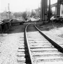
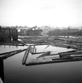
2013.6.36.1.048.10
·
Item
·
26 Sept. 1974
Part of David Davies Railway Collection
Photograph depicts the south shore line of the B.C. Electric Railway in False Creek, Vancouver. B.C. Hydro operated it, if not owned it. The location was directly opposite from Granville Island.
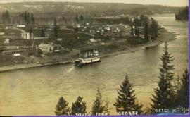
2011.3.4.13
·
Item
·
30 October 1910
Part of North Coast & Central BC Postcard Collection
Lofty view of stern wheeler in river. Scattered buildings and tents in background. Printed annotation on recto reads: “South Fort George Oct 30th 1910”

2014.10.1.102
·
Item
·
1910
Part of Arthur Holland Land Surveying Collection
Photograph depicts scattered buildings, an outhouse, and tents on a rough clearing. A river and its cutbacks are in the background.
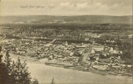
2011.3.2.21
·
Item
·
1914
Part of North Coast & Central BC Postcard Collection
Overhead view of downtown Prince George with a forested area in the background. Printed annotation on recto reads: "South Fort George- 1914."

2012.13.1.7.233
·
Item
·
Mar. 2003
Part of J. Kent Sedgwick fonds
Image depicts a house somewhere in the South Fort George subdivision of Prince George, B.C.

2012.13.1.7.028
·
Item
·
June 1976
Part of J. Kent Sedgwick fonds
Image depicts a cemetery in the South Fort George suburb of Prince George, B.C.
2012.13.3.1.50
·
File
·
1970-2005
Part of J. Kent Sedgwick fonds
File consists of notes, clippings, and reproductions relating to South Fort George. Includes: "South Fort George - A trip to the past" heritage brochure produced by South Fort George Community Association (1987) and "B.C. Express Co. Heritage Site" typed document prepared by the Heritage Advisory Committee (Feb. 1994). Also includes photographs depicting various buildings from old South Fort George.
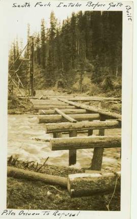
2004.8.1.104
·
Item
·
[ca. 1935]
Part of Alexander Manson mining collection
Wooden piles driven into a river bed, pile driver visible in background. Handwritten annotation on recto reads: "South fork intake before gate built, pile driven to refusal".

2023.2.2.7.4.033
·
Item
·
2009
Part of Dr. Paul Sanborn fonds

2023.2.2.7.4.050
·
Item
·
2009
Part of Dr. Paul Sanborn fonds
2023.2.2.7.4.051
·
Item
·
2009
Part of Dr. Paul Sanborn fonds
2023.2.2.7.4.035
·
Item
·
2009
Part of Dr. Paul Sanborn fonds
2023.2.2.7.4.034
·
Item
·
2009
Part of Dr. Paul Sanborn fonds

2023.2.2.12.6.69
·
Item
·
2007
Part of Dr. Paul Sanborn fonds
2023.2.2.12.6.65
·
Item
·
2007
Part of Dr. Paul Sanborn fonds
2023.2.2.12.6.68
·
Item
·
2007
Part of Dr. Paul Sanborn fonds
2023.2.2.12.6.59
·
Item
·
2007
Part of Dr. Paul Sanborn fonds
2023.2.2.12.6.60
·
Item
·
2007
Part of Dr. Paul Sanborn fonds
2023.2.2.12.6.62
·
Item
·
2007
Part of Dr. Paul Sanborn fonds
2023.2.2.12.6.63
·
Item
·
2007
Part of Dr. Paul Sanborn fonds
2023.2.2.12.6.67
·
Item
·
2007
Part of Dr. Paul Sanborn fonds