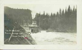
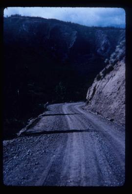
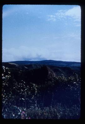
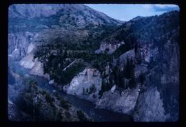
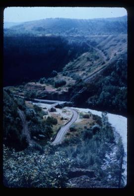
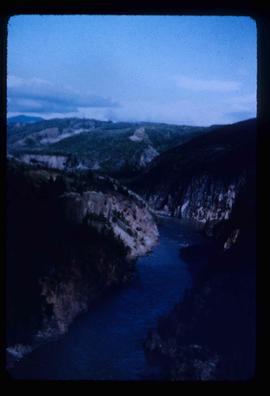
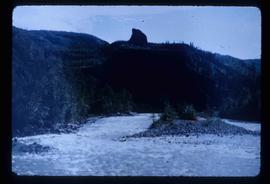
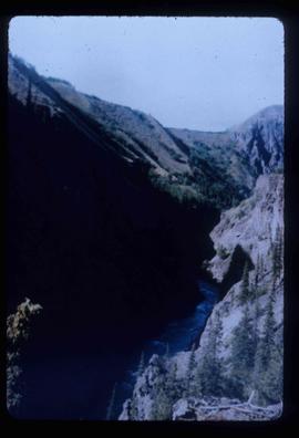
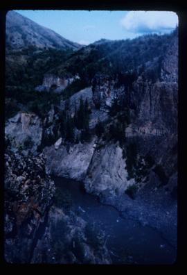
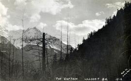
Photograph depicts a view of "The Captain" mountain near Lillooet, BC.
Photograph depicts one man kneeling the other sitting on the forest floor. The first man is giving the second man a shave.
Image depicts the Bullion Pit in Likely, B.C. It is a man-made canyon from the days of the gold-rush, formed by the use of hydraulic monitors. The gold-mine operated from 1892 to 1942.
This photograph album consists of photographs of remote police barracks at Mile 47 and Mile 29; early settlements and/or mercantile stores at Tete Jaune Cache, McBride, Sand Creek, Fort George and South Fort George; Grand Trunk Pacific Railway forestry and railway camps; scows and paddlewheel conveyors on the Fraser River; automobiles; community leisure activities; as well as, images of the Bourchier family. The following South Fort George establishments are identifiable within these photographs: Empress Hotel, Ah Yee General Merchant, German Bakery, Northern Hotel, South Fort George Drug Store & Post Office, St. Michael’s Church, Prince George Hotel, Ford Monarch dealership, Astoria Hotel, and King George V Elementary School. Identified geographic locations featured in these photographs include: Tete Jaune, Upper Fraser, Mile 47, Mile 29, Fraser River, Mt. Robson, McBride, Sand Creek, Glacier Mountain, Moose River, Giscome Portage, Pott Falls, Red Deer River, Grand Canyon, Summit Lake, Canoe Pass, Connaught Hill, Nechako Bridge, and Island Cache.
Bourchier, Alan K.Hand coloured lofty view of the Prince Rupert waterfront. Printed annotation on recto reads: "The Beginning of Prince Rupert, B.C. : Grand Trunk Pacific Hotel in foreground." Artist's stamp in lower left corner reads: "104,036 J.V."
Stern wheeler passing through rapids. Printed annotation on recto reads: “The B.C. Express passing through the Grand Canyon B.C.” Handwritten annotation in red ink on recto adds: “1913”
Photograph depicts a small cluster of buildings near the river bank.
Image depicts a vehicle on a gravel road somewhere near Tête Jaune Cache, B.C.
Image depicts a forest service cabin somewhere near Tête Jaune Cache, B.C.
Image depicts a collapsing shack somewhere near Tête Jaune Cache, B.C.
Handwritten photo album caption below this photo reads: "Teslin Lake and River, at 11 000 feet." Photograph depicts winding river below, mountain range in background.
Royal Canadian Air ForceImage depicts the Terzaghi Dam on the Bridge River, looking from the upstream (reservoir) side located near Bralorne, B.C. The water is Carpenter Lake.
Image depicts the Terzaghi Dam viewed from the downstream side near Bralorne B.C.
Image depicts a rail road bridge located somewhere near Terrace, B.C.
Image depicts a view of Terrace, B.C.
Image depicts several orange and blue tents, possibly somewhere near Riske Creek, B.C.
Gathering of tents in Vickersville with the harbour and mountains in the distance. Annotation on recto reads: "Vickersville Prince Rupert o/n[?] 1908."
Image depicts a view of a lake that is near Telkwa, B.C. The slide is labelled as "Telkwa - McClure Lake," though it is possibly Tyhee Lake.
Image depicts two bridges in Telkwa, B.C. One is for trains.
Image depicts the Telkwa river in Telkwa, B.C.
Image depicts the old telegraph station in Stewart, B.C.
Image depicts a field along Telegraph Road, south-west of Vanderhoof, B.C.
Image depicts Telegraph Road, south-west of Vanderhoof, B.C.
File contains slides depicting Telegraph Creek.
Image depicts the Telegraph Creek Road, as well as the Creek itself.
Image depicts Telegraph Creek Road.
Image depicts the Telegraph Creek.
Image depicts a cliff face near Telegraph Creek.
Image depicts a bridge over Telegraph Creek.
Image depicts the Telegraph Creek.
Image depicts what appears to be a teepee at an uncertain location.
Image depicts a man, possibly Ted Faulkner, looking at a creek.
Snow on either side of highway stands at extreme height.
Image depicts a tall pine tree somewhere on Haida Gwaii.
Photograph depicts narrow waterfall in steep cliff, trees and bushes visible above. Handwritten annotation visible on negative: "Waterfall on way up Taku River."
Image is one of 65 photos documenting a survey of the Canada-Alaska Boundary, Taku River area, May 23 to Oct. 15, 1906. This particular photo is one of 7 found in original enclosure with the following handwritten annotation: "Around River Taku and main camp on same." See also items 2006.20.3.35 - 2006.20.3.41.
Photograph depicts waterfall between rocky cliffs, trees on either side and in foreground.
Image is one of 65 photos documenting a survey of the Canada-Alaska Boundary, Taku River area, May 23 to Oct. 15, 1906.
This particular photo is one of 13 found in original enclosure with the following handwritten annotation: "SOME OTHERS." See also items 2006.20.3.23 - 2006.20.3.34.