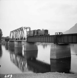
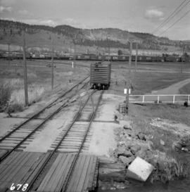
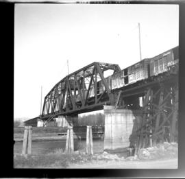
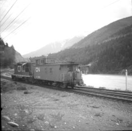
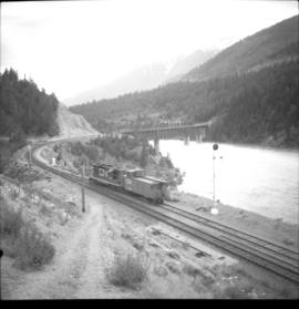
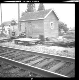
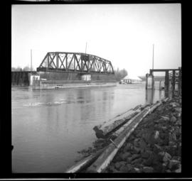
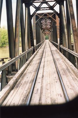
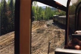
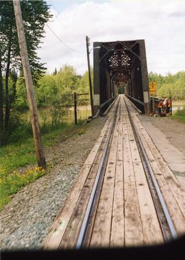
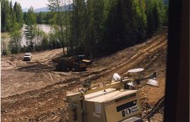
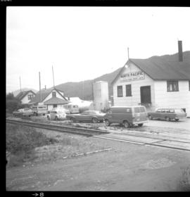
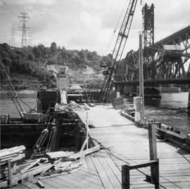
Photograph depicts work in progress on a new CNR lifting span bridge.
Photograph depicts the Canadian National Railway (CN) line crossing the south Thompson River. Kamloops Junction and Kamloops city are joined by a 2 mile spur, which crosses the river as shown. The view in the photo is looking north from the site of the former fort.
Photograph depicts the Canadian National Railway (CN) line at Deerholme Junction on Vancouver Island, near Duncan. The wrecking train on siding is ready for emergencies. The caboose is newly painted.
Photograph depicts the Canadian National Railway (CN) Peachland on Okanagan Lake. It was used for the lumber trade mainly, but also fruit in season. The track stops at the foreground of the photo.
Photograph depicts the Canadian National Railway (CN) line at Penticton. The wharf at the lake head is for loading rail scows.
Photograph depicts the Canadian National Railway (CN) line in Kelowna. In the background are freight yards and a loading ramp to rail scows on Lake Okanagan.
Photo displays a CNR locomotive, #4809. Found at the Port Mann yards. Was found in old style livery.
Photograph depicts a CNR locomotive pushing snow removal equipment #51070 near a building, possibly a railway station.
Photograph depicts a CN switcher crossing Wiggins Street in South Burnaby. Image captured looking west towards the bridge crossing the north arm of the Fraser River. A trestle appproach on the south side of the bridge was burned down in September 1973, causing cessation of service along this part of the branch for several months.
Photograph taken in New Westminster, crossing the north arm of the Fraser River. The visible freight was travelling north and consisted of about 12 cars.
Photograph taken on mile 6.9 at the Lulu Island Branch. Image captures one of the few surviving telegraph poles on this branch.
Photograph taken on mile 6.9 at the Lulu Island Branch. The No. 8 Road crossing track is found in the background. The track was about to be laid with heavier rail. Davies notes that the trackage levels were poor with big stone ballast.
Photograph depicts the entrance to the CNR yards in Lumby. Principal outgoing products from this location are poles and dressed lumber while incoming products are oil and gas.
Photograph depicts a caboose at the end of a contractor's gear train. This train was being hauled one mile south to Winch Spur where loads were removed from flat cars.
Photograph taken at the southern end of the Lytton yard limits. The visible rail bridge carries a protected pedestrian footpath on its northern trusses.
Photograph depicts the Canadian National Railway (CN) main line from the Vancouver depot. The view is looking east, down from the bridge carrying Clark Dr.
Photograph taken at the Matsqui depot which stood on the north side of the track and was a flag stop. Electric indicator board for stopping the train was below the left-handed window. The depot house was occupied by a family, but the CNR intended to close and demolish it.
Photograph depicts a track motor shed located at about 300 yards west from the Matsqui depot.
Photograph taken at the Matsqui depot on mile 87.4 from Boston Bar, BCCNR applied to close and abolish the Matsqui depot in 1872, but no action had been taken by 1973. The house visible was occupied by a family.
Photograph taken at the Matsqui depot on mile 87.4 from Boston Bar and 45 minutes from Vancouver. Trackage consists of a passing lie and a storage loop, which in 1973 contained no cars.
Photograph depicts the CNR depot in McBride. It was built by the Grand Trunk Pacific Railway in 1919 according to an individual design.
Photograph depicts derail equipment. Image captured on mile 54.3 from Jasper at the Albreda Sub-Divison.
Photograph depicts the site of the Mount Robson stop which could be reached by a 3 mile gravel road from the BC Government campsite at the bottom of a valley in Albreda. The Tete Jaune Subdivision line (to Prince George) is located on the left.
Photograph depicts a CN box car. It was operating a self-propelled crane in the vicinity, moving new bridge timbers.
Photograph depicts a freight shed at mile 49.5 on the Bulkley Subdivision. The depot in New Hazelton (now demolished at the time) was built in 1913.
Photograph depicts a depot that was destroyed at this point 2 years prior from when the photograph was taken. Visible is a tunnel clearance work trolley. There were 10 tunnels in the location of the photo, the Bulkley Subdivision.
Photograph taken at the CNR yards, located north of Ballantyne Pier. Visible is a CN yard switcher #1251. Davies notes that the photograph was taken because it was unusual to find any locomotives that do not have a new colour scheme during this time.
Photograph taken north of Fraser, about 5 miles north east of the Patulla Bridge in New Westminster. The image displays the CNR swing bridge that connects to the trackage of Lulu Island. The CNR swing bridge is left open except for the passage of the daily freight train.
Photograph taken somewhere between Prince George and McBride.
Photo at Hansard, a railway point in the Fraser Subdivision. This was the only bridge in B.C. used by both rail and road vehicles. In the Grand Trunk Pacific Railway construction days, it was known as the third crossing of the Fraser River.
Photograph taken in the Fraser Subdivision. Depicts the site of a wreck that was due to unstable clay ground. Apparently, there were known problems since 1912-13 construction days.
Photograph taken at Hasard, a railway point in the Fraser Subdivision. The Hansard "station" (non existent) was on mile 100.2. Looking west with Prince George 47 rail miles away.
Photograph taken in the Fraser Subdivision. Depicts the site of a trestle train wreck and subsequent fire where 2 men were killed.
Photograph taken between Hutton and Dewey, near the Fraser Subdivision.
Photograph taken in the Fraser Subdivision, somewhere between Dewey and Hansard.
Photograph depicts the details of the east side of the McBride depot.
Photograph depicts the McBride depot and an eastbound VIA train.
Photograph taken somewhere between Endako and Prince George, Nechako Subdivision.
Photograph taken somewhere between Endako and Prince George, Nechako Subdivision. Captured from an old-type (1950s) observation/dome car at the end of an eastbound VIA train.
Photograph taken outside of a museum cannery near Port Edward and Phelan.
Photograph depicts the Smithers depot.
Photograph taken from a speeder at the Lumby Junction. The two visible sidings held trains awaiting departure to Kelowna or Kamloops.
Photograph taken on mile 90, with Kalamalka Lake at the right.There were very sharp curves in this area.
Photograph depicts a slowly-disappearing, older CN logo. Davies notes that he saw it infrequently in 1970, but it was still not yet rare. This was a good example of a box car at Fort Langley.
Photograph depicts where track runs from the east side of Wood Lake to the west side of Kalamalka Lake. Image captured 19.7 rail miles north of Kelowna.
Photograph taken 19.7 miles north of Kelowna. The line pictured was built in the mid-1920's and had passenger traffic till the mid-1930's.
Photograph taken in the Okanagan Subdivision, 19.7 rail miles north of Kelowna.
Photograph depicts the Canadian National Railway (CN) permanent way gang at Lytton, about 100 yards north of the depot. The Fraser River is in the background.
Photograph depicts a spur that leads to a North Pacific cannery. Davies noted in 2003 that the place became a museum and the spur track disappeared.
Photograph depicts a fish cannery that was in use, but its spur looked to be unused according to Davies. Prince Rupert is 10.7 miles away.