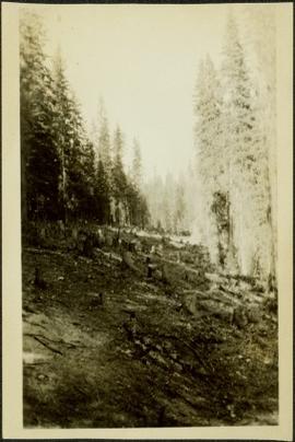
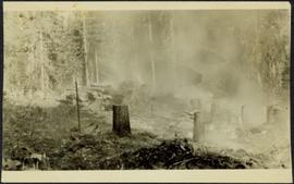
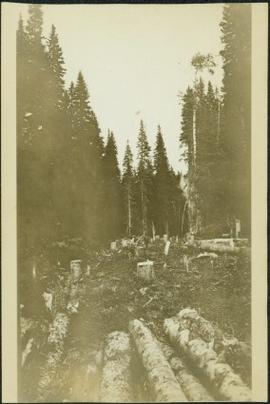
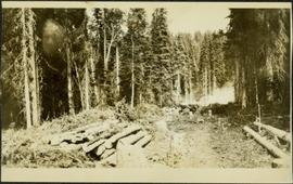
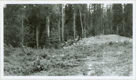
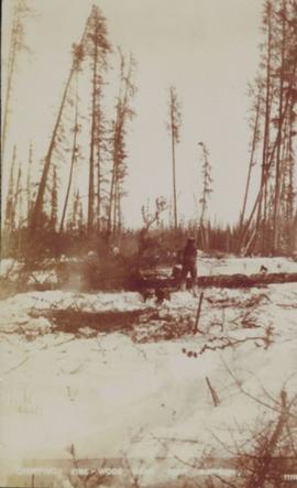
Image depicts a view of the scenery near Clinton, B.C.
Image depicts a climbing either up or down a rock face.
Image depicts a camper passing under an overhang as it drives along a narrow road near a cliff; located somewhere near Bralorne, B.C.
Image depicts a camper parked on the side of a narrow road along a cliff as another car approaches; located somewhere near Bralorne, B.C.
Photograph depicts tree stumps in forest clearing of the railway right-of-way.
Photograph depicts stumps and log piles in forest clearing of the railway right-of-way.
Photograph depicts men walking among stumps and log piles in forest clearing of the railway right-of-way.
Photograph depicts smoke, stumps and log piles in forest clearing of the railway right-of-way.
Slide depicts a cleared area in a forest, likely at the Aleza Lake Experiment Station.
Image depicts a clearing at Island Cache.
Photograph depicts cleared area of forest, vehicle tracks visible in the mud, and a large dirt area in midground.
Slide depicts a cleared area at the Aleza Lake Experiment Station with plant regeneration.
Image depicts a highway, and a section of mountain in the background which is bare due to clear-cut logging. It is possibly somewhere near Prince George, B.C.
Image depicts a logging area, and a section of mountain in the background which is bare due to clear-cut logging. The slide is also labelled "logging show." It is possibly somewhere near Prince George, B.C.
Image depicts the Clayhurst Ferry on the Peace River.
Image depicts a church on a hill somewhere in Seton Portage, B.C.
Photograph depicts three men with fishing gear. Trees and mountains in background. Left to right: Plato Malezemoff (holding fish), Jack Christian, Tam Zimmermann.
Photograph depicts three men fishing from shore. Water and trees in background. Left to right: Jack Christian, Plato Malezemoff, Tam Zimmermann.
Photograph of a person chopping down firewood in a forest. Printed annotation on recto reads: "Chopping Fire-Wood, near Fort Simpson, 1118." Handwritten annotation on verso reads: "55 Avenell Road, N. 29-2-'08 I wanted to write you a letter, but have had suck a lot to do, I find there isn't time before Prayer meeting; and as I haven't been able to go to P.M. for the last three weeks, I am sure you won't mind just for this once. Here is a p.c. of Canada which I promised you; don't you think it is pretty? Things are going on pretty well now; mother is better & Daisy- well, I never saw SO much improvement in anyone in one short week. As much love as if this were the longest letter I have ever written you, from Effie." Postcard is addressed to: "Mis J.G. Grafton "Belmont" Tividale Road, Tipton, Staffs." Verso is affixed with a British halfpenny green stamp and canceled with a postmark that reads: "Highbury S.O. 915 PM Fe 29 08."
Image depicts the Chimney Lake Lodge.
Image depicts Chimney lake with a number of houses near the shore, and a child in the foreground.
Image depicts a sign titled "Chilcotin Wildlife Management Area" somewhere near Riske Creek, B.C. It reads: "This trail has been provided by the Fish and Wildlife Branch in co-operation with Riske Creek Ranching Ltd., as access to the Chilcotin Wildlife Management Area. Please do not leave the the trail as the surrounding land is private property."
Image depicts a group of hikers hiking towards what is possibly the Chilcotin River.
Image depicts what is possibly the Chilcotin River.
Image depicts a view of a train passing through an area of Chetwynd, B.C.
Image depicts a view of a saw mill in Chetwynd, B.C.
Image depicts a view of some farm land in Chetwynd, B.C.
Image depicts a view of Chetwynd, possibly from Highway 97.
Image depicts the Cheslatta River.
Image depicts what appears to be a tour group at Cheslatta.
Image depicts the Cheslatta Falls.
Image depicts the wall of a chasm full of trees at an unknown location.
Image depicts a chasm full of trees at an unknown location.