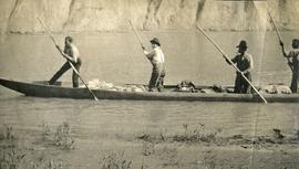
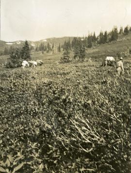
Print preview Close

Showing 3546 results

Archival description
3546 results with digital objects Show results with digital objects
Poling a canoe
2009.7.1.165 · Item · [ca. 1910]
Part of Archdeacon W. H. Collison fonds

Three Indigenous men stand in a canoe poling their craft along a shoreline while one man sits and steers. An unidentified village is visible along the opposite shore.

Plane on Summit Lake, BC
2005.3.37 · Item · [ca. 1945]
Part of John Hart Highway Photograph Collection

Handwritten caption above this photo reads: "Plane on Sumit Lake." Logs can be seen floating on water in foreground, as well as trees on opposite shore in background. The seaplane has the letters "CF-ATF" on its side.

Plane on Summit Lake, BC
2005.3.36 · Item · [ca. 1945]
Part of John Hart Highway Photograph Collection

Handwritten caption above this photo reads: "Plane on Sumit Lake." Logs can be seen floating on water in foreground, as well as trees on opposite shore in background. The seaplane has the letters "CF-ATF" on its side.

2009.7.1.150 · Item · [ca. 1878 - ca. 1915]
Part of Archdeacon W. H. Collison fonds

Photograph features a steep cliff across water, rocky shore in foreground.

Handwritten annotation on verso reads: "Up the 'Big Creek' at Kincolith B.C. Rock face called 'the place of echoes' by the Indian people."

Pine Pass
2012.13.1.91.31 · Item · Nov. 1978
Part of J. Kent Sedgwick fonds

Image depicts an unidentified individual standing near a drop-off in the Pine Pass between Alberta and British Columbia. The sign behind the individual reads: "Pine Pass - 2,868 FT. Here the great barrier of the Rock Mountains is breached by the lowest highway pass. Once the remote route of the trapper, it now links the commerce of the north and markets of the south. The John Hart Highway was completed in 1952 and followed by the P.G.E. in 1958. Gas and oil lines also take advantage of this convenient natural feature."

Pine Pass?
2012.13.1.73.03 · Item · Aug. 1979
Part of J. Kent Sedgwick fonds

Image depicts a view of what is possibly the Pine Pass located near the Murray Ridge.

PGE Grade - View South
2012.13.1.41.03 · Item · 2001
Part of J. Kent Sedgwick fonds

Image depicts a view of the south direction of the grade for the British Columbia Railway, which was formerly known as the Pacific Great Eastern until 1972. It is at an uncertain location, possibly near Woodpecker or Prince George.

P.G. Logging
2012.13.1.122.01 · Item · June 1975
Part of J. Kent Sedgwick fonds

Image depicts an aerial view of areas that have been used for logging around Prince George, B.C.