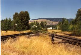
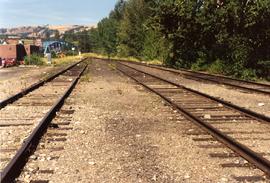
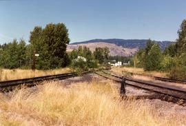
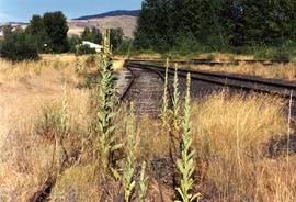
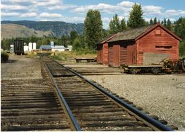
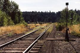
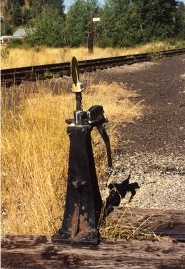
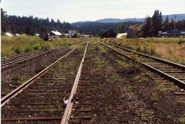
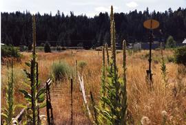
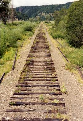
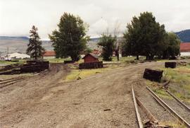
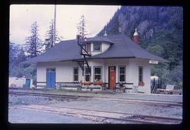
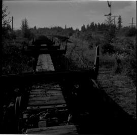
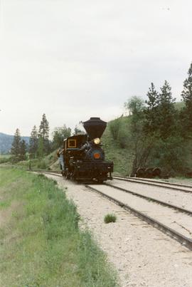
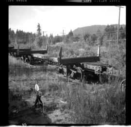
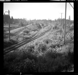
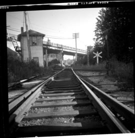
Photograph depicts a train at the KVR Museum in Summerland.
Photograph taken looking east, towards the depot and town of Princeton. Behind the yard lay the beginnings of the former Copper Canyon branch.
Photograph depicts abandoned KVR track. The depot was located just behind the camera.
Photograph depicts the west yards of the KVR.
Photograph depicts a spur that led off on the norst side of the main line between Princeton and Brookmere. The last train seen here was in May, 1989.
Photograph depicts KVR track in Princeton.
Photograph taken in the KVR yard area where there was a ballon in the place of a turning wye.
Photograph depicts details of a switch stand.
Photograph taken looking west towards the depot in Princeton on mile 70.5.
Photograph depicts an open space where former yards of the KVR were located. Visible is a 2 stall engine shed, a turning ballon (in place of a wye), and the connection with the 14 long Copper Mountain Bracnch which conveyed copper concentrate and closed in 1957. Just out of view, on the right, was the Princeton Tunnel built by the GNR in 1910.
Photograph taken somewhere between Thalia and Manning. At this point, Davies caught up with dismantling crews of Pacific Northern Rail Contractors Ltd. Here, rails were removed, but ties were still in place.
Photograph taken east of the KVR depot in Merritt. Trackage on the left was a Nicola spur/branch. Track to the right was part of the main line to Princeton. The two connected behind the trees to form a turning a wye.
Photograph depicts a Kwakiutl petroglyph in Fort Rupert near Port Hardy. Handwritten annotations on verso reads: “Reversed negative, dry rock, 1957”; “Dry Rock, 1957”
Photograph depicts a Kwakiutl petroglyph exposed at low tide in Fort Rupert near Port Hardy. Handwritten annotations on verso read: “1957 Port Hardy, visible at low tide”; “Right negative, rock (?) Port Hardy visible at low tide”
Image depicts the Kwinitsa CNR station in Kwinitsa, along the Skeena River.
Image depicts the Kwinitsa CNR station, which is Prince Rupert's railway museum.
Photograph depicts the "Kwuna" Ferry from the wharf at Sandspit, Queen Charlotte Islands.
Photograph depicts the "Kwuna" ferry coming in to dock at the landing at Sandspit, Queen Charlotte Islands.
Photograph depicts the "Kwuna" ferry about to dock at the landing at Sandspit, Queen Charlotte Islands.
Photograph depicts the "Kwuna" ferry coming in to the landing at Sandspit, Queen Charlotte Islands.
Photograph depicts an island and ferry at the "Kwuna" ferry landing at Sandspit, Queen Charlotte Islands.
Image depicts the La Tienda Hair and Nail Salon on an uncertain street somewhere in Prince George, B.C.
Photograph depicts an indoor view of a cannery machine. Handwritten annotation below photograph reads, "Lacquer machine".
Photograph depicts the a sign about 200 yards away from depot aadjacent to the Island highway. It was probably erected within the last 9 months as a result of the Canadian Transport Commission's investigation of the Esquimalt & Nanaimo Railway in late 1970. Amongst the other structures there is a lack of sign posting, dirty and unkept stations, and active discouragement of passenger traffic.
Photograph depicts the tombstone of John Wargo, born January 2, 1868, died October 5, 1909. Killed in an explosion at Extension Coal Mines. At least another 5 men were killed in the same incident and buried in the Ladysmith Cemetary.
Photograph taken at the Ladysmith Cemetary. The column reads "Ici repose Oscar Masset mort accidentellement a Extension le 24 mars 1909 a l'age de 53 ans, native de Bellgique." Davies noted that it seemed a good proportion of the local coal miners were Belgian, Scottish, Welsh, and Central European based on the tombstones.
Photograph depicts disused cars on the CPR spur just north of the crossing between the Esquimalt & Nanaimo Railway and Comox Logging and Railway Company (Division of Crown Zellerbach Canada Ltd.)
Photograph depicts the Ladysmith diamond crossing, looking north from the highway. Esquimalt & Nanaimo Railway is visible on the right and in the centre. On the left are the Comox Logging and Railway Company lines. Strings of disused log cars are on the centre tracks and are owned by CPR.
Photograph depicts the crossing between the Esquimalt & Nanaimo Railway (the camera is facing these tracks) and Comox Logging and Railway Company. The guard tower was manned at 7:00 p.m. and had its roof recently reshingled. It faces southward.
Photograph depicts disused log cars standing on spurs immediately north of the crossing between Esquimalt & Nanaimo Railway and Comox Logging and Railway Company. Both track cars are owned by CPR. Note: protection signals are located on the right. The camera is aimed towards the north.
Image depicts the Lajoie Dam on the Bridge River, upstream side, showing part of Downton Lake and, in the foreground, the spillway intake.
Image depicts the Lajoie Dam on the Bridge River from the upstream side.
Image depicts the Lajoie hydroelectric generating station at the Lajoie Dam on the Bridge River (view of powerhouse and tailrace from top of dam).
Image depicts a lake with numerous buildings along the shore. The location is uncertain.
Image depicts a lake with lily pads somewhere on Haida Gwaii.
Image depicts a lake with a "Swim at Own Risk" sign at an uncertain location.
Image depicts a lake and a cabin at an uncertain location.
Image depicts an aerial view of a lake and large, forested areas. The location is uncertain.
Image depicts a lake and a mountain in the distance. The location is uncertain.
Image depicts an aerial view of a lake, and what appears to be a set of railway tracks running towards the mountains in the distance. The location is uncertain.
Image depicts an aerial view of several lakes and their surrounding areas at an uncertain location.
Image depicts an aerial view of a lake and the surrounding area at an uncertain location.
Photograph depicts an unidentified lake as seen through coniferous trees. In the background a mountain is visible with trees at the base.
Photograph depicts an unidentified lake seen through the tops of coniferous trees. In the background a large mountain is visible with trees at the base.
Photograph depicts a body of water with trees on opposite bank crossing mid ground. Trees and rocks in foreground, hills visible in distant background. Handwritten photo caption below photograph reads: "Lake Beau Vert."