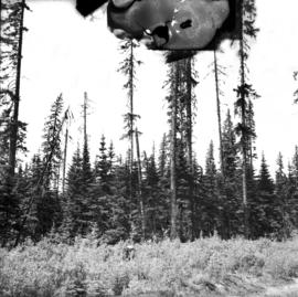
Print preview Close

Showing 2047 results

Archival description
Range cattle
2014.10.1.232 · Item · 1912
Part of Arthur Holland Land Surveying Collection

Photograph depicts a view of a herd of cattle from behind. A ranch hand is mounted on a horse on the left. There is a sparsely treed landscape in the midground and low treed hills in the distance.

2011.3.3.98 · Item · [ca. 1909-1930]
Part of North Coast & Central BC Postcard Collection

Photograph of a line of rail cars along a track next to a blasted pile of rubble. Printed annotation on recto reads: "Photo by McRae Bros. Prince Rupert." Handwritten annotation on verso reads: "Hello Charly. I have been dead for 2 month and just woke up tell the folks out home I am doing[??] fine. don't know when I will be down again Remember me to the good little woman, and weave[??] all Well. you're[??] friend Stan C." Postcard is addressed to: "Mr. Charles Chislett 96 Colonist Printing Co. Broad Street Victoria B.C." Verso is affixed with a one cent Canadian stamp. Postmark reads: "Prince Rupert B.C. [illegible date]."

2007.1.30.2.086 · Item · [between 1965 and 1968]
Part of Aleza Lake Research Forest fonds

Caption describing photograph: "Pulpwood Logging Operations on P.T.S. X91960, Swamp Lake, Prince George Pulp and Paper Ltd. Close-up of rubber-tired skidder at landing." Harry Coates holds a measuring tape against a felled tree to show trunk diameter.

2000.13.1.25 · Item · 1958
Part of Ray Williston fonds

Item is a photograph of Princess Margaret on July 17, 1958 at an event staged in the Prince George railway yards. Alex Moffat dressed as a prospector demonstrates panning for previously salted gold nuggets, which were later given to the Princess.

Prince George Sawmill
2012.13.1.3.158 · Item · Nov. 2000
Part of J. Kent Sedgwick fonds

Image depicts Prince George Sawmill taken from across the Nechako River looking southwest. Map coordinates 53°56'00.0"N 122°44'29.7"W

Prince George Sawmill
2012.13.1.3.159 · Item · Nov. 2000
Part of J. Kent Sedgwick fonds

Image depicts Prince George Sawmill taken from across the Nechako River looking southwest. Map coordinates 53°56'00.0"N 122°44'29.7"W

Prince George
2012.13.1.3.135 · Item · 12 Oct. 1989
Part of J. Kent Sedgwick fonds

Image depicts Prince George, possibly with the Northwood Pulpmill in the background.

Prince George
2012.13.1.3.133 · Item · 12 Oct. 1989
Part of J. Kent Sedgwick fonds

Image depicts Prince George, possibly with the Northwood Pulpmill in the background.

Prince George
2012.13.1.3.134 · Item · 12 Oct. 1989
Part of J. Kent Sedgwick fonds

Image depicts Prince George, possibly with the Northwood Pulpmill in the background.

2007.1.30.2.012 · Item · [30 June 1966]
Part of Aleza Lake Research Forest fonds

No caption provided with photograph negative. Appears similar to 2007.1.30.2.011, which has the following caption: "Poor quality Spruce left after diameter cutting. Note insect killed trees and leaning tree. Sparse stocking. Very poor increment. Devils Club site. Silty clay. No post logging regeneration. Continous understory of alder and willow. West Branch, F.E.S. Aleza Lake."