Print preview Close
Showing 671 results
Archival description
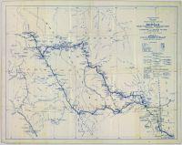
"Pre-Emptor's Map Tete Jaune Sheet" 1919
"Pre-Emptor's Map Tete Jaune Sheet" 1919
Preemptor's map Sheet No. 3 Valleys of Fraser, Salmon & Willow Rivers in Fort George and Peace River Land Recording Districts
Preemptor's map Sheet No. 3 Valleys of Fraser, Salmon & Willow Rivers in Fort George and Peace River Land Recording Districts
"Pre-Emptor's Map Quesnel Sheet" 1935
"Pre-Emptor's Map Quesnel Sheet" 1935
Pre-emptor's map of Fort George
Pre-emptor's map of Fort George
"Pre-Emptor's Map Fort George Sheet" 1949
"Pre-Emptor's Map Fort George Sheet" 1949
"Pre-Emptor's Map Fort George Sheet" 1943
"Pre-Emptor's Map Fort George Sheet" 1943
"Pre-Emptor's Map Fort George Sheet" 1930
"Pre-Emptor's Map Fort George Sheet" 1930
"Pre-Emptor's Map Fort George Sheet" 1930
"Pre-Emptor's Map Fort George Sheet" 1930
"Pre-Emptor's Map Fort George Sheet" 1923
"Pre-Emptor's Map Fort George Sheet" 1923
"Pre-Emptor's Map Fort George Sheet" 1915
"Pre-Emptor's Map Fort George Sheet" 1915
"Prairie Creek Flats (Summerland) Auger Holes with Uranium Content"
"Prairie Creek Flats (Summerland) Auger Holes with Uranium Content"
"Prairie Creek Flats (Dale Meadows) Post Glacial Uranium Deposit, Summerland, BC"
"Prairie Creek Flats (Dale Meadows) Post Glacial Uranium Deposit, Summerland, BC"
Political Papers
Political Papers
Plot maps, photos, and reports
Plot maps, photos, and reports
"Plan Showing the Growth of Vancouver's Street Car System as from the Laying of the First Tracks in 1889 to the Last Section Laid (Clark Dr., Hastings to Venables)"
"Plan Showing the Growth of Vancouver's Street Car System as from the Laying of the First Tracks in 1889 to the Last Section Laid (Clark Dr., Hastings to Venables)"
Plan showing provincial government property in the subdivision of Lots 933 & 934, Group 1, Cariboo District, South Fort George, British Columbia, to be offer for sale at public auction
Plan showing provincial government property in the subdivision of Lots 933 & 934, Group 1, Cariboo District, South Fort George, British Columbia, to be offer for sale at public auction
"Plan of the Fort George Indian Reserves"
"Plan of the Fort George Indian Reserves"
"Plan of subdivision of part of lot 932 Cariboo District"
"Plan of subdivision of part of lot 932 Cariboo District"
"Plan of subdivision of part of lot 925"
"Plan of subdivision of part of lot 925"
"Plan of subdivision of part of Lot 913 Cariboo District"
"Plan of subdivision of part of Lot 913 Cariboo District"
"Plan of subdivision of part of lot 2507 Fort George B.C."
"Plan of subdivision of part of lot 2507 Fort George B.C."
"Plan of subdivision of lot 934 townsite of Fort George South Fort George addition"
"Plan of subdivision of lot 934 townsite of Fort George South Fort George addition"
"Plan of subdivision of lot 933 Thapage addition Fort George"
"Plan of subdivision of lot 933 Thapage addition Fort George"
"Plan of subdivision of lot 1426 Fort George Collins addition"
"Plan of subdivision of lot 1426 Fort George Collins addition"
"Plan of subdivision of D. L. 752 Cariboo"
"Plan of subdivision of D. L. 752 Cariboo"
"Plan of subdivision of D. L. 2508 Cariboo District"
"Plan of subdivision of D. L. 2508 Cariboo District"
"Plan of subdivision D. L. 417 Cariboo District B. C."
"Plan of subdivision D. L. 417 Cariboo District B. C."
"Plan of official Grand Trunk Pacific Ry. Townsite of South Hazelton B.C."
"Plan of official Grand Trunk Pacific Ry. Townsite of South Hazelton B.C."
"Plan No. 1268 Subdivision of part of Indian Reserve No. 1 Lot 343 Cariboo District British Columbia"
"Plan No. 1268 Subdivision of part of Indian Reserve No. 1 Lot 343 Cariboo District British Columbia"
"Plan No. 1268 Subdivision of part of Indian Reserve No. 1 Lot 343 Cariboo District British Columbia"
"Plan No. 1268 Subdivision of part of Indian Reserve No. 1 Lot 343 Cariboo District British Columbia"
Pl. 721 DL 1426
Pl. 721 DL 1426
"Pictorial Key for Angiosperms"
"Pictorial Key for Angiosperms"
"Peace River - Liard, British Columbia" 1986 map
"Peace River - Liard, British Columbia" 1986 map
Parks and Outdoor Recreation
Parks and Outdoor Recreation
Parks and Conservation Areas in British Columbia
Parks and Conservation Areas in British Columbia
"Park No. JK 85 Fort George Park"
"Park No. JK 85 Fort George Park"
