Showing 441 results
Archival description
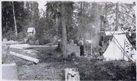
Tents on newly cleared land
Tents on newly cleared land

Four men at campsite with snowshoes and sleds
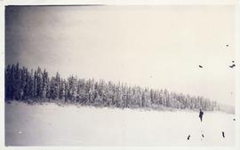
Man standing in a vast snow-covered clearing
Man in campsite with tents and outhouse
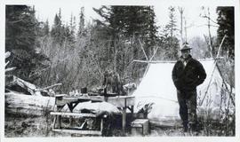
Man standing next to a picnic table in front of a tent
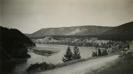
View of Fort St. James, with Mount Murray in the distant background
View of Fort St. James, with Mount Murray in the distant background
Bob Harkins interview with Walter Gill
Bob Harkins interview with Walter Gill
Cunard Canadian services booklet
Cunard Canadian services booklet

Construction of Fifth St in Prince Rupert

Centre street, Prince Rupert BC

Construction of Third Avenue in Prince Rupert, BC

The last big blast in Prince Rupert, BC

Big blast in Prince Rupert, BC

First pile driven at Prince Rupert BC

After the blast 24 April 1913

Before the blast 24 April 1913

The last big blast 21 January 1914

Moving mountains at Prince Rupert BC

First train leaving Prince Rupert

Close up of several buildings in Prince Rupert

Prince Rupert looking east from waterworks
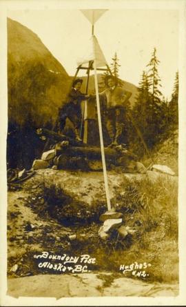
Boundary post between Alaska and BC
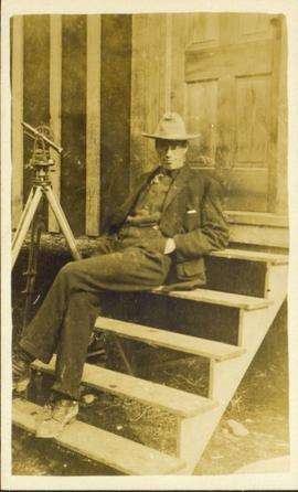
Man in hat sitting on steps
"First addition to townsite of Central Fort George"
"First addition to townsite of Central Fort George"
"Townsite of Central Fort George being subdivision of Lot 1429, Group 1"
"Townsite of Central Fort George being subdivision of Lot 1429, Group 1"
Pl. 721 DL 1426
Pl. 721 DL 1426
"Plan of subdivision of lot 1426 Fort George Collins addition"
"Plan of subdivision of lot 1426 Fort George Collins addition"
"Plan of subdivision of lot 934 townsite of Fort George South Fort George addition"
"Plan of subdivision of lot 934 townsite of Fort George South Fort George addition"
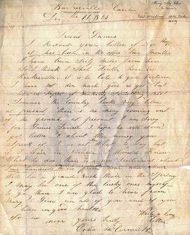
John McCormick Cariboo Letter December 11, 1869

Gordon Wyness, Louis LeBourdais, and Earl Malcolm at Twilight Lodge

Gordon Wyness and Jack Lee at Bobtail campsite near Vanderhoof

Jack Lee rafting on Bobtail Lake

Lone Butte, BC

View of Prince George from east hill
View of Fraser River from Soda Creek hill in October

Town of Lytton

Chasm
"Moran Dam Environmental Analysis"
"Moran Dam Environmental Analysis"
"Resource Management Course for Certificate in Band Planning"
"Resource Management Course for Certificate in Band Planning"
"Cariboo-Chilcotin Tourism Resource Inventory Study: Explanatory Notes"
"Cariboo-Chilcotin Tourism Resource Inventory Study: Explanatory Notes"
"Soil Survey of the North Okanagan Valley"
"Soil Survey of the North Okanagan Valley"
"Scheduling of Irrigation"
"Scheduling of Irrigation"
"Grassland Ranges in the Southern Interior of British Columbia"
"Grassland Ranges in the Southern Interior of British Columbia"
"British Columbia Recreation Sector Analysis East Kootenay Intersector Evaluation"
"British Columbia Recreation Sector Analysis East Kootenay Intersector Evaluation"
"Land Capability for Forestry: A Report to the British Columbia Forest Service by the Canada Land Inventory Staff - East Kootenay (Region 13)"
"Land Capability for Forestry: A Report to the British Columbia Forest Service by the Canada Land Inventory Staff - East Kootenay (Region 13)"
"Ecology and Food Production"
"Ecology and Food Production"
"The Role of Aerial Photography in the Canada Land Inventory Classification Program"
"The Role of Aerial Photography in the Canada Land Inventory Classification Program"
"A Technical Approach to Land Use Planning Based on the Canada Land Inventory"
"A Technical Approach to Land Use Planning Based on the Canada Land Inventory"
"A Study of the Agricultural Resources & Potentials of the British Columbia Gulf Islands"
"A Study of the Agricultural Resources & Potentials of the British Columbia Gulf Islands"
"A Topographic Classification to Map Spring Frost Risk for Six Deciduous Tree Fruit Varieties"
"A Topographic Classification to Map Spring Frost Risk for Six Deciduous Tree Fruit Varieties"