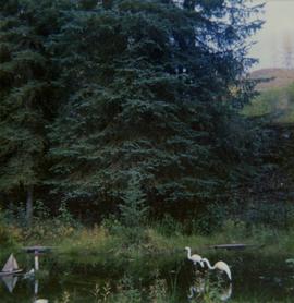
Image depicts a pile of dead trees in a forest somewhere on Haida Gwaii.
Photograph depicts Pine Creek winding through forest and hills. Altin Lake and mountains in background. Handwritten annotation on recto of photograph: "Atlin: Looking down lower Pine Ck, westerly towards Atlin, Atlin Lk, & the Atlin Mts. (part of Coast Range)."
Image depicts a view of Pine Pass.
Image depicts an unidentified individual standing near a drop-off in the Pine Pass between Alberta and British Columbia. The sign behind the individual reads: "Pine Pass - 2,868 FT. Here the great barrier of the Rock Mountains is breached by the lowest highway pass. Once the remote route of the trapper, it now links the commerce of the north and markets of the south. The John Hart Highway was completed in 1952 and followed by the P.G.E. in 1958. Gas and oil lines also take advantage of this convenient natural feature."
Image depicts a view of what is possibly the Pine Pass located near the Murray Ridge.
Image depicts what is either the Peace or Kiskatinaw River in Pine Valley, B.C.
Image depicts the mostly frozen Place Creek Falls.
Image depicts the Place Glacier.
Image depicts two unknown individuals at the Place Glacier.
Image depicts the Place Glacier. There are two unknown individuals present.
Image depicts the Place Glacier.
Image depicts the Place Glacier. There are two unknown individuals present.
Image depicts an unknown individual at the Place Glacier.
Photograph features a steep cliff across water, rocky shore in foreground.
Handwritten annotation on verso reads: "Up the 'Big Creek' at Kincolith B.C. Rock face called 'the place of echoes' by the Indian people."
Photograph features a steep cliff across still water.
Handwritten annotation on verso reads: "Place of Scalps / Kincolith BC"
Photograph depicts an unidentified man mining in rocky area, trees and hills in background. Handwritten annotations on verso of photograph: "PLACER MINER WSHING FOR GOLD FINDLAY RIVER BC", "PHOTO WWW".
Photograph depicts two miners standing on either side of wooden sluicing trough in rocky area. Man on left pans for gold. Hills in background. Handwritten annotations on verso of photograph: "PLACER MINERS AT WORK INGINECA RIVER BC", "PHOTO WWW".
Consists of 2 overlapping legal-size copies depicting the plans for Lot 7392 in Port Essington.
Plan of Port Essington consists of an architectural plan for the townsite of Port Essington compiled from plans in Land Registry and described as Composite Plan 537 (originally deposited October 17th 1893). Depicts Skeena River, Hocsal River, individual lots and streets, the B.C. Fishing and Packing Co. Ltd., a graveyard, and the Anglo British Columbia Packing Co.
Consists of 1 plan entitled "Plan of Subdivision of S.W. 1/4, D.L. 4041 : Cariboo District," surveyed and signed by P.A. Landry, of South Fort George.
Handwritten caption above this photo reads: "Plane on Sumit Lake." Logs can be seen floating on water in foreground, as well as trees on opposite shore in background. The seaplane has the letters "CF-ATF" on its side.
Photograph depicts plateau below summit between John Brown and Kitseucla creeks. Survey of 55th parallel.
Image depicts an aerial view of a plateau near the Fraser River.
Image depicts a totem pole and a playground in what appears to be a residential area somewhere on Haida Gwaii, B.C.
Photograph depicts a few scattered buildings and railway siding in the foreground, sparsely forested mountain in the background.
Three Indigenous men stand in a canoe poling their craft along a shoreline while one man sits and steers. An unidentified village is visible along the opposite shore.
Photograph depicts two persons holding long poles, standing on a canoe on the Nechako river. The water vessel appears to be very near a falls. Image is out of focus.
Photograph depicts four men standing on a canoe, loaded with supplies. Calm river water in the background, bluffs in the background.
Photograph depicts a pond with pink flamingos and a model boat that is located in Driftwood Canyon near Smithers.
Image depicts a pulp mill in Port Edward, B.C.
"Port Essington: A Town Remembered" consists of copies of 4 black & white photographs of Port Essington, taken in October 1984 by Nancy Robertson, and published on page 13 of the 15 November 1984 edition of The Daily News, Prince Rupert's newspaper. The page caption reads as follows : "Port Essington : a town remembered - These photos are from an aging Port Essington taken in the fall month of October by photographer Nancy Robertson. Once a thriving community, Port Essington stands derelict at a Skeena estuary with only occasional visitors."
Photograph depicts Port Simpson in winter. Water and shoreline in foreground, hill in distance.
Handwritten photo caption below image reads: "Port Simpson".
Image depicts the North end of Portage Lake.
Image depicts the canoe group portaging to Indianpoint Lake.
Image depicts the path taken during the portage to McCleary Lake.
Image depicts Portal Lake, located near the Yellowhead Pass on the British Columbia-Alberta border, west of Jasper, A.B.
Image depicts numerous lily pads on the surface of Portal Lake, located near the Yellowhead Pass on the British Columbia-Alberta border, west of Jasper, A.B.
Photograph of a mountain on the waterfront. Annotation on recto reads: "Portland & Stewart. New Twin Cities. Portland Canal. June 17th 1910. Button Photo. Prince Rupert, BC."
Photograph depicts a power dam near Cascade, BC.
Image depicts power lines east of the pulp mills in Prince George, B.C.
Colour-coded map depicting lands open for pre-emption, lands in “University Reserve,” and lands reserved for public auction. Depicts land recording divisions, communities, bodies of water, transport routes, and game reserves.
Colour-coded map depicting lands surveyed as alienated, reserved, Statutory Timber Lands, B.C. Land Settlement Board Area, or open for pre-emption. Depicts land districts, land recording divisions, communities, game reserves, bodies of water, transport routes, and communication lines.