Image depicts numerous boats docked by a buildings identified as the "Prince Rupert Fishermen's Co-operative Association."
Photograph depicts an unidentified fishing boat at the Prince Rupert marina. An unidentified person stands beside a building in the far background.
Photograph of many fishing boats in a Prince Rupert harbour. Printed annotation on recto reads: "Fishing Boats Prince Rupert, BC Photo by J. Wrathall." Handwritten annotation on verso reads: "Greetings from British Columbia Ruth and Jim Warner[??]." Postcard is addressed to: "Mr. and Mrs. C. Ott 426 So. Humboldh Denver 9. Colorado U.S.A." Verso is affixed with a 4 cent Canadian stamp. Postmark reads: " Vancouver B.C. Canada. Jun 5 5 PM 1954."
Photograph of many fishing boats in a harbour. Printed annotation on recto reads: "Fishing Boats Unloading at Prince Rupert, B.C."
Tugboat appears to be towing a long line of small boats.
Handwritten annotation on verso reads: "Fishing fleet coming home Nass River B.C."
Photograph depicts two men in a row boat, one rowing and one holding a peugh (J.J. Claxton) and watching the catch being reeled in on the fishing pole of another man wearing a hospital gown. A small boy on the deck watches. Handwritten annotation in pencil on verso reads: “JJC x”
Photograph depicts the fishing vessel “Callistratus” at the Fairview Terminal in Prince Rupert.
Photograph depicts five First Nations children leaning over the deck on the M.S. Columbia. Stamped annotation on recto: “Oct – 64”. Handwritten annotation in pen on verso reads: “Mamalicula”
Photograph depicts a flat car on the CPR line at Rock Creek, located about mile 11.7 from Midway, which is east of Osoyoos. The flat car had a temporary roof to carry work train supplies. The sidings capacity is 70 cars.
Photograph depicts a flat car wheel set carrier not related to Kamloops Auxiliary Trains.
Photograph depicts two large metal structures on flatbed trailer. Trees visible in background.
Handwritten photo album caption below this photo reads: "F/O P.B.COX Grand Prairie. C.D. #1. Unit. N.W.S.R." Photograph depicts the officer standing in uniform at airstrip, wearing what appears to be an RCAF wings medallion on his right breast. Machinery can be seen in background (two sets of land-rollers).
Royal Canadian Air ForcePhotograph depicts the repairing of a float plane. The tug was used as a ladder.
Photograph depicts a float plane landing at Gold River on west Vancouver Island.
Photograph depicts a Gruman Goose float-amphibian plane on a ramp of the lake. Side base was owned by Forest Industries Flying Tankers Ltd.
Photograph depicts lane in front of tent buildings flooded with water, forest trees in background. Photograph taken from canoe, portion of canoe visible in foreground. It is believed that this photograph may depict the Island Cache in flood, at Prince George, BC.
Photograph depicts lane in front of tent buildings flooded with water. Tree in midground, forest trees in background. A man can be seen between first and second row of tent buildings. Photograph taken from canoe, portion of canoe visible in right foreground. It is believed that this photograph may depict the Island Cache in flood, at Prince George, BC.
Photograph taken at the main main fire station on the site of the former RCAF station near the Vancouver Airport. Visible is foam pumper #2, operated by the Federal Department of Tranpsort, as well as a Sicard truck.
Photograph depicts the folding steel stern door of the S.S. Canora C.N.R. ferry to Vancouver Island. The door is raised and lowered by a 2 cylinder steam winch.
Footage of thee men in dugout canoe bringing in ooligan nets full of ooligan fish on what is believed to be the Bella Coola river. Two of the men bring in the net while the third bails water. The men then bring in the canoe to shore using long poles. Women then join and help transport the fish to shore and then place the fish in large "stink box" where they are stirred with a stick.
Footage of ducks on a lake and flying away, horses in a corral, a campsite, caribou in the high country of the mountains, probably the Rainbow Mountains, a campsite where men are packing horses and game kill and their journey home in pack train.
Possible locations of filming include Anahim Lake, Chilcotin area, Holt Homestead, Rainbow Mountains, Tweedsmuir Provincial Park, or Wells Gray Provincial Park.
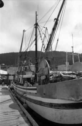
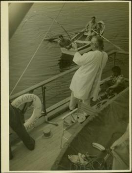
Footage includes salmon jumping in a river, men filleting fish in fishing boat in tide water, a beaver in the water, and a bird, probably a heron, flying.
Recordings from the boat on a river, some loons on a lake, either Anahim or Fenton lake, and a panoramic view of the lake with mountains in background.
Also some footage of men fishing from the shore of a river, children catching fish, children swimming, some river rapids, footage of an eagle, a pelican on the lake, a group of birds, probably sand pipers, in water.
There are two young girls playing on a boat near shore, a view of white and brown house, and an older boy pulling a young girl in a wagon.
Include is footage of a backyard BBQ picnic, two young girls fishing, a cabin at a lake, and general scenery of birch trees, a boat house, and a dock at lake.
There is also a sign that reads "Breezy Cove," people relaxing on porch in front of cabin, and footage of a woman believed to be Mrs. Elsey and a friend walking on a forest path.
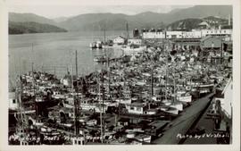
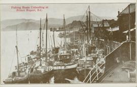
The film ends with footage of more fishing off a motor boat and unloading the motor boat at a dock.
Possible locations of the filming include the Bella Coola River, the Bella Coola Valley, the Bulkley Valley, the Hagensborg area, and Nimpo Lake.
Photograph of several men traveling across a river. Printed annotation on recto reads: "Fording The Nelson River Going to the Naas #93."
Photograph depicts men on river boat and small canoe floating just off shore. Men sit and stand on shore among square bales and large cut lumber. Forest in background. Handwritten annotations on recto of photograph: "Fort Fraser wooding up at Giscome Portage", "Chilco at Giscome Portage".
Image depicts several pieces of heavy machinery used in forestry. The Coast Inn of the North is seen in the background.
Image depicts an unidentified individual examining a piece of heavy machinery used in the forestry industry. It is located in Prince George, B.C.
Photograph depicts one woman with her back turned, and four men standing on scow next to chairs and table adorned with food. Trees on shore in background. Handwritten annotation on recto of photograph reads: "Bourchier Scow".
Photograph depicts the former automobile, passenger ferry, "San Diego," that had been acquired for conventions and sightseeing purpsoses. It was believed to have been a San Francisco ferry before being purchased by its present owner in 1973.
Photograph depicts the former B.C. Electric Railway spur running westwards along Bridgeport Rd., leading from the former main trackage. It was not in use for many years and was lifted in 1965, except for road crossings. The photo is taken from the intersection with Sexsmith Rd., looking east. The former main trackage is sited about 300 yards in the background and at right angles to the track in the foreground.
Photograph depicts the former B.C. Electric Railway track crossing Sea Island Way near Bridgeport, Lulu Island, and looking north to the Oak St. road bridge. The track was lifted in 1965 when the new Steveston route went into service.
Photograph depicts a former boiler house and machine shop built in 1929. Located at the CNR Kamloops Junction.
Photograph depicts the former bridge that crossed the Nanaimo River. Davies had taken a photograph of the bridge in June 1965, when it was in use. The bridge was superceded by a newer one a year prior the photograph was taken. On June 13, 1972, it was standing, but on this day the Highways Department took it down.
Photograph depicts a car standing on what was once the Carson spur of the CPR (pre-1919 it was GNR). Car was switched by G.F. Railroad Co. locomotive #6703.
Photograph depicts a turntable that had been lifted out of a pit and set on the ground at the Kamloops Junction. Lifting had been done by two powerful sterling cranes.
Photograph depicts a former turntable pit that was pictured immediately after the table was removed. The pit was later filled in with dirt/gravel. R.H. track wioth 2 locomotives was made into a running line. L.H. track that had a switcher was made into a dead-end spur.
Photograph depicts a former turntable pit iat the CN Kamloops Junction that was pictured immediately after the table was removed. CN lost no time in filling the pit. A running rail was salvaged by the 2141 Society.
Photograph depicts a former C.N.R. station at Youbou on Lake Cowichan on Vancouver Island. The track is still used to serve the plywood lumber mill at Youbou.
Photograph depicts the former CPR Brodie Junction at mile 65.2 from Spences Bridge on the former Merritt Subdivision, connecting with Princeton, 42.5 miles to the south. The view is looking southeast with the existing line on a sharp curve, and two former connector of the Coquihalla line converging onto it. The northbound connector, with rails from 1913, 1914, and 1919, is still in position but the southbound connector has been lifted, though the bridge is still retained. The elevation is 3025 ft.
Photograph depicts the former CPR Coquihalla to Brookmere rail line. It shows a former rail tunnel at about 15 miles northeast of Hope. The view is looking northeast.
Photograph depicts the former CPR Coquihalla to Brookmere rail line. This view is about 10 miles northeast of Hope. The abandoned bridge has been left to stand in isolation.
Photograph depicts the former CPR depot in Castlegar that was now a museum. Depot rebuilt in 1907.
Photograph depicts a view of former C.P.R. steam locomotive sheds at North Bend, B.C. in the Fraser Canyon.
Photograph depicts the former C.P.R. passenger vessel "Lady Alexandra", now a floating restaurant in Coal Harbour. The Bayshore Hotel is at the right. The picture was taken after a snowfall and shows a view looking east.
Photograph depicts a former electric service car of the B.C. Electric Railway located in Chilliwack. It is in remarkably good shape.
Photograph depicts a former Great Northern Railway bridge, which carried the line over the Similkameen River between Keremeos and Hedley. The bridge is about 2-3 miles west of Keremeos.
Photograph depicts a former Great Northern Railway bridge carrying a single track over the Similkameen River, between Keremeos and Hedley. The bridge is about 2-3 miles west of Keremeos.
Photograph depicts a former highway bridge that was probably made obsolete when the new road to Edmonton was built in 1970.