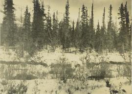
Showing 3487 results

Archival description
3098 results with digital objects Show results with digital objects
Deer in the brush
2000.19.1.97 · Item · 20 Sept. 1926-19 Oct. 1926
Part of Prentiss Gray Collection

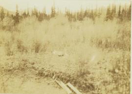
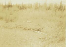
Photograph depicts a distance perspective of a deer in a brush covered area with a forest in the background.

Demolished House
2012.13.1.22.05 · Item · 1970
Part of J. Kent Sedgwick fonds

Image depicts the rubble of a demolished house at Island Cache, with several other buildings in the background.

2000.1.1.3.14.01 · Item · 1952
Part of Cassiar Asbestos Corporation Ltd. fonds

Photograph depicts two pick hammers laid in asbestos fibre. Annotations on note glued to recto of photograph: "ASBESTOS"; "Detail view of asbestos talus. Early test pit near top of showing. Western slope." Areas of image have been labeled "A" and "B". Photo caption under printed copy of image in 1952 Annual Report: "A - Asbestos fibre partially opened by frost action. B - Serpentine rock originally containing the asbestos fibre."

2012.13.1.87.065 · Item · [between 1975 and 1995]
Part of J. Kent Sedgwick fonds

Image depicts an old house for sale surrounded by overgrown bushes in Upper Fraser, B.C. Map coordinates 54°07'15.0"N 121°57'02.0"W

Dirt Road
2012.13.1.87.024 · Item · [between 1975 and 1995]
Part of J. Kent Sedgwick fonds

Image depicts a dirt road leading through numerous trees toward a mountain. The location is uncertain, likely on the way to Longworth, B.C.

Dirt Road
2012.13.1.87.025 · Item · [between 1975 and 1995]
Part of J. Kent Sedgwick fonds

Image depicts a dirt road leading through numerous trees toward a mountain. The location is uncertain, likely on the way to Longworth, B.C.

2009.5.3.50 · Item · [ca. 1910]
Part of Taylor-Baxter Family Photograph Collection

Photograph depicts settlement across frozen lake. Trees cross midground, mountains stand in background. Handwritten annotation on verso of photograph reads: "Distant view of Tete Jaune B.C.", on recto of photograph: "I marked about where you loaded your boat the telephone pole is down the road toward 53. Tete Jaune Mile 52."

Disturbed Ground
2012.13.1.50.117 · Item · 1980
Part of J. Kent Sedgwick fonds

Image depicts an area of disturbed ground, most likely due to a landslide, at an unknown location.

Disturbed Ground
2012.13.1.50.119 · Item · 1980
Part of J. Kent Sedgwick fonds

Image depicts an area of disturbed ground, most likely due to a landslide, at an unknown location.

Diving
2012.13.1.84.40 · Item · 1994
Part of J. Kent Sedgwick fonds

Image depicts an unidentified individual diving into a pool of water at an uncertain location.

Dock
2012.13.1.60.18 · Item · July 1973
Part of J. Kent Sedgwick fonds

Image depicts a dock on a lake in Carp Lake Provincial Park, possibly War Lake.

Dog on a Path
2012.13.1.60.15 · Item · July 1973
Part of J. Kent Sedgwick fonds

Image depicts a dog standing on a path through the woods somewhere in Carp Lake Provincial Park.

Dog on Bridge
2012.13.1.56.09 · Item · 1973
Part of J. Kent Sedgwick fonds

Image depicts an unknown individual and a dog on a bridge over what is possibly the Robson River.