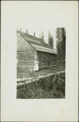
Showing 3487 results

Archival description
3098 results with digital objects Show results with digital objects
Sawmill - Saw
2012.13.1.122.18 · Item · June 1980
Part of J. Kent Sedgwick fonds

Image depicts a saw cutting a log in half at a saw mill in Prince George, B.C.

Sawmill - People and Logs
2012.13.1.122.22 · Item · June 1980
Part of J. Kent Sedgwick fonds

Image depicts numerous stripped logs and several unidentified individuals in hard hats at a saw mill somewhere in Prince George, B.C.

Sawmill
2012.13.1.3.141 · Item · Dec. 1997
Part of J. Kent Sedgwick fonds

Image depicts a sawmill, possibly Lakeland Sawmill, in Prince George B.C.

Sawmill
2012.13.1.122.15 · Item · [1979?]
Part of J. Kent Sedgwick fonds

Image depicts logs being stripped of their bark at a saw mill in Prince George, B.C.

2009.5.2.180 · Item · [ca. 1905?]
Part of Taylor-Baxter Family Photograph Collection

Photograph depicts man standing with women believed to be Sarah Glassey. The pair holds a line of fish between them. Boat and trees in background. Handwritten annotation on recto of photograph: "[Mert?] and myself after an hours trolling."

2009.5.2.8 · Item · [ca. 1911]
Part of Taylor-Baxter Family Photograph Collection

Photograph depicts Sarah Glassey, holding her fox terrier, and standing at corner of log house. Felled trees in foreground, forest trees in background. Photograph believed to have been taken on the 160 acres of land which Sarah purchased in the Kispiox Valley in 1911. She became the first single woman to pre-empt land in British Columbia. This house was built in a year with the help of a Gitxsan Elder.

2009.5.3.72 · Item · [ca. 1912]
Part of Taylor-Baxter Family Photograph Collection

Photograph depicts small log buildings and loaded wagons in cleared dirt area. Building on far left has the sign "POOL HALL" posted on front . Treetops, lumber piles, and hills in background. Mountains can be seen in distance. Handwritten annotation on verso of photograph reads: "Sand Creek. B.C."

2009.5.3.136 · Item · 1912
Part of Taylor-Baxter Family Photograph Collection

Photograph depicts creek barely visible at bottom of steep valley in cliffs. Trees and underbrush in foreground, mountains visible in background. It is believed that this photograph may have been taken near Mt. Robson. Handwritten annotation on recto of photograph duplicate reads: "Sand Creek."

2009.5.3.75 · Item · 1912
Part of Taylor-Baxter Family Photograph Collection

Photograph depicts creek barely visible at bottom of steep valley in cliffs. Trees and underbrush in foreground. It is believed that this photograph may have been taken near Mt. Robson. Handwritten annotation on recto of photograph reads: "Sand Creek."

Sand Beds
2012.13.1.124.17 · Item · Oct. 1975
Part of J. Kent Sedgwick fonds

Image depicts sand beds with a shovel present for size reference. The slide places it at the "BCR site," possibly in Prince George, B.C.

Ruined Cars
2012.13.1.22.16 · Item · 1970
Part of J. Kent Sedgwick fonds

Image depicts several old, ruined cars and an unknown individual in Island Cache.

Rudi's Bridge
2012.13.1.50.059 · Item · 1978
Part of J. Kent Sedgwick fonds

Image depicts a small foot bridge at an unknown location. The slide is simply labelled "Rudi's Bridge."

Rowboat on Lake
2006.25.1.26 · Item · Aug. 1965
Part of Al Elsey Moving Images Collection

Footage of two people, Doris and Jerry, in a rowboat on a lake.

Speculated locations include Anahim Lake, Fenton Lake or Lassard Lake.

Rocky Shore
2012.13.1.65.72 · Item · May 1984
Part of J. Kent Sedgwick fonds

Image depicts the rocky shore of an unidentified body of water, possibly near Meldrum Creek, B.C.

Rocky Shore
2012.13.1.65.70 · Item · May 1984
Part of J. Kent Sedgwick fonds

Image depicts the rocky shore of an unidentified body of water, possibly near Meldrum Creek, B.C.

Rocky Mountain Trench
2012.13.1.86.02 · Item · Oct. 1975
Part of J. Kent Sedgwick fonds

Image depicts a heavily forested area located in the Rocky Mountain Trench, possibly near Dome Creek or Lamming Mills, B.C.

Rocky Mountain Trench
2012.13.1.86.01 · Item · Oct. 1975
Part of J. Kent Sedgwick fonds

Image depicts a heavily forested area located in the Rocky Mountain Trench, possibly near Dome Creek or Lamming Mills, B.C.

2000.1.1.3.15.30 · Item · June 1970
Part of Cassiar Asbestos Corporation Ltd. fonds

Photograph depicts truck at reject plant in foreground. Mine road can be seen leading to plant in centre background, town in right background. South mountain range visible in distance. Handwritten annotation on recto of photograph: "June 1970 / Looking South across Rock Reject Tailings / Note Southern direction of conveyor [?] towards No 1 Gully. Tom Kiefer".

2009.5.3.108 · Item · 1911
Part of Taylor-Baxter Family Photograph Collection

Photograph depicts men on river scow, large rock island or peninsula protruding into river behind them. Trees on opposite shore in background, large rock in foreground. Handwritten annotation on verso of photograph: "Grand Canyon. Fraser River. Big Rock.", on recto of copy print: "1911."

Rock Formations
2012.13.1.65.52 · Item · [1976?]
Part of J. Kent Sedgwick fonds

Image depicts ridge-like rock formations at an uncertain location, though possibly somewhere near the Fraser River.