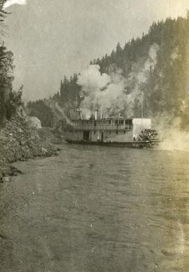
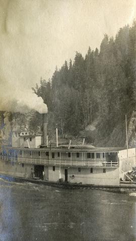
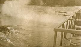
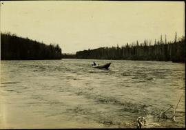
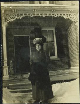
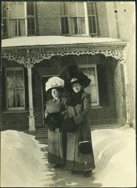
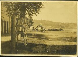
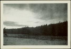
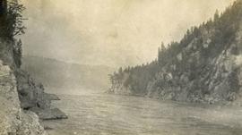
Photograph depicts a narrow canyon on the Fraser River.
Photograph depicts a steamboat on the Fraser River with a full view of the paddles.
Image depicts the Cottonwood Canyon.
Photograph depicts a steamboat on the Fraser River.
Photograph depicts a view of rough river waters from the deck of a steamboat.
Typed annotation on recto: "Cottonwood dugout on Tachi River Stuart Lake Section of B.C." Two people sit in dugout canoe, tree-covered banks in background.
Image depicts a section of the Heritage Trail on Cottonwood Island in Prince George, B.C.
Image depicts the Cottonwood House at the Historic Site located in Barkerville, B.C.
Image depicts the Cottonwood House.
Image depicts the Cottonwood House Historic Site along Barkerville Highway, east of Quesnel, B.C. A sign posted by the fence reads: "For over half a century the Boyd family operated this haven for man and beast. Here weary travellers found lodging, food, and drink. Here fresh horses were hitched to stage-coaches and miners bought supplies. This historic road-house, built in 1864, stood as an oasis of civilization on the frontier of a rich new land."
Image depicts the kitchen area of the interior of the Cottonwood House.
Image depicts the living area of the interior of the Cottonwood House.
Image depicts the picnic site of the Cottonwood House Historic Site, located on the Barkerville Highway, east of Quesnel, B.C.
Image depicts Cottonwood Island.
Image depicts a nature trail in Cottonwood Island Park by a beehive burner. Map coordinates 53°55'23.6"N 122°43'53.8"W
Image depicts a couple walking through a nature trail in Cottonwood Island Park. Map coordinates 53°55'23.6"N 122°43'53.8"W
Image depicts a crowd of people in Cottonwood Park in Prince George, B.C.
Image depicts Elmer Mercier, a former mayor of Prince George, B.C., cutting the ribbon to open Cottonwood Park's Heritage Trail.
Image depicts a the Cottonwood Island Nature Park sign and map in Prince George, B.C.
Photograph depicts large bridge and dam over a wide river, industrial structures throughout. Hills on opposite shore in background. Handwritten annotation on recto of photograph: "Coulee Dam, This is were[sic] I went this fall. Wished you had of been with me."
Aline’s son Dominic Dobrzensky stands in uniform in background.
Handwritten annotation on verso reads: “June 04”.
Photograph depicts man and woman speculated to be Pat (Bridget Moran's son) and Tracy holding food and beverage on deck in backyard. Unidentified individuals semi-visible on far left and right. Trees and building visible in background. Photo taken on the day Bridget Moran received an Honourary Law Degree from the University of Northern British Columbia in Prince George, B.C.
Woman pours drink into glass of man seated in chair. Handwritten annotation on recto of photograph: "Firm believers in the 'putting down' of drink. John [Ross?]." It is speculated that these may be the parents of H.F. Glassey.
Woman and man stand with baby on path, field in background. Handwritten annotation on recto of photograph: "Archie & I with the Bunker baby."
Man and woman sit on large barrels in dark area. Dog stands on right. Illegible annotation on recto of photograph: "Mr. Lev and self at Brew and [Chaisr?] Winery [Lakevill?] Cal. Sitting on '[puncheon?]' '[...?]' in the background."
Item is a photograph of Ray and Gladys Williston in fancy dress with a number of other people. Mr. & Mrs. Williston are the second couple from the left.
Photograph depicts large three story building, road and parked cars in foreground.
Annotation on verso: “Court House and Prov. Govt. offices at Pr. George. Once used to be 'Alexandra Hotel' now site occupied by Kresge’s. Alexander Hotel. Opened Sept 25, 1915."
Photograph depicts the Courtenay terminus of the Esquimalt and Nanaimo Railway. The view is looking north.
Photograph depicts a courthouse at Revelstoke, B.C. that was built in 1912-1913.
Photograph depicts a courthouse in Richfield, 1 mile above Barkerville. It was the only building left standing of the former mining community.
Photograph depicts a courthouse in Vancouver, B.C. Photo shows the ripped up forecourt.
Photograph depicts a courthouse on Georgia St., looking west towards the Vancouver Hotel. The fence surrounding the courthouse is covered with paintings.
Photograph depicts a courthouse in Vancouver, B.C. Photo shows the ripped up forecourt.
Photograph depicts a courthouse on Howe St. in Vancouver, B.C. There are paintings on the fence surrounding the forecourt.
Photograph depicts a courthouse in Vancouver, B.C. surrounded by a fence with paintings.
Photograph depicts water fountain in centre of grass courtyard at the Museum of King Jan III's Palace at Wilanów, Warsaw, Poland. Three unidentified women and one unidentified man can be seen walking in left foreground. Photograph taken during European Sports Tour with Team Canada.
Woman stands in walkway cleared of snow in front of tall brick home with a detailed porch, believed to be in Victoria, B.C. Woman wears long winter coat, fur hand-warmer, and large hat. It is believed this woman may be a cousin to Sarah Glassey's family, possibly through the Taylor line.
Two women stand in walkway cleared of snow in front of tall brick home with a detailed porch, believed to be in Victoria, B.C. The women wear long winter coats, fur hand-warmers, and large hats. It is believed that one or both of these women is a cousin to Violet Baxter's family, through the Taylor line.
Photograph depicts men standing near three covered wagons pulled by team of horses on street. Buildings line the street on left behind trees with protective structures built around their trunks. A windmill stands near small building and woodpiles in background on right. Trees on hill are visible in distance. Handwritten annotation on recto of photograph: "Quesnel".
Photograph depicts open field with dark clouds overhead. Cow grazing in left, forest in background.
Photograph taken at the Cowichan Valley Forest Museum.
Photograph taken at the Cowichan Valley Forest Museum near Sommos Lake in Duncan. Visible is a 2 truck shay owned by Gerry Wellburn. It was sited beside the Island Highway, at the entrance of the museum.
Photograph taken at the Cowichan Valley Forest Museum near Sommos Lake in Duncan.
Photograph taken at the Cowichan Valley Forest Museum.
Map reflects highways, main, branch and property roads, trails, public sustained yield unit boundaries, cutting permit boundary, contours, height of land, edge of lake, merchantable and immature timber, non-commercial cover, and swamps.
Photograph depicts CPR delivering 4 tank cars at an interchange track on Home Street. Kamloops Heritage Railways was commencing to build its facilities on the north side of the interchange track.