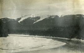
Showing 3615 results

Archival description
2009.5.2.59 · Item · [ca. 1930?]
Part of Taylor-Baxter Family Photograph Collection

Photograph depicts power plant by waterfall. Extensive construction materials and structures can be seen scattered to left of plant. River in foreground, forest and hills in background. Typed annotation on verso of photograph: "Northern B.C. Power Co. Falls River Plant Prince Rupert B.C."

Hydraulic
2012.13.1.69.30 · Item · [1981?]
Part of J. Kent Sedgwick fonds

Image depicts the old log buildings of the town of Hydraulic, B.C.

Houses on Stilts
2012.13.1.6.106 · Item · Nov. 1980
Part of J. Kent Sedgwick fonds

Image depicts a number of houses built on stilts over a body of water in an uncertain location.

2011.3.1.06 · Item · [ca. 1905]
Part of North Coast & Central BC Postcard Collection

View of peninsula with houses and trees. Dock in mid ground, trees and grasses in foreground. Recto stamped “Port Simpson DE 17" and "Port Essington DE 18". Handwritten annotation on recto of photograph: "W. J. O'Neill Esq. Telegraph Point Via Pt. Essington B.C. Don't you think this pretty [Weggs & Mr. Byron?] was over last night - said he saw you and [Halie?]. Yours - BaBa".

Houses in Giscome
2012.13.1.87.072 · Item · [between 1975 and 1995]
Part of J. Kent Sedgwick fonds

Image depicts the Giscome B.C. townsite from across the railroad tracks looking southeast. Map coordinates 54°04'19.7"N 122°22'04.7"W

Houses and Train in Giscome
2012.13.1.87.073 · Item · [between 1975 and 1995]
Part of J. Kent Sedgwick fonds

Image depicts the Giscome B.C. townsite from across the railroad tracks looking southeast. Map coordinates 54°04'19.7"N 122°22'04.7"W

Houses and Three Goats
2012.13.1.87.021 · Item · [between 1975 and 1995]
Part of J. Kent Sedgwick fonds

Image depicts several houses, and three goats standing on a narrow dirt road. The location is uncertain, likely Sinclair Mills, B.C.

Houses and a Ballpark
2012.13.1.93.01 · Item · 1978
Part of J. Kent Sedgwick fonds

Image depicts a view of numerous houses and a ballpark at an uncertain location. It is possibly located somewhere in the Peace River Region.

Houses
2012.13.1.22.12 · Item · 1970
Part of J. Kent Sedgwick fonds

Image depicts numerous houses, and an unknown child standing in a street at Island Cache.

Houses
2012.13.1.22.17 · Item · 1970
Part of J. Kent Sedgwick fonds

Image depicts a few houses and a dog on a porch at Island Cache.

House with Ivy
2012.13.1.87.116 · Item · [between 1970 and 1990]
Part of J. Kent Sedgwick fonds

Image depicts a house with ivy growing over it. The location is uncertain.

2012.13.1.87.050 · Item · [between 1975 and 1995]
Part of J. Kent Sedgwick fonds

Image depicts a house being removed from Upper Fraser, B.C. during demolition of town site. A sign on the house reads: "Murray Blackwell House Raising & Moving." Map coordinates 54°06'51.6"N 121°56'26.3"W

House in Giscome
2012.13.1.87.159 · Item · [between 1975 and 1995]
Part of J. Kent Sedgwick fonds

Image depicts a house in Giscome, B.C. Map coordinates 54°04'17.6"N 122°22'06.1"W