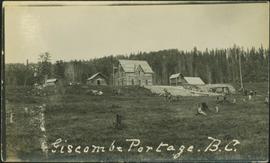
Showing 3098 results

Archival description
Giscome Sawmill
2012.13.1.87.176 · Item · [between 1975 and 1995]
Part of J. Kent Sedgwick fonds

Image depicts the Giscome, B.C. mill site looking west. Map coordinates 54°04'18.5"N 122°21'57.7"W

Giscome Quarry
2012.13.1.87.074 · Item · [between 1975 and 1995]
Part of J. Kent Sedgwick fonds

Image depicts what is possibly the quarry located at Eaglet Lake in Giscome, B.C.

Giscome Landscape
2012.13.1.87.071 · Item · [between 1975 and 1995]
Part of J. Kent Sedgwick fonds

Image depicts an open area with Eaglet Lake in the background. It depicts the previous site of the mill at Giscome, B.C. Map coordinates 54°04'19.7"N 122°22'04.7"W

2012.13.1.89.084 · Item · [1980?]
Part of J. Kent Sedgwick fonds

Image depicts Giscome with the school on the left, the remnants of the town site in the middle and the church on the right. Map coordinates 54°03'58.2"N 122°22'04.8"W

Giscome Dairy Farm
2012.13.1.87.083 · Item · [between 1975 and 1995]
Part of J. Kent Sedgwick fonds

Image depicts a large, old and collapsing barn, as well as a nearby house of the dairy farm in Giscome, B.C. Map coordinates 54°03'53.3"N 122°21'22.6"W

Giscome Dairy Farm
2012.13.1.87.141 · Item · [between 1975 and 1995]
Part of J. Kent Sedgwick fonds

Image depicts the dairy farm in Giscome, B.C. Map coordinates 54°03'53.3"N 122°21'22.6"W

Giscome Dairy Farm
2012.13.1.87.152 · Item · [between 1975 and 1995]
Part of J. Kent Sedgwick fonds

Image depicts the dairy farm in Giscome, B.C. Map coordinates 54°03'53.3"N 122°21'22.6"W

Giscome Community Hall
2012.13.1.87.160 · Item · [between 1975 and 1995]
Part of J. Kent Sedgwick fonds

Image depicts the Giscome Community Hall in Giscome, B.C. Map coordinates 54°04'18.5"N 122°21'57.7"W

Giscome CN Station
2012.13.1.87.161 · Item · [between 1975 and 1995]
Part of J. Kent Sedgwick fonds

Image depicts the old CN station in Giscome, B.C. Map coordinates 54°04'20.7"N 122°22'01.1"W

Giscome Bunkhouse
2012.13.1.87.158 · Item · [between 1975 and 1995]
Part of J. Kent Sedgwick fonds

Image depicts the Giscome bunkhouse in Giscome, B.C. Map coordinates 54°04'17.6"N 122°22'06.1"W

2012.13.1.87.087 · Item · [between 1975 and 1995]
Part of J. Kent Sedgwick fonds

Image depicts the Giscome mill site in Giscome, B.C. The railroad tracks are in the foreground. Map coordinates 54°04'17.6"N 122°22'06.1"W

Giscome - Power Poles
2012.13.1.87.098 · Item · [between 1975 and 1995]
Part of J. Kent Sedgwick fonds

Image depicts the remains of a street of houses in Giscome, B.C. The quarry is slightly visible in the background. Map coordinates 54°04'20.9"N 122°21'53.1"W

Giscome - Eaglet Lake
2012.13.1.87.090 · Item · [between 1980 and 2000]
Part of J. Kent Sedgwick fonds

Image depicts mill site and dock in Giscome, B.C. with Eaglet Lake in the background covered in ice. There is a large crowd of people gathered near the dock. Map coordinates 54°04'34.9"N 122°21'50.0"W

Giscome
2012.13.1.87.175 · Item · [between 1975 and 1995]
Part of J. Kent Sedgwick fonds

Image depicts the Giscome, B.C. town site with the Giscome railway station and the Giscome store in the center surrounded by vehicles. Map coordinates 54°04'18.5"N 122°21'57.7"W

Ginter House
2012.13.1.14.03 · Item · Dec. 1997
Part of J. Kent Sedgwick fonds

Image depicts the Ginter House and the surrounding woods, in Prince George, B.C.

Germansen Landing
2012.13.1.71.01 · Item · 1979
Part of J. Kent Sedgwick fonds

Image depicts the Germansen River, with the buildings of Germansen Landing visible on the other side.

Garden at Jean's House
2009.5.3.122 · Item · [ca. 1920]
Part of Taylor-Baxter Family Photograph Collection

Photograph depicts hedges and creeping foliage around picket fence in foreground. House stands in background featuring enclosed porch. Handwritten annotation on recto of photograph: "Merry Xmas + Happy New Year Aunt Lillian. This is my garden in the foreground the main thing in view being the morning glories. Lots of love Jean."

Gang Ranch Sign
2012.13.1.52.04 · Item · 1980
Part of J. Kent Sedgwick fonds

Image depicts the sign to Gang Ranch, located in the Upper Fraser Canyon, with graffiti on it.