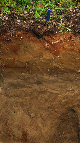
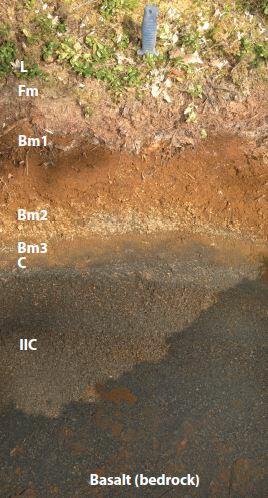
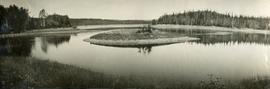
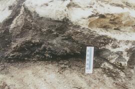
This image appears as Figure 2 in the publication:
Sanborn, P., 2010. Soil reconnaissance of the Fort Selkirk volcanic field, Yukon (115I/13 and 14).
In: Yukon Exploration and Geology 2009, K.E. MacFarlane, L.H. Weston and L.R. Blackburn
(eds.), Yukon Geological Survey, Whitehorse, Yukon. pp. 293-304.
https://emrlibrary.gov.yk.ca/ygs/yeg/2009/2009_p293-304.pdf
This image appears as Figure 4 in the publication:
Sanborn, P., 2010. Soil reconnaissance of the Fort Selkirk volcanic field, Yukon (115I/13 and 14).
In: Yukon Exploration and Geology 2009, K.E. MacFarlane, L.H. Weston and L.R. Blackburn
(eds.), Yukon Geological Survey, Whitehorse, Yukon. pp. 293-304. https://emrlibrary.gov.yk.ca/ygs/yeg/2009/2009_p293-304.pdf
This image appears as Figure 11 in the publication:
Sanborn, P., 2010. Soil reconnaissance of the Fort Selkirk volcanic field, Yukon (115I/13 and 14).
In: Yukon Exploration and Geology 2009, K.E. MacFarlane, L.H. Weston and L.R. Blackburn
(eds.), Yukon Geological Survey, Whitehorse, Yukon. pp. 293-304. https://emrlibrary.gov.yk.ca/ygs/yeg/2009/2009_p293-304.pdf
This image appears as Figure 9 in the publication:
Sanborn, P., 2010. Soil reconnaissance of the Fort Selkirk volcanic field, Yukon (115I/13 and 14).
In: Yukon Exploration and Geology 2009, K.E. MacFarlane, L.H. Weston and L.R. Blackburn
(eds.), Yukon Geological Survey, Whitehorse, Yukon. pp. 293-304. https://emrlibrary.gov.yk.ca/ygs/yeg/2009/2009_p293-304.pdf
This image appears as Figure 8 in the publication:
Sanborn, P., 2010. Soil reconnaissance of the Fort Selkirk volcanic field, Yukon (115I/13 and 14).
In: Yukon Exploration and Geology 2009, K.E. MacFarlane, L.H. Weston and L.R. Blackburn
(eds.), Yukon Geological Survey, Whitehorse, Yukon. pp. 293-304. https://emrlibrary.gov.yk.ca/ygs/yeg/2009/2009_p293-304.pdf
Photograph depicts Siwash Rock in Stanley Park British Columbia.
Attached description: Brilliant lights outline the 750 t/d Skeena Kraft mill at night. Lights on the two Kamyr continuous digesters give the vessels the appearance of missiles in position for takeoff. Lights outline graphically the shape of the spacious and bright structure housing the pulping group, the pulp machine including wet-end equipment and Flakt Drier, and the large warehouse which is nearest the camera.
Attached description: In early stages of construction Skeena Kraft mill was a beehive of activity as carpenters, steel workers, welders and many other trades project to completion.
Attached description: The Skeena Kraft Group occupies the center of this picture showing the bleaching towers and the continuous Kamyr digesters. In the foreground is the Administration building, the Personnel and Safety building, and the employees' parking lot. The covered conveyor leading to the digesters carries chips. An emergency 1,000,000 water tower stands on the hill in the background.
Item is a diagram of the layout of Skeena Kraft recovery and recausticizing.
Reproduced map on mylar depicts locations of elevations and benchmarks at the Aleza Lake forest.
Item is a copyprint reproduced from the British Columbia Forest Service photographic records held at BC Archives.
Photograph depicts a dock and building near the water. A few buildings are being constructed on some newly cleared land nearby.
Photograph depicts sluice trunk in mining area, men on tall structure in background.
Caption describing photograph: "Small area of transplants on West side of clearing, established Spring 1966. Note thrifty stand of aspend with Spruce understory, typical of stands on this soil type and history of burning."
Photograph depicts a two men on small fishing boat, called a gillnetter, moored at a fish packer dock with six men at work. One man is transferring materials from crates into large bags while several others watch. Handwritten annotation in pen on verso reads: “Fish Packer”
Photograph depicts reeds and marsh grasses in the foreground, a beaver house at center of photograph with open water and treed shoreline in the distance.