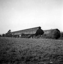
Photograph depicts a portion of the Cassiar pit in right foreground. Crushing plant visible to left of pit, West peak visible in right background. Mountain range can be seen in distance.
Photograph depicts a portion of the pit in foreground at the Cassiar mine. Crushing plant visible in centre below base of West peak. Footwall road in midground, mine valley in background. Building near trucks at top of pit was called the "shifter shack," where crews were relieved or dropped off for work.
Image depicts a pipeline at Shelley, B.C.
Photograph depicts Pioneer Sash and Door Company Ltd. Davies suggests that it may have been the same as S.C. Smith Ltd., which commenced operating in Vernon in 1883. In the early days, products were verandah posters, balusters, and fancy trim. Most products were sent to the U.S. Most of the fancy trim in early north Okanagan homes came from this plant. In 1972, its main output was cedar panelling for Florida.
Image depicts an old Swedish style house somewhere in the Pineview subdivision in Prince George, B.C.
Image depicts an old barn somewhere in the Pineview subdivision in Prince George, B.C.
Image depicts Pineview on Buckhorn Lake Road, Prince George, B.C.
Image depicts the Pine Tree Restaurant in Atlin, B.C. It is possibly part of the Atlin Museum.
Image depicts an unidentified individual standing near a drop-off in the Pine Pass between Alberta and British Columbia. The sign behind the individual reads: "Pine Pass - 2,868 FT. Here the great barrier of the Rock Mountains is breached by the lowest highway pass. Once the remote route of the trapper, it now links the commerce of the north and markets of the south. The John Hart Highway was completed in 1952 and followed by the P.G.E. in 1958. Gas and oil lines also take advantage of this convenient natural feature."
Image depicts an aerial view of Pine Centre Mall and Masich Place Stadium in Prince George, B.C.
Image depicts Pine Centre Mall in Prince George, B. C. Map coordinates 53°53'53.2"N 122°46'36.4"W
Item is a photograph of Pilot Mountain School.
Item is a photograph of Pilot Mountain School taken from the back
Photograph depicts Pier B of C.P.R., just west of the C.P.R. railway station. This is the only pier accessible to ocean going passenger liners and is used by P&O vessels. Facilities generally in adequate for the 1960s.
Perspective of Port Simpson and pier as seen from the water.
Perspective of pier and wharf as seen from the water. Port Simpson and hill in background. Sternwheeler can be seen on shore.
Image depicts the Prince George Multiplex.
Image depicts an individual walking on a a log bridge in a forest somewhere on Haida Gwaii.
Photograph depicts an unknown person eating at a picnic table on a house construction site.
Image depicts several unidentified individuals standing on a bridge; it possibly crosses the peace River.
Image depicts a group of people observing splintered wooden boards at an uncertain location.
Image depicts several unidentified individuals and a bridge behind them; it is possibly crossing the Peace River.
Photograph depicts the Penticton CPR depot. The view is looking northwest.
Image depicts the community hall in Penny, B.C.
Image depicts the CN Station in Penny B.C. A woman, possibly Sue Sedgwick, is sitting against the outside wall.
Image depicts the CN Station in Penny B.C.
Image depicts a railway crossing sign with peeling and cracked paint somewhere in or near Penny, B.C.
Image depicts the post office in Penny, B.C.
Image depicts Sue Sedgwick standing in front of an old, run-down house somewhere in or near Penny, B.C.
Image depicts two signs for hiking trails in Penny, B.C. One reads: "Hiking trail to Red Mt. Lake (Grizzly Bear Mt.) expect to meet wild animals."
Image depicts a beehive burner somewhere in or near Penny, B.C.
Image depicts the condominiums in the "Pemberton Valley Estates" in Pemberton, B.C.
Image depicts rail road tracks and several buildings in Pemberton, B.C.
Image depicts a view of Peden Hill in Prince George, B.C.
Photograph depicts peat barns on the New Westminster Highway on Lulu Island, near the #8 Rd., half a mile west of rail crossing.
Image depicts the Pearson Homestead.
Photograph depicts buildings and signage on either side of dirt road. Unidentified man stands on far left, Atlin Lake and mountains can be seen in background.
Hand inscribed annotation on recto of photograph reads: “Pearl St., Atlin, B.C. Aug. 1899. A.C. Hirschfeld, No.74”.
Photograph depicts tent buildings on either side of dirt road. Unidentified men are visible on left, Atlin Lake and mountains can be seen in background.
Hand inscribed annotation on recto of photograph reads: “Pearl Av. looking towards Atlin Lake, Atlin, B.C., A.C. Hirschfeld, No. 174”
Image depicts a street of shops at an uncertain location somewhere in the Peace River Regional District. A pink and blue building, possibly a theatre, is labelled "Lux."
Image depicts the W.A.C. Bennett Dam on the Peace River in Hudson's Hope, B.C.
Image depicts a dam and a reservoir of water, possibly on the Peace River.
Image depicts a dam, possibly on the Peace River.
Image depicts a dam on what is possibly the Peace River.