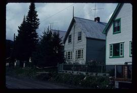
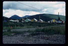
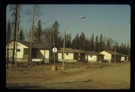
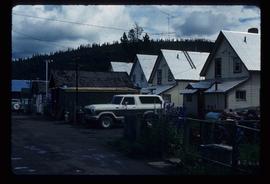
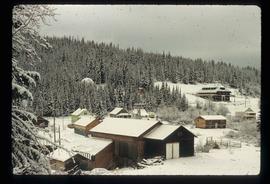
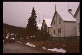
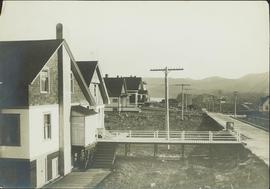
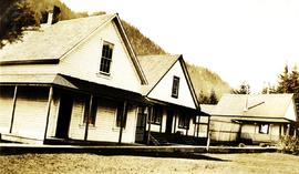
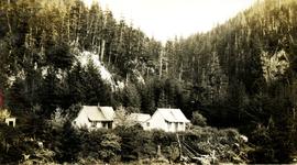
Showing 21297 results

Archival description
Houses
2012.13.1.37.31 · Item · [1980?]
Part of J. Kent Sedgwick fonds

Image depicts a row of houses somewhere in Wells, B.C.

Houses
2012.13.1.6.151 · Item · Oct. 1980
Part of J. Kent Sedgwick fonds

Image depicts a number of houses at an uncertain location, possibly Williams Lake, B.C.

Houses
2012.13.1.22.12 · Item · 1970
Part of J. Kent Sedgwick fonds

Image depicts numerous houses, and an unknown child standing in a street at Island Cache.

Houses
2012.13.1.22.30 · Item · 1970
Part of J. Kent Sedgwick fonds

Image depicts a few houses in Island Cache. There are two unknown individuals present.

Houses
2012.13.1.22.17 · Item · 1970
Part of J. Kent Sedgwick fonds

Image depicts a few houses and a dog on a porch at Island Cache.

Houses and a Ballpark
2012.13.1.93.01 · Item · 1978
Part of J. Kent Sedgwick fonds

Image depicts a view of numerous houses and a ballpark at an uncertain location. It is possibly located somewhere in the Peace River Region.

Houses and a Church
2012.13.1.37.19 · Item · 1978
Part of J. Kent Sedgwick fonds

Image depicts a row of houses, as well as a United Church of Canada on the right side of the image, located in Wells, B.C.

Houses and Three Goats
2012.13.1.87.021 · Item · [between 1975 and 1995]
Part of J. Kent Sedgwick fonds

Image depicts several houses, and three goats standing on a narrow dirt road. The location is uncertain, likely Sinclair Mills, B.C.

Houses and Train in Giscome
2012.13.1.87.073 · Item · [between 1975 and 1995]
Part of J. Kent Sedgwick fonds

Image depicts the Giscome B.C. townsite from across the railroad tracks looking southeast. Map coordinates 54°04'19.7"N 122°22'04.7"W

Houses at Nass Harbour
2009.10.3.39 · Item · [between 1923 and 1926]
Part of Fred Jeffery Photograph Collection

Photograph depicts a street view looking toward homes build next to a boardwalk, dirt street in the foreground, homes in midground, treed hillsides in the background. Handwritten annotation below photograph reads, "Houses at Naas Harbour".

Houses in Giscome
2012.13.1.87.072 · Item · [between 1975 and 1995]
Part of J. Kent Sedgwick fonds

Image depicts the Giscome B.C. townsite from across the railroad tracks looking southeast. Map coordinates 54°04'19.7"N 122°22'04.7"W

Houses on Dogwood Street
2012.13.1.24.34 · Item · 2000
Part of J. Kent Sedgwick fonds

Image depicts houses on Dogwood Street in the Millar Addition neighbourhood of Prince George, B.C. On the left is 1610 Dogwood Street and 1630 Dogwood Street is the middle house; 1650 Dogwood Street is the blue house on the right.

2011.3.1.06 · Item · [ca. 1905]
Part of North Coast & Central BC Postcard Collection

View of peninsula with houses and trees. Dock in mid ground, trees and grasses in foreground. Recto stamped “Port Simpson DE 17" and "Port Essington DE 18". Handwritten annotation on recto of photograph: "W. J. O'Neill Esq. Telegraph Point Via Pt. Essington B.C. Don't you think this pretty [Weggs & Mr. Byron?] was over last night - said he saw you and [Halie?]. Yours - BaBa".

Houses on Stilts
2012.13.1.6.106 · Item · Nov. 1980
Part of J. Kent Sedgwick fonds

Image depicts a number of houses built on stilts over a body of water in an uncertain location.

2009.10.1.69 · Item · [1927 or 1928]
Part of Fred Jeffery Photograph Collection

Photograph depicts two wood frame houses with gardens, and expanse of lawn in the foreground, a clothes line with fresh laundry in the midground and a treed mountainside in the background. Handwritten annotation reads, "wash day".