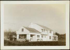
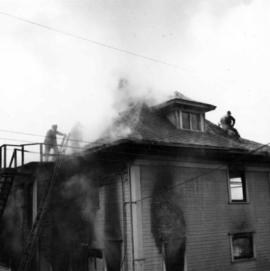
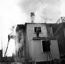
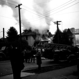
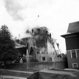
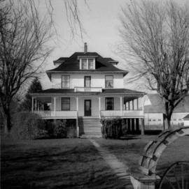
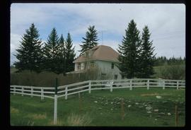
Showing 21297 results

Archival description
House - Elevated Main Floor
2012.13.1.87.079 · Item · [between 1975 and 1995]
Part of J. Kent Sedgwick fonds

Image depicts a house with the main floor and entrance high off the ground. The location is uncertain, likely Giscome, B.C.

House 40
2012.13.1.84.46 · Item · 1994
Part of J. Kent Sedgwick fonds

Image depicts a house with a vehicle in a garage and the number 40 on it; location is uncertain.

House at Echo Cove
2009.10.3.21 · Item · [between 1923 and 1926]
Part of Fred Jeffery Photograph Collection

Photograph depicts a small paddle wheel boat pulled up on the shore, a cluster of small buildings built near the water's edge. Handwritten annotation below photograph reads, "Domicile De Charley- Echo Cove".

House fire
2013.6.36.1.003.024 · Item · [1964?]
Part of David Davies Railway Collection

Photograph depicts a house fire possibly on 1000 Beach Block and Thurlow St. , caused by a wrecking gang.

House fire
2013.6.36.1.003.021 · Item · [1964?]
Part of David Davies Railway Collection

Photograph depicts a house fire possibly on 1000 Beach Block and Thurlow St. , caused by a wrecking gang.

House fire
2013.6.36.1.003.025 · Item · [1964?]
Part of David Davies Railway Collection

Photograph depicts a house fire possibly on 1000 Beach Block and Thurlow St. , caused by a wrecking gang.

House in Delta, B.C.
2013.6.36.1.002.096 · Item · Mar. 1966
Part of David Davies Railway Collection

Photograph depicts a house on Ladner Trunk Rd. in Delta, B.C. It is in the northeast corner of an intersection with the road leading to the Canadian Army Signal Station.

House in Giscome
2012.13.1.87.159 · Item · [between 1975 and 1995]
Part of J. Kent Sedgwick fonds

Image depicts a house in Giscome, B.C. Map coordinates 54°04'17.6"N 122°22'06.1"W

2013.6.36.1.072.06 · Item · [July 1969]
Part of David Davies Railway Collection

Photograph depicts the Moha "ghost" vilage, 20 miles west of Lillooet, at the fork of Bridge and Yalako Rivers. It used to be a gold mining village. About 8 houses/cabins were left standing, but none were occupied. Displayed is one that had 2 ft. thick walss to waist height, as shown.

House Interior
2012.13.1.6.027 · Item · May 1974
Part of J. Kent Sedgwick fonds

Image depicts the interior of an old house, possibly the Cottonwood House, and most likely in or near Barkerville, B.C.

2013.6.36.1.072.19 · Item · 28 Oct, 1967
Part of David Davies Railway Collection

Photograph depicts a house that had a "sold" notice on it and was partly demolished. Up to the date the photograph was captured, this block on Beach Ave. was the sole remaining one to have only houses on it, as opposed to a mixture of houses and apartment blocks, or blocks only.

2012.13.1.87.050 · Item · [between 1975 and 1995]
Part of J. Kent Sedgwick fonds

Image depicts a house being removed from Upper Fraser, B.C. during demolition of town site. A sign on the house reads: "Murray Blackwell House Raising & Moving." Map coordinates 54°06'51.6"N 121°56'26.3"W

House with Ivy
2012.13.1.87.116 · Item · [between 1970 and 1990]
Part of J. Kent Sedgwick fonds

Image depicts a house with ivy growing over it. The location is uncertain.