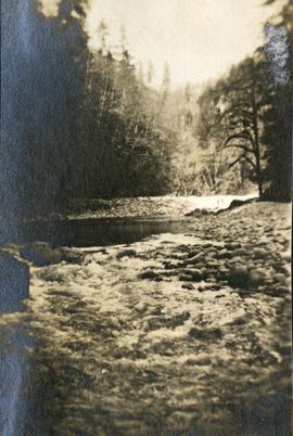
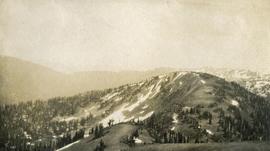
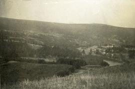
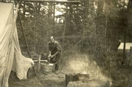
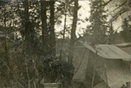
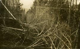
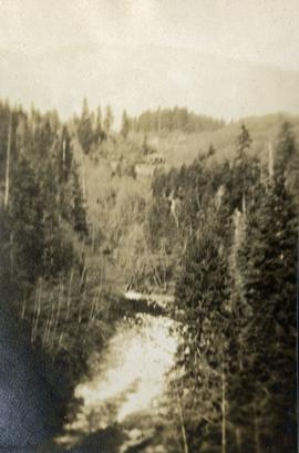
Photograph depicts a view from above, looking down on a stream with forest on both sides.
Photograph depicts a stream with a rocky bank surrounded by forest.
Image depicts a small stream somewhere on Cottonwood Island.
Image depicts a small stream running through a cluster of trees somewhere in or around Seton Portage, B.C.
Photograph depicts a stream, forest and buildings. Location is not named.
Photograph depicts view of street showing that a large hill of rock has been cut through to allow for construction of roadway.
Image depicts a street in Giscome. The store was previously located on the left. The church is in the background. Map coordinates 54°04'18.5"N 122°21'57.7"W
Image depicts a street in Giscome B.C. The Giscome Store is located on the left side of the image with the church in the background. Map coordinates 54°04'18.5"N 122°21'57.7"W
Photograph depicts four men and small cart standing in street, lines of log buildings on either side. Tents can be seen at end of left side of street. First building on left is larger, with the sign "STOPPING PLACE". Trees cross midground, mountains stand in background. Handwritten annotation on verso of photograph reads: "Tete Jaune Cache. B.C."
Street view down Centre Street in Prince Rupert, BC. Printed annotation on recto reads: "Centre Street, Prince Rupert, B.C. 1664." Handwritten annotation on verso reads: "Minnie sent a parcel to you by express to-day- some things you left behind you. I hope you and Bertie had a good trip up. Florrie and the children will leave on the morning train. All are pretty well and send their love to you. Harrie." Postcard is addressed to: "Miss M.V. Beattie Enderby, B.C." Verso is affixed with a two cent Canadian stamp. Postmarkson recto and verso are illegible.
Photograph depicts ten men aboard a scow on a river or lake. The scow is equipped with long poles and may be propelled by steam.
Typed annotation on recto: "Stuart Lake - British Columbia." The hills on left, cliff on right, and two small islands on horizon are reflected in the lake.
Photograph depicts a small car and passengers on log ferry in foreground and one man on dock. Stuart River and forested banks in background. Handwritten photo caption below photograph reads: "Stuart River Ferry."
Image depicts Sue Sedgwick standing next to a camper.
Image depicts Sue Sedgwick standing on the bank of a river.
Photograph depicts a view of a lake from a row boat. The back of one male boat passenger and oars are in the foreground.
Photograph depicts an alpine ridge, with patches of snow.
View of Summit Lake with sun at horizon reflected in water and dark clouds above. Part of a man's head is silhouetted in the foreground. Handwritten caption above this photo reads: "Sumit Lake."
Photograph depicts range grass in the foreground, river in the midground and sparsely treed hills in the distance.
Photograph depicts a man washing clothes using a scrub board and metal wash tub. There is a fire pit in the foreground, tents on either side and forest in the background.
Photograph depicts one or two person's bending over a washtub. There are tall trees behind and a canvas tent to the right.
Photograph depicts a man sitting inside a canvas tent.
Photograph depicts a man using a large wash tub. There is an open canvas tent with large trees behind in the background. There are a variety of camp utensils scattered nearby.
Photograph depicts a smoking wood fire in the foreground. A man sits in an open canvas tent in the background.
Photograph depicts seven or more men relaxing near a canvas tent. Some of the men appear to be whittling wood. Long underwear dry on a tent rope and wood smoke drifts past the men and tent to the forest behind.
Image depicts a view of a sunset at an uncertain location, possibly in the Peace River Region.
Typed annotation on recto: "Sunset at Stuart Lake, B.C." Hills on shore in midground, sun behind clouds reflected in rippled water.
Wide angled photograph of a sunset on the waterfront in Prince Rupert. Several buildings are silhouetted in the foreground. Annotation on recto: "Sunset, Prince Rupert, BC No. 4465."
Image depicts objects, including a flag pole, that the slide labels as "survey equipment." The slide also places it as a "Peyto icefall," on the Peyto Galcier in the Banff National Park in Alberta, B.C.
Photograph depicts cut alders, a long straight line through the forest.
Photograph depicts a large concrete post with dirt mounded around.
Photograph depicts a view of a forested valley, a human figure stands on a path in the midground.
Photograph depicts a view from the water looking toward Swanson's Bay, BC.
Image depicts grooves on Tabor Mountain in Prince George, B.C.
Image depicts grooving on Tabor Mountain in Prince George, B.C.
Image depicts a view of Tabor Lake.
Image depicts the Tabor Lake Subdivision in Prince George, B.C.
Image depicts a view of the area around Tabor Mountain in Prince George, B.C.
Image depicts Tabor Mountain in the distance, located in Prince George, B.C.
Image depicts a view of the area around Tabor Mountain in Prince George, B.C.
Image depicts Tabor Mountain from the airport in Prince George, B.C.
Image depicts a view of Prince George, from Gunn Point in the L.C. Gunn Park.
Image depicts a forest of dead trees on the slopes of Tabor Mountain in Prince George, B.C.
Image depicts two cabins on the shore near the lodge at Takla Lake.
Image depicts a view of Takla Lake from a cabin on the "west arm."
Image depicts a lake viewed "south-east from lodge;" it is possibly Takla Lake.
Image depicts a cabin on the "west arm" of Takla Lake.