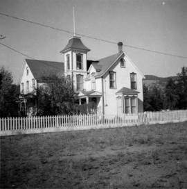
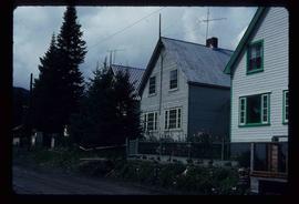
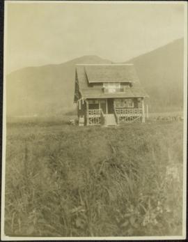
Showing 20407 results

Archival description
House in Giscome
2012.13.1.87.159 · Item · [between 1975 and 1995]
Part of J. Kent Sedgwick fonds

Image depicts a house in Giscome, B.C. Map coordinates 54°04'17.6"N 122°22'06.1"W

2013.6.36.1.072.06 · Item · [July 1969]
Part of David Davies Railway Collection

Photograph depicts the Moha "ghost" vilage, 20 miles west of Lillooet, at the fork of Bridge and Yalako Rivers. It used to be a gold mining village. About 8 houses/cabins were left standing, but none were occupied. Displayed is one that had 2 ft. thick walss to waist height, as shown.

House Interior
2012.13.1.6.027 · Item · May 1974
Part of J. Kent Sedgwick fonds

Image depicts the interior of an old house, possibly the Cottonwood House, and most likely in or near Barkerville, B.C.

2013.6.36.1.072.19 · Item · 28 Oct, 1967
Part of David Davies Railway Collection

Photograph depicts a house that had a "sold" notice on it and was partly demolished. Up to the date the photograph was captured, this block on Beach Ave. was the sole remaining one to have only houses on it, as opposed to a mixture of houses and apartment blocks, or blocks only.

2012.13.1.87.050 · Item · [between 1975 and 1995]
Part of J. Kent Sedgwick fonds

Image depicts a house being removed from Upper Fraser, B.C. during demolition of town site. A sign on the house reads: "Murray Blackwell House Raising & Moving." Map coordinates 54°06'51.6"N 121°56'26.3"W

House with Ivy
2012.13.1.87.116 · Item · [between 1970 and 1990]
Part of J. Kent Sedgwick fonds

Image depicts a house with ivy growing over it. The location is uncertain.

Houses
2012.13.1.37.31 · Item · [1980?]
Part of J. Kent Sedgwick fonds

Image depicts a row of houses somewhere in Wells, B.C.

Houses
2012.13.1.6.151 · Item · Oct. 1980
Part of J. Kent Sedgwick fonds

Image depicts a number of houses at an uncertain location, possibly Williams Lake, B.C.

Houses
2012.13.1.22.12 · Item · 1970
Part of J. Kent Sedgwick fonds

Image depicts numerous houses, and an unknown child standing in a street at Island Cache.

Houses
2012.13.1.22.30 · Item · 1970
Part of J. Kent Sedgwick fonds

Image depicts a few houses in Island Cache. There are two unknown individuals present.

Houses
2012.13.1.22.17 · Item · 1970
Part of J. Kent Sedgwick fonds

Image depicts a few houses and a dog on a porch at Island Cache.

Houses and a Ballpark
2012.13.1.93.01 · Item · 1978
Part of J. Kent Sedgwick fonds

Image depicts a view of numerous houses and a ballpark at an uncertain location. It is possibly located somewhere in the Peace River Region.

Houses and a Church
2012.13.1.37.19 · Item · 1978
Part of J. Kent Sedgwick fonds

Image depicts a row of houses, as well as a United Church of Canada on the right side of the image, located in Wells, B.C.