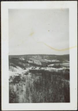
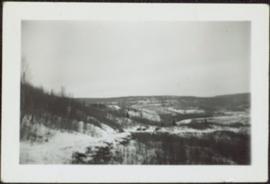
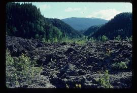
Photograph depicts the Cassiar valley: town in foreground, plant and tailings pile in background. Mountain range visible in distance. Photograph was taken from above, facing east.
Photograph depicts the Cassiar valley: plant and tailings pile on left, town on right. Mountain range visible in distance. Photograph was taken from above, facing south.
Photograph depicts the town of Cassiar behind plant buildings in left foreground. Mountain base in background. Photograph was taken from the air, portion of plane visible in top left of image.
Photograph depicts the town of Cassiar, mountain base in background. Mine road visible in top right of image.
Photograph depicts the Cassiar valley: town on left, plant on right, mine valley in background. Photograph was taken from above, facing north east.
Photograph depicts the town of Cassiar behind plant and tailings pile in foreground. Mountain range in background.
Photograph depicts the town of Cassiar, mountain base in background.
Photograph depicts the town of Cassiar in foreground, mountain base in background. Photograph was taken from the air, portion of plane visible in top left of image.
Photograph depicts the Cassiar townsite in foreground. Mill, dry rock storage building, and tailings pile can be seen in background. Handwritten annotation on verso of photograph: "1958 [1961 crossed through]."
Photograph depicts the Cassiar plantsite including the mill, dry rock storage building, tailings pile, and many other buildings. A portion of the townsite can be seen on left.
Photograph depicts the Cassiar plantsite in foreground, including the mill, dry rock storage building, tailings pile, and many other buildings. Townsite in midground, mountains in background. Handwritten annotation on recto of photograph: "Cassiar."
Photograph depicts the Cassiar valley. Handwritten annotation on verso of photograph: "1958 [1961 crossed through]", on recto: "Cassiar Asbestos Corporation Limited. Cassiar B.C. Townsite in foreground mill and ore storage in left middle ground," "Toronto set". It is believed that this photograph was made into a post card.
Photograph depicts tracks made by machinery in an earth road turning left in forest.
Image depicts a tractor with a claw lifting logs at a saw mill in Prince George, B.C.
Image depicts a patch of snow-covered ground with a sign that reads "Trail of 98," somewhere along the White Pass railway.
Photograph of a team of sled dogs pulling a load, followed by a group of men. Mountains are visible in the background. Printed annotation on recto reads: "Trail Over Bitter Creek Glacier to the Naas."
Image depicts a train in an uncertain location, though it is possibly Howe Sound in the background.
Image depicts the side of a train and the tracks it is on, somewhere in the Seton Portage area.
Photograph of a train passing through a forested area.
Photograph of a train passing over a bridge near Stewart, BC. Printed annotation on recto reads: "103 Stewart BC."
Image depicts a train on the Hansard Bridge across the Fraser River looking west. Map coordinates 54°04'37.7"N 121°50'39.9"W
Al Elsey compiled his original footage from 1965 to produce this commercial film that deals with trapping beaver, the Anahim Lake Stampede and Caribou migration. The video provides a compilation of film footage shot by Elsey and is narrated by him describing the activities documented in the footage
Photograph depicts tree-covered mountain ranges in winter.
Image depicts two unidentified individuals examining a thick log still attached to the machine that cut it down. It is located somewhere in Prince George, B.C.
Item is a photograph of a large tree cutting machine.
Slide depicts cleared ground and felled trees in a forested area, likely at the Aleza Lake Experiment Station.
Item is a photograph of a tree stump apparently eaten through by beavers.
Image depicts numerous trees in an uncertain location; the slide itself is labelled "T.T. Cutting," possibly meaning "Telegraph Trail Cutting."
Image depicts a few trees, with what is possibly the Northwood Pulpmill in the background, in Prince George, B.C.
Image depicts a small copse of trees boxed in by very small concrete barriers somewhere in Kettle Valley, B.C.
Bench visible in left foreground.
Image depicts a green car among some trees on Cottonwood Island.
Image depicts two old houses surrounded by numerous trees at an uncertain location.
Image depicts a stand of trees and a shed at Island Cache.
Image depicts a west-looking view of Trembleur Lake.
Footage of a pack train along a river, a campsite, view of the mountains, and two grouse.
Location is believed to be the Rainbow Mountains.
Image depicts a snow-covered cabin and a mountain in the distance. It is located somewhere near Birken, B.C.
Image depicts a mountain in the distance. It is located somewhere near Birken, B.C.
Image depicts numerous skiers at the cabin located at Troll Lake on Tabor Mountain in Prince George, B.C.
Item is a photograph of a truck hauling logs from the shores of a lake.
Photograph depicts men and haul trucks visible in distance on snowy road in tree-covered hills.
Image depicts truncated spurs somewhere near McBride, B.C.
Image depicts the Tseax Lava Flow.