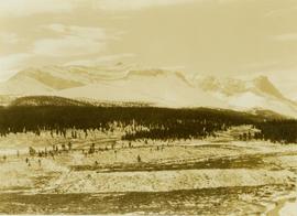
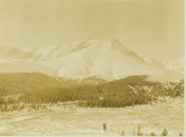
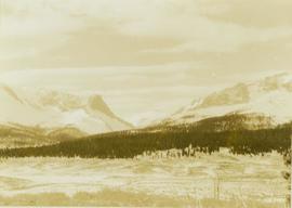
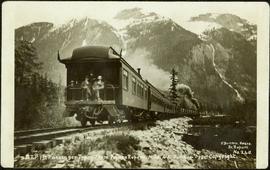
Image depicts a group of individuals and a bus with words that read: "Prince George Limousine & Charter." The river in the background is possibly the Peace River, and the location is possibly somewhere near Fort St. John, B.C.
Image depicts an aerial view of a grooved region of land at an uncertain location.
Image depicts an aerial view of grooves in the land near the Fraser River, possibly caused by glaciers.
Image depicts a view of grooves in the land near the Fraser River, possibly caused by glaciers.
Image depicts an aerial view of a grooved region of land at an uncertain location.
Handwritten caption below this photo reads: "Bought in Picture Prince George". Photograph depicts a grizzly bear walking on all fours in forest area, slash debris in background.
Photograph depicts a lighthouse on a rocky island with water in the foreground. Annotation on verso of photograph states: "Dear Dr. Thanks for the cheque received yesterday. Christmas Greetings. Yours Sincerely Mr. Cruickshank (?) Green Island"
Al Elsey compiled this commercial video using footage he filmed in 1964 and 1965 in the Bella Coola area. The video provides a compilation of film footage shot by Elsey and is narrated by him describing the activities related to the Grease Trail. Description verso of VHS commercial box reads:
"Al Elsey's friendship with Margaret Siwallace with other people of the Nuxalk Nation dates back over fifty years. This, his premier documentary, produced from vintage 16 mm movie film taken in the Bella Coola Valley in 1963, invites us to witness their tradition of making Ooligan Grease. The process, followed for centuries by the Nuxalk and other coastal First Nations people, was of such importance that their trading routes from the Coast to the Interior of British Columbia were called Grease Trails. The Ooligan were netted by the ton each year, returning from the ocean to spawn in early spring. The destruction of the Ooligan runs in the Bella Coola and other coast rivers of Southern B.C. probably resulted from over-fishing by shrimp trawl draggers during the late 1990s. GREASE shows catching the Ooligan with conical nets and dugout canoes, rotting them in "stink boxes," then rendering and purifying the Grease. Elsey's captivating narrative and brilliant footage transport us back to another time on the shores of the Bella Coola River."
Image depicts a small graveyard at an uncertain location.
Photograph depicts close up view of gravel pit, ruler displayed for scale. Photograph speculated to have been taken at the plant or near the Cassiar airstrip. Stamped annotation on recto of photograph: "JUN. 1987".
Image depicts layers of gravel at the BCR site in Prince George, B.C.
Image depicts the grave of John A. Fraser in Barkerville, B.C.
Image depicts the grave of John A. Cameron at Barkerville, B.C.
Image depicts numerous grave markers at an uncertain location.
Image depicts the grave of Frank Russell "Russ" Baker in Fort St. James, B.C.
Photograph depicts a grassy plateau leading to forested foothills and rising to rocky mountain slopes.
Photograph depicts a grassy plateau with a tree in the foreground leading to forested foothills and rising to rocky mountain slopes.
Photograph depicts a grassy, snow-covered plateau leading to forested foothills and rising to rocky mountain slopes.
Photograph depicts a grassy plateau leading to forested foothills and rising to rocky mountain slopes.
Photograph depicts a grassy plateau leading to forested foothills and rising rocky mountain slopes.
Photograph depicts a landscape shot of a grassy area with fruit-bearing trees in the background.
Photograph depicts Granite Falls near the Wigwam Inn, Indian Arm, Vancouver, B.C.
Photograph depicts Granite Falls and wharf at Indian Arm, looking west from the top of the falls.
Image depicts a large, electric shovel at a mine site somewhere in Granisle, B.C.
Image depicts a drill for blasting holes at a mine site somewhere in Granisle, B.C.
Image depicts numerous bags of blasting powder at a mine site somewhere in Granisle, B.C.
Image depicts an 80 tonne truck at a mine site somewhere in Granisle, B.C.
Handwritten annotation on verso of photograph: "G.T.P. 1st Passenger Train From Prince Rupert. Mile 45. June. 14th 1911. Copyright. F. Button. PHOTO. Pr. Rupert. No. 240." Photograph depicts three men (two sitting on chairs) on caboose of train. Power poles run parallel to tracks, which curve to the right of the image. Train tracks in foreground, forest and mountain in background.
Image depicts the Fraser River and the Grand Trunk Pacific Bridge from Cottonwood Island Park.
River in foreground, trees and cliffs in background.
River in foreground, trees on shore in background. Handwritten annotation on verso of photograph: "Grand Canyon Fraser R."
River in foreground, trees and rocky shore in background.
Photograph depicts an unidentified person seated on rocks in foreground. River crosses midground, cliffs and trees on opposite shore in background. Unidentified structures believed to be buildings can be seen on opposite shore. Handwritten annotation on verso of photograph: "Grand Canyon. fraser R."
Image depicts a grain elevator in Prince Rupert, B.C.
Image depicts a clearing through the woods, possibly an abandoned grade for the BCR. It is possibly located on Iron Road South, near Woodpecker B.C.
Footage of golden eye duck and ducklings on a lake.
Speculated locations include Anahim Lake, Ulkatcho Lake or Fenton Lake.
Image depicts the Fraser River in the Grand Canyon, B.C.
Image depicts a set of rail road tracks and an old, collapsing log building somewhere in Goat River, B.C.
Image depicts an old, collapsing log building somewhere in Goat River, B.C.
Image depicts the CN Railway and Station at Goat River, B.C.
Image depicts a cabin and several sheds somewhere in Goat River, B.C.
Photograph depicts glacier and snow in mountains. Handwritten annotation on verso of photograph reads: "Glacier, Moose River. B.C."
Image depicts the Gitwinksihlkw Elementary School in Gitwinksihlkw, B.C.
Side perspective of wooden swings covered in snow. Handwritten annotation in pen on verso reads: “The school swings.”
Image depicts the Giscome, B.C. mill site looking west. Map coordinates 54°04'18.5"N 122°21'57.7"W