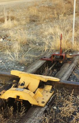
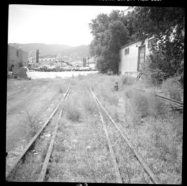
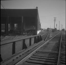
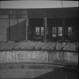
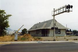
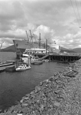
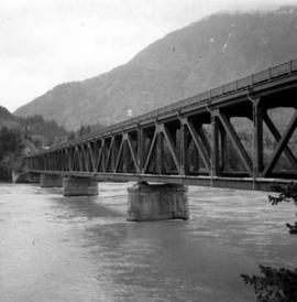
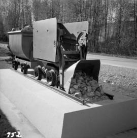
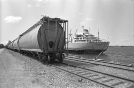
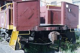
Photograph depicts a spare crane and an idler car. Visible are the details of the rear end of the idle car.
Photograph depicts details of a CN derailment that occurred in Kamloops.
Photograph depicts the details of 3 axle trucks and car steps.
Photograph depicts details of a spout on a preserved water tank.
Photograph depicts a diesel switching locomotive, owned and on the premise of the Vancouver Iron and Engineering Works Ltd, at 1155 west 15th Ave. The view is looking north to False Creek.
Photograph depicts a small vessel called "Dinamac." It had a red hull, suggesting that it may have been a Department of Transport tender.
Image depicts a dirt road leading through numerous trees toward a mountain. The location is uncertain, likely on the way to Longworth, B.C.
Image depicts a dirt road and a possibly abandoned building at an uncertain location.
Image depicts a dirt road leading through a forest.
Image depicts a dirt road leading through a forest with what appears to be an area for turning around at the end.
Photograph depicts a display item in front of the office of the Nelson Machinery Co. Ltd. located on 1255 Welch St. in North Vancouver. It is a rock car on a 2 ft. gauge track.
Photograph depicts a disused Canadian National Railway (CN) passenger depot at Kelowna. The offices still used for parcels, ticket sales, etc. There is still good freight traffic.
Photograph depicts a disused Canadian National Railway (CN) water tower at Spuzzum, 25 miles north of Hope. The view is looking east across the Fraser Canyon.
Photograph depicts a disused coaling stage beside the track that leads to Merritt at Spences Bridge. Coal cars were unloaded by hand or bottom emptied, in covered bay on the left, into metal grating below the track. Coal was then taken by continuous chain hoppers (1 C. powered) to overhead coal bunkers.
Photograph depicts the disused CPR Kettle Valley Railway line in Penticton. The trackage leads from the lakefront to the main yards. All the track was removed by July 1981. The view is looking northeast to the lake and the Incola Hotel.
Photograph depicts the disused CPR Kettle Valley Railway line in Penticton. The trackage leads from the Okanagan Lake CPR wharf to the main yards. All the trackage was obliterated by July 1981. The photo was taken about 1 block away from the lake and near Brunswick St. The view is looking southwest.
Photograph depicts a disused CPR roundhouse and a used turntable at the Port Coquitlam yards. The view is looking east.
Photograph depicts a disused CPR roundhouse at the Port Coquitlam yards. The house had 8 stalls and may be used for other purposes, but not for locomotives.
Photograph depicts a disused depot at Ellis and Clement. Taken from Ellis, looking east. Tracks across Ellis had just been removed. Side walk was inserted and black top had been laid. The removal of the road crossing signals had yet to be done.
Photograph depicts a disused depot at Ellis and Clement. Taken from Ellis, looking east. Track was an isolated piece between St. Paul Street and Ellis and had been subsequently removed. Davies notes the vague talk at the time of converting the building into a railway centre
Photograph depicts a disused water tower 50 yards from the C.P.R. Shuswap Depot, looking west towards Kamloops.
Image depicts the "Divides Lake Waterfall" as well as a man in front of a helicopter in the foreground.
Image depicts numerous docked boats in Prince Rupert, B.C.
Image depicts numerous docked boats somewhere in Prince Rupert, B.C.
Image depicts numerous boats docked in Prince Rupert, B.C.
Image depicts a ferry docked at Haida Gwaii, B.C.
Photograph depicts the docked ship “Aegean Sea” and a Canadian National grain car in Prince Rupert.
Photograph depicts the ship “Aegean Sea” docked in Prince Rupert.
Photograph depicts the ship “Aegean Sea” in Prince Rupert.
Photograph depicts a docked ship named “Dexterity” at the harbour in Prince Rupert.
Photograph depicts a docked ship named “Aegean Sea” and a docked vessel named “Cape Ball” in Prince Rupert.
Photograph depicts a dog sitting in shoveled walkway in steep snow, snowshoes inserted in the snow banks over dog's head. Unidentified building in background.
Image depicts a house and numerous rundown vehicles in Dog Creek, B.C.
3 dog teams pulling 3 sleds with 6 men attending. There is a large mountain in the background. Printed annotation on recto reads: “Mail team Skeena River B.C.” Handwritten message on verso is address to “Dear Alice and dated March 23, Easter Sunday 1913”.
Photograph depicts a team of dogs and sled resting in a very flat snow-covered area. Hills in background. Handwritten annotation on recto of photograph: "ATLIN."
Photograph depicts a team of dogs pulling a sled and an unidentified person across a very flat area under heavy clouds. Mountains in background. Handwritten annotations on verso of photograph: "Unbroken Trails", "Taylor". Photograph speculated to have been taken near Atlin, B.C.
Photograph depicts three dogs harnessed to a loaded sled in snow-covered area, trees in background.
Photograph depicts a dome car unit in the C.P.R. False Creek yards in Vancouver, B.C.
Image depicts the CN Station in Dome Creek, B.C.
Image depicts a strangely shaped orange vehicle somewhere in Dome Creek, B.C.
Photograph depicts the Dorreen railway station on the Canadian National Railway main line, located on the west bank of the Skeena River between Cedarvale and Terrace, British Columbia. CN boxcars visible on the siding.
Photograph depicts a double-use bridge across the Fraser River at Hope, BCon the north side of the village. The upper deck carries road traffic and the lower deck the C.P.R. rail line leading to the Kettle Valley Line. View looking north.
Photograph depicts a double-use bridge across the Fraser River at Hope, BCon the north side of the village. The upper deck carries road traffic and the lower deck the C.P.R. rail line. View looking north.
Photograph depicts unknown man driving bulldozer in foreground. Shop area in background, numerous haul trucks and dozers throughout. Old mine garage can be seen in center behind dozer, and the mine's West Peak rises on right behind shop buildings. Mountain range in background. Handwritten annotations on recto of photograph: "Cassiar Asbestos Corporation Limited. Cassiar B.C. Mining asbestos ore elevation approx 6000 ft. above sea level. McDame mountain, Northern British Columbia"; "Toronto Set"; "D - 336"; "-4 1/2 -". What appears to be framing measurements are annotated on verso.