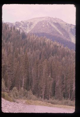
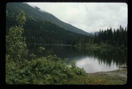
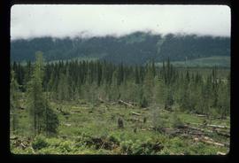
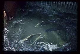
Image depicts several salmon somewhere in the Meziadin Lake Provincial Park.
Image depicts several individuals looking down into a closed off section of a river in Meziadin Lake Provincial Park. They are counting fish.
Photograph depicts large buildings on shore. Three unidentified individuals can be seen walking on dock in foreground.
Printed on image: "METLAKATLA B.C. / McRAE BROS"; handwritten annotation on verso reads: "A section of Metlakahtla, showing Church & Schoolhouse." See also item 2009.7.1.58 for similar image also featuring the new church building at Metlakatla, B.C.
Image depicts buildings in the village community of Metlakatla, B.C.
Image depicts Metlakatla, located near Prince Rupert, B.C.
Image depicts buildings in the village community of Metlakatla, B.C.
View of crusher building from above, featuring the bottom level foundation. A dirt road and long building believed to be housing conveyor "B" cross the midground. Valley in background.
Man standing on far left believed to be H.F. Glassey. One mam stands in military uniform. Hauling truck parked close behind plane, hill in left background.
Photograph depicts workers sitting in the back of a truck at the construction site for the Pacific Northern Gas pipeline from Summit Lake to Kitimat.
Photograph depicts men standing on different deck levels of conveyor in river. Wood planks built into shore in foreground, trees on opposite shore in background. It is speculated that this photo may have been taken near Tete Jaune Cache shortly after the conveyor was rebuilt. Handwritten annotation on verso of photograph reads: "Str. Conveyor".
Photograph depicts a line of men standing on rocky shore and holding a long rope between them, while men on scow float close to shore in distance. Trees on opposite shore in background. Handwritten photo caption on verso and recto of this photo reads: "in the Grand Canyon."
Photograph depicts a line of men standing on opposite shore and holding a long rope between them, while men on scow float close to shore in distance. River water in foreground, trees on shore in background. Handwritten photo caption on verso and recto of this photograph reads: "In the Grand Canyon."
Five unidentified men sit with dog in canoe. One man stands on dock in foreground.
Handwritten annotation on verso reads: "Freighting by canoe on skeena river".
Men working among lumber at crusher building site, various materials scattered throughout. Vertically protruding planks from framework of crusher building are in foreground. Tree-covered valley in background. Construction of a long structure near the edge of the excavation area can be seen in midground; this is speculated to be the section of the crusher building which housed conveyor "B".
Photograph depicts three men standing with oars in small boat, forest slash at their feet. More slash lies in foreground behind bushes and plants on swampy shore. Trees in background. These men are believed to be members of the Bourchier forestry crew.
Photograph depicts two unidentified men standing on wood walkway extended high above water. Cliffs in background. Photograph speculated to have been taken at Sayer Creek, B.C.
Photograph depicts two men beside the creek below the lake outlet at the proposed site for the hydro power project on Klemtu Lake.
Photograph depicts pipeline construction workers for the Pacific Northern Gas pipeline from Summit Lake to Kitimat with a helicopter on the north end of Prudhomme Lake.
Photograph depicts two men standing on mining bench in mountainside, three boxes and what appears to be a long hose to the left. Third man and tractor plow can be seen in distance at end of bench. Photo caption next to printed copy of image in 1953 Annual Report: "Benches being prepared for mining."
Photograph depicts two men working with air track drill in mine area. Hose and dynamite box in foreground, mountains in background. Handwritten annotation on verso of photograph: "Sept. 1954." This photograph was originally stored inside duotang labeled "CASSIAR ASBESTOS CORPORATION LIMITED PHOTOGRAPHS 1954"; photo caption beneath this image: "Starting New Bench at South end of Deposit."
Photograph depicts a memorial totem pole in front of a fence line and a forested environment. Inscription on memorial pole states: “In loving memory of Tlaqwa Latle of the Qidwasudinuk Tribe, Died Nov. 9 - ” Photographer’s stamp on verso: “W.E. Nicholson, 268 E. 10th, Vancouver 10, B.C.”
Image depicts a house with torn-up siding. The slide is labelled: "Mellos house relocated from Penny." The location is uncertain.
Photograph depicts McRae Creek Falls.
Photograph depicts McRae creek canyon.
Photograph depicts McRae Creek Falls.
Image depicts the McLeod River in Carp Lake Provincial Park.
Image depicts a building by the shore of McLeod Lake.
Image depicts McLeod Lake and several buildings along the shore.
Image depicts McLeod lake.
Photograph depicts dry creek bed, tall banks on either side. Hills and lake cross midground, mountains visible in background. Handwritten annotation on verso of photograph: "Looking down McKee Creek across Atlin Lake Towards Taku Glacier 6/27/37."
Image depicts a dirt road and a densely forested treeline, possibly in the McGregor Valley.
Image depicts a pass in the McGregor Valley.
Image depicts a view of a section of a pass in the McGregor Valley.
Image depicts a what is possibly the McGregor River in the McGregor Valley.
Image depicts a gravel road somewhere in the McGregor Valley.
Image depicts numerous felled trees somewhere in the McGregor Valley.
Image depicts a red vehicle parked on the side of the road with a view of the McGregor Valley behind it. The slide is labelled "dam site."
Image depicts numerous burned tree stumps somewhere in the McGregor Valley.
Image depicts a view of McGregor Valley from an uncertain location.
Image depicts a view of McGregor Valley.
Image depicts a view of the McGregor Valley.
Image depicts a view of McGregor Valley.
Image depicts a view of McGregor Valley from an uncertain location.
Image depicts a view of McGregor Valley.
Image depicts the McGregor from the point of view of a bridge.
Image depicts a bridge over the McGregor River. A sign in the image reads: "Danger. The river is not navigable for any type of boat. Down stream falls and rapids impassible!"