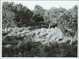
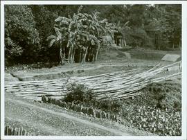
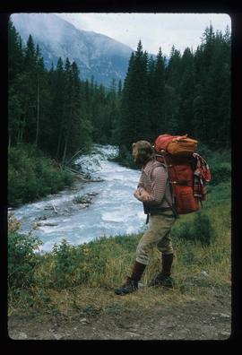
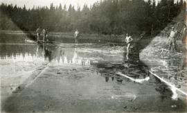
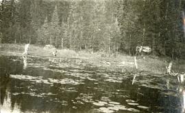
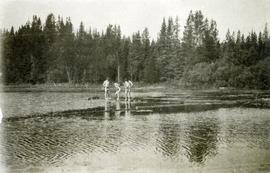
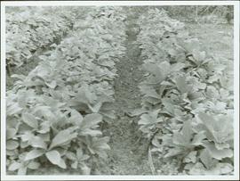
Item is a photograph of rows of plants in a garden.
Item is a photograph of a forested area.
Item is a photograph of a street food vendor.
Item is a photograph of a fishing boat with the net deployed with other boats and people on shore.
Item is a photograph of building construction with bamboo scaffolding.
Item is a photograph of men doing wood construction.
Item is a photograph of the Chittagong Research Institute buildings.
Item is a photograph of a boy carrying a bundle of books on his head.
Item is a photograph of boats docked on the shore behind piles of grain or straw.
Item is a photograph of a boat under construction.
Item is a photograph of a bicycle repair shop.
Item is a photograph of a pile of bamboo in a field.
Item is a photograph of a river bend and the surrounding country taken from the air.
Photograph depicts a view from the shore of Babine Lake looking across the water to forest and snowy mountain peaks in the distance. [55th parallel]
Photograph depicts a group of men and dogs standing outdoors in the sunshine.
Photograph depicts rolling hills with dry vegetation and river in the background.
Photograph depicts A. H. Holland viewing North Fork valley from a high mountain ridge.
Photograph depicts twenty-eight or more people standing on the river's edge, a stack of wood is ready for loading on the steamer that is anchored near the shore.
Photograph depicts a view of the river shore, a few scattered buildings and tents are near the shore. A footpath leads from the water's edge between the dwellings and through the newly cleared land.
Photograph depicts view from the steamboat deck approaching Cottonwood Canyon.
Photograph depicts a view from the steamboat deck approaching Cottonwood Canyon.
Photograph depicts snow covered trees and forest.
Photograph depicts an open field with a fence, house and shed in the midground, low treed hills in the background.
Image depicts a marker for aerial photography at an uncertain location. The slide labels it as "Elizabeth Station."
Photograph depicts a southeast aerial view from Sustut Pass of a snow-covered mountain range toward Thutade Lake.
Photograph depicts an aerial view of the north half of Thutade Lake located between a snow-capped mountain range.
Photograph depicts an aerial view of Finlay Falls from below Thutade Lake set in a forested landscape.
Photograph is one of seven images believed to have been taken on a Canadian University Service Overseas (CUSO) mission in Mozambique; see also items 2009.6.1.483 - 2009.6.1.489.
Photograph depicts a northwest aerial view from Sustut River of a snow-covered mountain range toward Thutade Lake.
Photograph depicts a northwest aerial view from Sustut Pass of a snow-covered mountain range toward Thutade Lake.
Photograph depicts a view from a high hill looking down on the Fraser River near Soda Creek.
Photograph depicts a tiny coastal village nestled on the shore. Treed hills surround the village, there are snow topped mountains in the background.
Photograph depicts a view from Billing siding toward a river with mountains behind.
Photograph depicts a man standing in front of a wood shed beside a tent in a snow covered landscape.
Photograph depicts a man and woman resting on the hood of a car with a rocky, tree covered cliffside in the background.
Image depicts a man on the hiking trail near Mt. Robson, with a river in the background; it is possibly the Robson River.
Item consists of a typewritten report together with three earlier complete or partial drafts of this report “A. H. Phipps Memoirs of Charles E. Bedaux Sub-Arctic Expedition 1934” along with original notebook which includes 11 pages of handwritten notes about the expedition.
Photograph depicts A. H. Holland standing under a tarp with a border collie dog. A pile of firewood is also under the tarp.
Photograph depicts open fields, cleared land, rolling hills and a river. There is a fence across the middle of the field and a building near the riverbank.
Photograph depicts four men bathing in a backwater or lake. One clothed man stands on the shore.
Photograph depicts two men wading and bathing in shallow water with lily pads.
Photograph depicts three men standing on the banks of a backwater or lake, with clothing piled on the ground.
Photograph depicts a stage coach harnessed with six horses, a fence and a log building in the background.
This map depicts a drawn bench plan for the estimated excavated waste for bench 6440 during the first quarter of 1972. Annotated details include the approximate excavated ore tonnages, broken and planned values for the first quarter and revised calculations from previous years values. Planned excavated areas are drawn with different colors.
This map depicts the pit layout and estimated waste extraction areas for 6410 bench. Extraction dates accompanied by its total tonnages are located within each planned area. Certain extraction dates are labeled with bench numbers. Annotated details include extraction dates, approximate total tonnages per area as well as extraction dates, total planned and broken tonnages, total tonnages from December 31, 1970 and numerical bench markers. The hand drawn plan consists of solid lines drawn with green, yellow, orange and lead pencils.
This map depicts the pit layout and estimated waste extraction areas for 6380 bench. Extraction dates accompanied by its total tonnages are located within each planned area. Certain extraction dates are labeled with bench numbers. Annotated details include extraction dates, approximate total tonnages per area as well as extraction dates, total planned and broken tonnages, total tonnages from December 31, 1970 from a survey done in September 1, numerical bench markers as well as a rough colored legend depicting extraction month by color. The hand drawn plan consists of solid lines drawn with green, yellow, red and lead pencils.
This map depicts the pit layout and estimated waste extraction areas for 6350 bench. Extraction dates accompanied by its total tonnages are located within each planned area. Annotated details include extraction dates, approximate total tonnages per area as well as extraction dates, total planned and broken tonnages and total tonnages from December 31, 1970 from a survey done in September 30. The hand drawn plan consists of solid lines drawn with red, green and orange colored pencils.
This map depicts the pit layout and estimated waste extraction areas for 6320 bench for the end of September to October. Extraction dates are included within certain portions of the plan. Annotated details include numerical bench markers, extraction dates, and approximate waste tonnage calculation for October. The hand drawn plan consists of solid and broken lines drawn with red, orange and lead pencils as well as black ink.
This map depicts the pit layout and estimated waste extraction areas for 6320 bench. Extraction dates accompanied by its total tonnages are located within each planned area. Certain extraction dates are labeled with bench numbers. Annotated details include extraction dates, approximate total tonnages per area accompanied by extraction dates, total planned tonnages, total tonnages from December 31, 1971 as well as a rough colored legend depicting extraction month by color. The hand drawn plan consists of solid lines drawn with green, red, orange and lead pencils.