Print preview Close

Showing 4258 results

Archival description
3217 results with digital objects Show results with digital objects
2000.1.2.3.1 · Item · June 1959
Part of Cassiar Asbestos Corporation Ltd. fonds

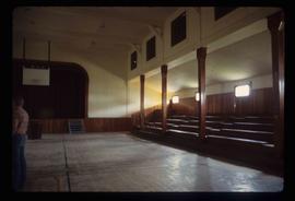
This blueprint depicts the general layout of the recreational centre. Top-down, side and front perspectives are used. The ground floor, second floor, outside walls and stage layouts are shown. Annotations in gold pen and pencil regarding clarification and changes to certain details are included. Numerical annotation at the bottom right hand of plan imposed new numbering system (3002/09/06).

2000.1.2.3.6 · Item · June 1959
Part of Cassiar Asbestos Corporation Ltd. fonds

This blueprint depicts the overall layout of the heating and ventilating units to be used for the first and second floor of the recreational centre. Details include the locations of fans, boilers, ducts and exhausts as well as typical heating connector connections and the plumbing layout. Annotations in gold pen and pencil regarding clarification and changes to certain details are included. Numerical annotation at the bottom right hand of plan imposed new numbering system (3002/09/11).

2000.1.2.2.7 · Item · June 1959
Part of Cassiar Asbestos Corporation Ltd. fonds

This blueprint depicts the gymnasium lighting layout. Also shown is an isometric view of the air supply unit piping as well as a ventilating unit automatic control diagram. Included are detailed notes regarding system desriptions, its plan and layout as well as directions for the automatic control of the ventilation unit and heating systems.

2000.1.2.3.7 · Item · June 1959
Part of Cassiar Asbestos Corporation Ltd. fonds

This blueprint depicts the gymnasium lighting layout. Also show is an isometric view of the air supply unit piping as well as a ventilating unit automatic control diagram. Included are detailed notes regarding system desriptions, its plan and layout as well as directions for the automatic control of the ventilation unit and heating systems. Annotations in gold pen and pencil regarding clarification and changes to certain details are included. Numerical annotation at the bottom right hand of plan imposed new numbering system (3002/09/12).

2000.1.1.3.13.04 · Item · [before 1970]
Part of Cassiar Asbestos Corporation Ltd. fonds

Photograph depicts the Cassiar townsite behind shadow in foreground. Plantsite can be seen including the mill, dry rock storage building, tailings pile, and many other buildings. Mountains in background. Handwritten annotation on recto: "<- 13 1/2" ->". (This photograph was made into a promotional poster.)

2009.5.2.58 · Item · [ca. 1913]
Part of Taylor-Baxter Family Photograph Collection

Photograph depicts Catholic church, with rectory on its left, and First United Church behind. A wood boardwalk crosses midground, and a man can be seen riding a bicycle near church. Power lines and rough cleared land in foreground, hills and mountains in background. Handwritten annotation on recto of photograph: "Church in Rupert."

2011.3.2.09 · Item · 1913
Part of North Coast & Central BC Postcard Collection

Printed annotation on recto reads: “Central Avenue Fort George B.C. Copyright Canada June 25th 1913”. Handwritten annotation in ink on recto reads: “Hotel Fort George; Pool room; Men’s furnishing; General store; Bank Vancouver; Telephone office; Temperance House; Trust-company; Grand stand & fair grounds; Hospital; Ware house and general store.” Cancelled 1 cent Canadian stamp on verso is dated: "Fort George BC Jul 14 13". Handwritten message in ink on verso is addressed to Mr. Chas H Wilson 94 Gould St Toronto: "Fort George. B.C> Box 65, July 13/ 13. Dear Father, This is a 'bird's eye view' of our main street - ha! ha! some class alright. We live right behind the bakery lunch room on the right hand side of the picture, on 1st avenue, some people eh? Will be moving to Cassiar Ave soon. How are all the folks. Mae is writing. Peace. M."

Central Business District
2012.13.1.3.057 · Item · July 1979
Part of J. Kent Sedgwick fonds

Image depicts the Central Business District of Prince George looking north from Connaught Hill. Map coordinates 53°54'41.4"N 122°44'58.5"W

Central Fort George school
2012.13.2.16.10.14 · Item · 2004
Part of J. Kent Sedgwick fonds

The item is a photograph depicting the front exterior side of Central Fort George School prior to demolition in 2004. The windows are boarded up.

Central Fort George school
2012.13.2.16.10.15 · Item · 2004
Part of J. Kent Sedgwick fonds

The item is a photograph depicting the front exterior side of Central Fort George School prior to demolition in 2004. The windows are boarded up.

Central Fort George school
2012.13.2.16.10.03 · Item · 2004
Part of J. Kent Sedgwick fonds

The item is a photograph depicting the front exterior of Central Fort George School and an adjacent house prior to demolition in 2004.

Central Fort George school
2012.13.2.16.10.13 · Item · 2004
Part of J. Kent Sedgwick fonds

The item is a photograph depicting the front exterior side of Central Fort George School prior to demolition in 2004. The windows are boarded up.

Central Fort George school
2012.13.2.16.10.16 · Item · 2004
Part of J. Kent Sedgwick fonds

The item is a photograph depicting the front exterior side of Central Fort George School prior to demolition in 2004. The windows are boarded up.

Central Fort George school
2012.13.2.16.10.05 · Item · 2004
Part of J. Kent Sedgwick fonds

The item is a photograph depicting the front exterior of Central Fort George School and an adjacent house prior to demolition in 2004.

Central Fort George school
2012.13.2.16.10.04 · Item · 2004
Part of J. Kent Sedgwick fonds

The item is a photograph depicting the front exterior of Central Fort George School and an adjacent house prior to demolition in 2004.

Central Fort George school
2012.13.2.16.10.06 · Item · 2004
Part of J. Kent Sedgwick fonds

The item is a photograph depicting the front exterior of Central Fort George School and an adjacent house prior to demolition in 2004.

Central Fort George school
2012.13.2.16.10.07 · Item · 2004
Part of J. Kent Sedgwick fonds

The item is a photograph depicting the front exterior of Central Fort George School and an adjacent house prior to demolition in 2004.

Central Fort George school
2012.13.2.16.10.08 · Item · 2004
Part of J. Kent Sedgwick fonds

The item is a photograph depicting the front exterior of Central Fort George School and an adjacent house prior to demolition in 2004.

Central Fort George school
2012.13.2.16.10.11 · Item · 2004
Part of J. Kent Sedgwick fonds

The item is a photograph depicting the front exterior side of Central Fort George School prior to demolition in 2004. The windows are boarded up. Annotation on reverse side of photograph states, "Central Ft Geo school just before demo summer 2004."

Central Fort George school
2012.13.2.16.10.12 · Item · 2004
Part of J. Kent Sedgwick fonds

The item is a photograph depicting the front exterior side of Central Fort George School prior to demolition in 2004. The windows are boarded up.

Central Fort School
2012.13.1.40.07 · Item · 1979
Part of J. Kent Sedgwick fonds

Image depicts an old, boarded up school, possibly the Central Fort George Traditional School in Prince George, B.C.

2011.3.3.30 · Item · [ca. 1910]
Part of North Coast & Central BC Postcard Collection

Street view of the Dominion Building in Prince Rupert, which contains the Government telegraph Office and Post Office. Printed annotation on recto reads: "Central Post Office Prince Rupert B.C." Handwritten annotation on verso reads: "Aug 18th. The cor. of the High bldg. on the right is the Prince Rupert Hotel. Front side is other way 5 stories high at [illegible] Hotel is in the next block. Notice [??] at the back is al-the [sic] lots of Hill leading down to Shops [??]. St. James' Hotel close by Prince Rupert was 5 stories high. For sure had [??] chimneys on it- a big fire engulfed [??] it about a year ago and it is being taken down. I must go & work bye bye. Love Dady. Psalm 46-1 & 48-14 was my AM verses specially."

Central Street West
2012.13.1.3.115 · Item · 12 Oct. 1989
Part of J. Kent Sedgwick fonds

Image depicts Central Street West, parallel to Highway 97 in Prince George, B.C. looking north. Shown: Prince George Motors and other car dealerships, Burger King, Grama's Inn, and the Spruceland Shopping Mall sign. Map coordinates 53°54'42.1"N 122°46'53.1"W