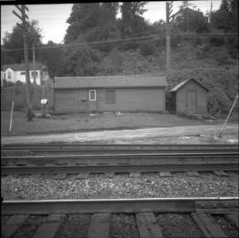
The photograph depicts two buildings, one beige, the other white, at the Prince George airport.
The photograph depicts three buildings, white, beige, and blue at the Prince George airport.
Image depicts several old buildings in a field, one of which has a caved-in roof, in Newlands, B.C. Map coordinates 54°06'28.2"N 122°12'01.0"W
Image depicts a row of buildings in Upper Fraser, B.C. with the store (titled "Paradise") with a Pepsi sign. Map coordinates 54°07'09.1"N 121°56'47.0"W
Photograph depicts small buildings sited on the north side of the tracks and just west of the Mission City CPR depot. They are all in use and well cared for.
Photograph depicts buildings of the former Vancouver-Lansdale ferry. They appeared to now be used by Kingcome Navigation Co. as well as other businesses.
Photograph depicts three buildings and a water tower on top of a deforested hill with water in the foreground.
Photograph is a printed postcard depicting scattered small buildings and a tent. Trees have been removed from the area around the buildings and many stumps remain.
Photograph depicts a wooden building under construction and piles of wood planks on the shoreline.
Image depicts a view of Bulkley Valley.
Photograph depicts man believed to be Bob Baxter on bulldozer by large framework structure in snow. House stands in background as well as a truck with "CITY OF PRINCE GEORGE" visible on its passenger door. Handwritten annotation on recto of photograph: "Civic centre 1948."
Photograph depicts man driving bulldozer in front of framework for Crusher building, view facing into the mountain. Excavated dirt in foreground.
Image depicts an old, half-collapsed house in Likely, B.C.. The slide labels it as "Bullion house."
Overview of Giscome, BC showing built and natural landscape.
Handwritten annotation in pencil on verso: "Bunkhouse & Dining Room / Giscome BC".
Image depicts bunkhouse, restaurant and store in Sinclair Mills, B.C. Map coordinates 54°01'17.4"N 121°40'53.0"W
The item is a photograph that depicts three veteran houses on Burden Street. Houses include beige siding, beige stucco and a white siding house.
Image depicts Burns Lake, B.C.
Image depicts a street in Burns Lake, B.C.
Image depicts the welcome sign in Burns Lake, B.C.
Photograph depicts group of men in hats and ties standing on wood deck connecting four store fronts. Left to right: Parsons Produce Co., Dunn & Co. Hardware and Tinware, Fortin & LeGappelain Druggists, Cummings & Richardson - Gents, Furnishings, Boots and Shoes. Handwritten annotation on recto of photograph: "Branch Parsons Produce Co at Atlin 1899."
Image depicts a street of businesses, possibly 3rd Avenue, in Prince George, B.C.
Photograph depicts various businesses along 3rd Avenue. The businesses include the Europe Hotel and The Bay in the background. Annotation on verso: "left Europe Hotel, right shearer bldg".
Photograph depicts Businesses in downtown in the North Thompson region, including a business 'Something Old & Something New'.
Photograph depicts Businesses in downtown in the North Thompson region, including a business '5 seasons, Sports Excellence'.
Photograph depicts Businesses in downtown in the North Thompson region, including a business called 'Something old & Something new'.
Photograph depicts Businesses in downtown in the North Thompson region, including a sign reading "Welcome to historic George Street" and a business called "Lizard River".
Photograph depicts Businesses in downtown in the North Thompson region, including a sign reading "Welcome to historic George Street" and Levi's jeans store.
Photograph depicts "Butterchurch" that was built in 1870 under the direction of Father Rondeault of the Oblate Order for missionary work among the Comiakan Natives, a tribe of about 100. It was abandoned by about 1880 because of its location. It was recently restored as a historical shrine.
Image depicts a cabin at an unknown location.
Image depicts a cabin somewhere in Mud River, B.C.
Image depicts a cabin at an uncertain location.
Image depicts a cabin somewhere in Mud River, B.C.
Photograph depicts a log cabin with sod roof in forest clearing. Handwritten annotation on recto of photograph: "Sayer Creek."
Photograph depicts a cabin near Williams Lake. Its interior contained two old treadle sewing machines and a chesterfield. Davies had the impression it had not been inhabited for at least a decade.
Photograph depicts Cadero St. in the west end of Vancouver, looking north from Barclay St. intersection in the 800 block.
The item is a photograph depicting the Caine building in Prince George.
Buildings visible on hillside in background, pier in foreground. Photo believed to have been taken at Port Simpson, B.C.
Photograph depicts the Cameron Lake station on the Alberni branch of the Esquimalt and Nanaimo Railway on Vancouver Island. It is no longer used but has been converted to a lodge. The view is looking west.
The item is a photograph depicting the Cameron Street bridge. The photograph is a reproduction of a photograph taken between 1917 and 1932. The picture depicts an ice jam with snow and ice along the Nechako River reaching the height of the base of the bridge. Annotations on the reverse of the photograph state, "Exp. Pl = 1922 p 986.9.9 Exp Pl = 16 Dec 1917 p 982 " 38.3 P 982.30.68 old bridge - can't be 1932."
The item is a photograph depicting the Cameron Street bridge. The photograph is a reproduction of a photograph taken between 1916 to 1931. The picture depicts the completed wooden Cameron Street bridge over the Nechako River. Annotations on the reverse side of the photograph state, "1st bridge between 1916 - 1934 983.7.13." Attached yellow sticky note states, "Note pilings in swing span. Ted Williams says the span was replaced with extension in 1922. So this photo is post - 1922."
The item is a photograph depicting the Cameron Street bridge plaque. The short write up details the construction and significance of the bridge. Annotations on reverse side of the photograph state, "169 words."
The item is a photograph slide reproduction depicting the Cameron Street bridge in Prince George. The river is flooded with and ice jam reaching the height of the bottom of the bridge. Annotation on the slide states, "Cameron bridge 1916-1931."
Image depicts an unknown individual eating in a camp somewhere in South Tweedsmuir Provincial Park.
Photograph depicts a numerous variety of buildings in snowy clearing of forest. A car is parked in foreground on road leading into the camp. Handwritten caption beside this photo reads: "Sumit Lake Camp". It is speculated that this may be the Campbell Construction Co. road camp.
Photograph depicts the camp at Summit Lake, B.C., a numerous variety of buildings in snowy clearing of forest. A car is parked in foreground on road leading into the camp. It is speculated that this may be the Campbell Construction Co. road camp.
Street view photograph of a commercial section in downtown Prince George with several "Campbell's" delivery carts parked along the road. Visible establishments include "Campbell's All Cash Store" and "Club Cafe." Handwritten annotation in blue ballpoint pen on recto reads: "Howdy from Prince George! Going easy with all these kids- good to see Kathee. Snow here. Have fun at the sports show & don't over do it. Thinking of you guys, love Judy and Vic. P.S. Can't wait to go home to somewhere peaceful and quiet. 2-27-83." Postcard is addressed to: "Mr. & Mrs. Hauffer 8429-221 PL. Sn. Edmonds, WA. U.S. 98020." Verso is affixed with four Canadian 8-cent stamps.
Image depicts numerous campers and other vehicles in Tumbler Ridge, B.C.