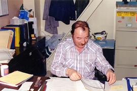
Photograph depicts Christopher Dewdney in Toronto.
Baby playing with a baby carrier
Photograph depicts plumber Chuck Molloy.
Image depicts a church, somewhere between Hazelton and Hagwilget, B.C.
Item depicts a church in a park like setting featuring a statue
Image depicts the interior of a church, most likely St. Mark's Anglican Church in Woodpecker, B.C.
Photograph depicts large church in fenced area, mission house visible behind trees in background.
Printed on image: "The Church. Old Massett. Q.C.I. / J.D. Allen. Photo. C."
Photograph depicts an unused church at Clayburn, near Abbotsford, B.C. The church and about half the buildings in the village are made of brick.
Photograph depicts two men standing in street at the Fort George Reserve. A church with steeple stands in midground, on left side of street. Forest in background. Handwritten annotation on verso and recto of this photograph reads: "Fort George Temple." See item 2009.5.3.28 for photograph depicting this reserve which belonged to the Lheidli T'enneh Band.
Photo of church door with spire, front door and picket fence. Handwritten annotation in pencil on recto reads: “Port Essington B. C.”
Photograph depicts a church built in 1876 in Nicola, 7 miles northeast of Merritt. It was originally a Presbyterian church and is one of the oldest in the interior, though it is now infrequently used.
Photograph depicts a church in Arrow Park on Arrow Lakes in southeastern B.C.
Photograph depicts a church on Wood St. in Greenwood, which is between Oliver and Grand Forks. The church may have been Roman Catholic.
Photograph depicts a church on River Road, Whonnock, Maple Ridge.
Image depicts the interior of a church, possibly one in or near Barkerville, B.C.
Image depicts the interior of a church, likely in Fort St. James, B.C.
Image depicts a church located near Mapes, B.C.
Photograph depicts the church of His Presence in Halfmoon Bay, Sechelt. It was built in 1962 by Cannon Greene, a former seafaring minister of the Columbia Coast Missions and the subject of a C.B.C. T.V. production in early April 1966.
Image depicts a church on a hill somewhere in Seton Portage, B.C.
Photograph depicts a church on a reservation at Mosquito Creek in North Vancouver, B.C.
Photograph depicts a church that was built of shaped logs on the territory of the Tsal'alh Nation on the road leading to Seton Lake. Church was derelict, but still held pews, plastic flowers and small shrines.
Photograph depicts a church or school on the south side of Craigflower Rd. in Victoria B.C. It is near or on the Songhees Reserve.
Photograph depicts one of the churches on Denman Island.
Water view of loading dock, Hudson Bay, Manitoba
Detail of <i>Castilleja</i> in flower, Manitoba
<i>Castilleja</i> in Manitoba
Habit of <i>Castilleja</i> in flower, Churhcill, Manitoba
Photograph depicts the Chute depot at mile 106.5 on the CPR line in the Carmi Subdivision. It is a totally isolated location, but not reachable by road. The photo shows the only surviving large building. The rail here is dated 1942.
Photograph depicts Ciara and Maura Shuttleworth.
Photograph is a school portrait of Ciara Shuttleworth.
Photograph depicts Ciara Shuttleworth swatting deerflies in the corral.
The item is a photograph of the CIBC Banking Centre on 3rd Avenue in Prince George.
Detail of <i>Potentilla</i> in flower
Habitat of <i>Potentilla</i>
<i>Potentilla</i>
Photograph of CIR Drill master in what is believed to be the mountains surround Cassiar.
Photograph depicts Ciril Habjan, mill maintenance general foreman.
The item is a photograph of Citi Financial and an empty commercial building on 3rd Avenue in Prince George. Scotiabank building is visible in the background.
Publication contains booklet entitled "Citizens Plus: The Nishga People of the Naas River in Northwestern British Columbia" published by the Nishga Tribal Council of New Aiyansh.
Annotation on recto: "I-57369" which denotes the same photograph in the collection of the BC Archives. Photograph depicts three men standing at the side of a muddy, deeply rutted mountain path while another man tries to drive a Citroen half-track.
The item is a photograph of a photograph depicting Prince George's City Hall circa. 1922 including an approximately 120 word write up describing its history. The building is approximately two stories high. There is an artillery cannon next to the building. A reflection of the photographer is barely visible in the photograph.
Image depicts City Hall in Prince George, B.C.
Image depicts Prince George City Hall. Map coordinates 53°54'46.3"N 122°44'41.9"W
The item is a photograph of a photograph depicting Prince George's City Hall circa. 1922 including an approximately 120 word write up describing its history. The building is approximately two stories high. There is an artillery cannon next to the building. A reflection of the photographer is barely visible in the photograph.