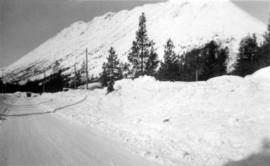
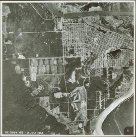
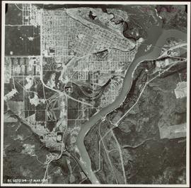
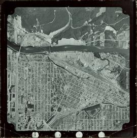
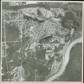
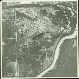
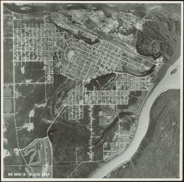
Image depicts Ash Street and Patricia Boulevard in Prince George, B.C.
Photograph depicts A. H. Holland viewing North Fork valley from a high mountain ridge.
Postcard featuring a photograph of a photograph of the arrival of the first stage coach at the Hotel Northern in South Fort George, BC on 19 October 1911. Handwritten annotation on recto of photograph reads: “Arrival of first stage at So. Ft. George B.C. Oct. 19, 1911. 28” Printed caption on the recto of the postcard reads: “First stage coach Prince George, B.C.” Handwritten annotation in pen on verso of postcard reads: “Mrs. C. Morris, Box 925, Penticton, BC. Thurs. 6pm, Dear Mother. Arr. Safely, good trip (bad pen!) Lovely weather. Hope all are well. Bia (?) Mary & Ed”
Photograph depicts twenty-eight or more people standing on the river's edge, a stack of wood is ready for loading on the steamer that is anchored near the shore.
Village can be seen in distance. Large church building stands in centre, hills in background.
Handwritten annotation on verso reads: "For heading of Page 18. Kincolith or 'The Rock of Scalps.' Section of Kincolith [...]"
Village can be seen in distance. Large church building stands in centre, hills in background.
Handwritten annotation on verso reads: "Grand Dad on beach at Kincolith".
Photograph of Archdeacon WH Collison reclining against a large tree with a group of friends and family. Handwritten annotation on verso reads: "Arch. Collison with sons Max & Arthur & friends in mountains above Portland [?] Canal Me."
Photograph depicts a view of the river shore, a few scattered buildings and tents are near the shore. A footpath leads from the water's edge between the dwellings and through the newly cleared land.
Photograph depicts view from the steamboat deck approaching Cottonwood Canyon.
Photograph depicts a view from the steamboat deck approaching Cottonwood Canyon.
Photograph depicts snow-plowed road lined with trees, valley and mountain in background. Believed to have been taken from vehicle. Handwritten annotation on recto of photograph: "Approach to Quartz Rock Creek".
Image depicts numerous buildings on the shore of Haida Gwaii as the ferry approaches.
Image depicts what appears to be an apartment building among several others in an uncertain location.
Image depicts another train on the White Pass railway along a forested mountain side.
Collection of four photographs of the Prince Rupert dry dock. Printed annotation on recto reads: "Dry Dock and Ship Building Plant, Prince Rupert BC."
Image depicts a view of D'Arcy, located on the southern end of Anderson Lake.
Image depicts a vehicle on a bridge somewhere near Anderson Lake in the Seton Portage area.
Image depicts power lines running alongside Anderson Lake near Seton Portage, B.C.
Image depicts the Anderson Lake.
Image depicts a view of Anderson Lake near Seton Portage, B.C. A vehicle on a mountain road is also visible.
Image depicts a view of Anderson Lake near Seton Portage, B.C.
Photograph depicts a railway water tower, a small building, and a rail line along a lake shore. This is a close-up of the area depicted in image 2020.08.84. The water tank is a typical PGE 25,000 gallon water tank. The station would be a little over 400 feet south of the tank.
Photograph depicts a couple in a row boat (likely the same couple depicted in image 2020.08.59) near Alta Lake shore docks and buildings. A rail line and a railway water tower are visible in the background. The water tank is a typical PGE 25,000 gallon water tank. The station would be a little over 400 feet south of the tank and is hidden by the stand of trees.
Image depicts the Alkali Lake Ranch in Alkali Lake, B.C.
Photograph depicts snow covered trees and forest.
Photograph depicts an open field with a fence, house and shed in the midground, low treed hills in the background.
Image depicts some farmland near Alexandria, B.C.
Photograph of a stone monument atop a small hill on a forested shoreline. Annotation on recto reads: "Alexander Mackenzie Monument, Dean Channel, Near Ocean Falls, BC."
Photograph depicts several carved totem poles and house posts in a clearing with a forested area in the background. Photographer’s stamp on verso: “W.E. Nicholson, 268 E. 10th, Vancouver 10, B.C.”
Image depicts the Alcan smelter in Kitimat, B.C.
Image depicts a small section of the Alaska Highway somewhere near Whitehorse, Y.T. The slide also appears to be labelled "army washing" for unknown reasons.
Image depicts the ferry to Alaska in the port of Prince Rupert, B.C.
Image depicts an old convenience store, with a sign on it labelled "Al Crosina." It is located at the 153 Mile House.
Item is a photograph of Prince George taken from the air.
Item is a photograph of Prince George taken from the air on August 2, 1965.
Item is a photograph of Prince George taken from the air.
Image depicts a marker for aerial photography at an uncertain location. The slide labels it as "Elizabeth Station."
Image depicts an aerial view of a forest somewhere in the area of Divide Lake.
View of summit lake from above, many small tree-covered islands and peninsulas visible. Handwritten caption beside this photo reads: "Sumit Lake".
Photograph depicts an aerial view of the proposed site for the Fairview general cargo dock elevator site.
Photograph depicts an aerial view of the Prince Rupert shoreline.