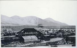
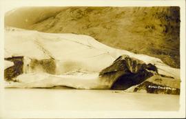
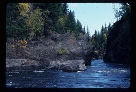
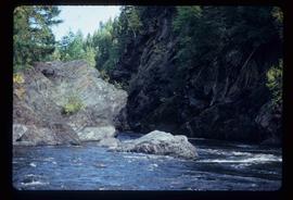
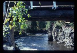
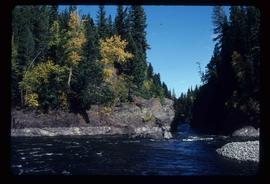
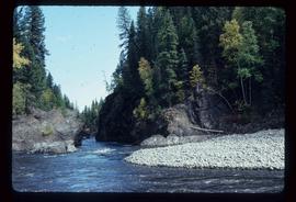
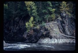
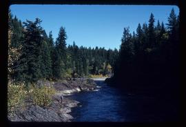
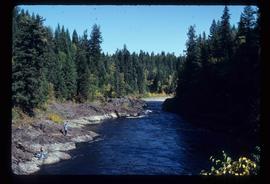
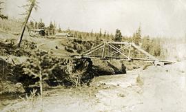
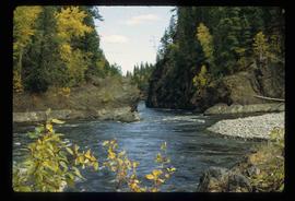
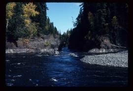
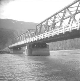
Photograph depicts Birch Island Bridge over the North Thompson River.
Photograph depicts a bird on a snow-coved wooden ledge with snow-covered trees in the background.
Photograph possibly depicts a hummingbird on a nest.
Photograph depicts a snow-covered forest clearing with six structures and a truck. Buildings have been numbered 1-8 with pen. Original handwritten annotations on verso of photograph are signed by Tom Marsh. Photograph is taped to paper. Typed annotation on recto of paper reads: “1. Bridge over creek. 2. Blacksmith shop. 3. Powerhouse. 4. Headframe over 200’ shaft. 5. Office 6. Water tanks from powerhouse. 7. Bunkhouse. 8. Truck. 9. Cookhouse behind #6 cannot be seen. We were always able to find the cookhouse even though hidden in this picture. Taken about 1935 by Russell Ross, supt. Quesnel Quarts Mine. Tom Marsh, Box 156, Squamish B. C.”
Photograph depicts a panoramic view of Stewart B.C. Annotation on front "Bird's Eye View" "Stewart, BC"
Aerial view of Prince George and surrounding forested area. Printed annotation on recto reads: "Prince George, B.C."
Photograph depicts Birken Station on the Pacific Great Eastern. It is 113.6 miles from North Vancouver and at an altitude for 1575 ft. The view is looking north.
Typed message on front reads: “Happy Birthday Your Honour, You have a way of making each person you come in contact with feel so special, so we all want to wish you the happiest birthday year ever. Staff of Government House, October 18, 2002.” Signed by the staff of Government House.
Handwritten annotation on verso reads: “The Rock - I spent 6 years creating 6 gardens surrounding”.
Group of men, women, and children pose in front of large building.
Handwritten annotation on verso reads: "Metlakatla BC / with Bishop Ridley - 4th from left - back row / Mrs Ridley - 4th from left - front row / [?] - [super?] of Ridley Home (beside the Bishop) / Father Hogan - behind the Bishop".
Group of men, women, and children pose in front of large building. Rev. William Edwin Collison stands on far left (son of Archdeacon W.H. Collison).
Handwritten annotation on verso reads: "Early Church Workers at Metlakatla BC / Bishop & Mrs Ridley in centre / (Approx 1898 - 1899)".
The Bishop sits at a table, drinking tea.
Handwritten annotation on verso reads: "[...?] taken at Eastbourne Missionary Exhibition March 1903 [...?]".
Photograph of a large glacier. Printed annotation on recto reads: "Bitter Creek Glacier."
Wide angle perspective of the Bitter Creek glacier, with trees visible in the foreground. Printed annotation on recto reads: "Hughes #22 Bitter Creek Glacier."
Handwritten caption beside this photo reads: "Bear at the Dump". Photograph depicts a black bear facing the camera and sitting alert in clearing.
Slide depicts a black bear eating garbage by wooden outbuildings, possibly at the Aleza Lake Experiment Station.
Caption describing photograph: "Black Spruce germinator. EMK seed."
Caption describing photograph: "Black Spruce Lot 1398. Planted 1969. Row No. 2, Tree No. 14. 1969 leader = 4.5"."
Caption describing photograph: "Black Spruce Lot 1398. Planted on Buckhorn Burn Spring 1968 at 10' by 10' spacing. 1968 leader = 5", 1969 leader = 1"."
Caption describing photograph: "Black Spruce residuals (Ht 35-40', 5-9" DBH Age 80). Potentially commercial pulp wood remaining after pulp logging a fully stock 95 yrs stand of Lodgepole pine and White Spruce on imperfectly drained silty clay. Mile 6.5 Hart Highway. (Illustrate frequent occurrence of P mariana on soils other than organic muck or sphagnum bogs)."
Caption describing photograph: "Black Spruce as GBW Film 4 Frame 7 ( 2007.1.30.2.045) on left. Betula glandulosa and willow on right, resulting from fire history--foreground showing development of organic peat over clay."
Item is a hand drawn and coloured map by the City of Prince George Planning Department depicting the Blackburn neighbourhood development area's proposed sector plan in 1976.
Image depicts a view of Blackburn Schools, possibly taken from Tabor Mountain.
Image depicts a view of Blackwater in the country near Punchaw, B.C.
Image depicts Blackwater River, B.C.
Image depicts the Blackwater River.
Image depicts Blackwater River.
Image depicts Blackwater River, B.C.
Image depicts a bridge over Blackwater River, with an unknown individual standing on it.
Image depicts an abandoned cabin and shed on Blackwater Road.
Image depicts the interior of an abandoned, deteriorating cabin on Blackwater Road.
Image depicts an abandoned, deteriorating cabin on Blackwater Road.
Image depicts a shed on Blackwater Road.
Photograph depicts a view of the Blackwater bridge from downstream. The cabin, house and telegraph poles in the background.
Photograph depicts a view from above the Blackwater telegraph cabin and house. The house has a large fence garden beside, telegraph poles with wires are visible alongside the dirt road. Wood smoke drifts from the house chimney to the sparsely forested area beside.
Photograph depicts a canvas tent and wooden tent frame in the foreground, more canvas tents erected in the background. Two men carry poles on the right, while another man in center photo stands near another pole frame. There is a body of water in the background.