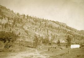
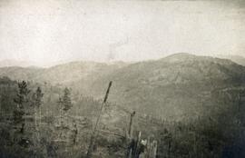
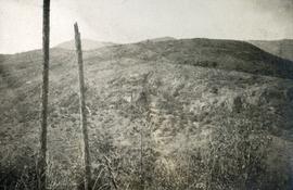
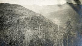
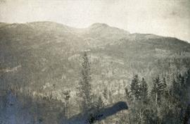
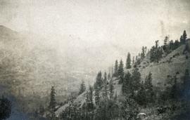
Photograph depicts mine valley and road in foreground. Cassiar plant and tailings pile visible in left midground, townsite in right midground. Mountainside of McDame Mountain in foreground, southern mountain range in background.
Photograph depicts the West Peak of the Cassiar mine on McDame Mountain. Pit area visible between West Peak and road in foreground. Mine valley and north mountain range in background. Photo speculated to have been taken from a point on or near the South or North Peak.
Photograph depicts crusher plant in centre foreground. Shifter shack and vehicles can be seen in front of pit area. West Peak semi-visible in right midground. Mine valley an northwestern mountain range in background.
Image depicts a man standing in front of a helicopter; a waterfall is visible on the cliffs in the background. The slide itself is labelled "BC Parks Tour."
Image depicts what is possibly either the Hecate Strait or the Minette Bay from somewhere near Kitimat, B.C.
Image depicts what is possibly either the Hecate Strait or Minette Bay from somewhere near Kitimat, B.C.
Image depicts the Hecate Strait near Prince Rupert, B.C.
Image depicts the waters of the Hecate Strait.
Image depicts the waters of the Hecate Strait, possibly on approach to Haida Gwaii, B.C.
Image depicts the Hecate Strait near Prince Rupert, B.C.
Image depicts a piece of heavy machinery lifting numerous logs off the back of a logging truck. It is likely located in Prince George, B.C.
Photograph depicts a sparsely forested mountainside.
Photograph depicts a high mountain meadow with alpine trees.
Photograph depicts a sparsely forested mountainside.
Image depicts the head of Lillooet Lake.
Image depicts the canoe group around a campfire at the head of Indianpoint Lake.
Photograph depicts nine or more people watching a steamer navigate the rough waters of Fort George Canyon from the river shore.
Photograph depicts the rough waters and rocks at Fort George Canyon.
Photograph depicts a view of mountains, described as the head of Cayoosh Creek near Lillooet, BC.
Handwritten annotation on verso of photograph: "HOCKEY - HAZELTON. VS G.T.P.R [Grand Truck Pacific Railway] FEB. 20/11" Twelve players can be seen skating on ice, surrounded by large crowd of people standing on either side of the game. Referees dressed in suits stand around players, and a dog can also be seen in crowd. Snow pile in foreground; river banks, forest, and mountains in background.
Image depicts the cemetery in Hazelton, B.C.
Image depicts a tombstone in the cemetery in Hazelton, B.C.
Image depicts the cemetery in Hazelton, B.C.
Image depicts a beaver dam somewhere in Hazleton, B.C.
Image depicts Hazelton, B.C.
Photograph of a large wooden bridge across Hayes Creek, Prince Rupert, BC. Printed annotation on recto reads: "Hayes Creek Bridge Prince Rupert BC." Handwritten annotation on recto reads: "Dear Mary. Why don't you and my letter hyp[illegible] old [illegible] Louisa A./ P.O. Box 32./ P.R." Handwritten address on verso reads: "Miss Mary Wonoghue Prideaux St., Nanaimo. B.C." Postcard is affixed with a one cent Canadian stamp. Postmarks on verso read: "Prince Rupert B.C. PM Jun 18 11." and "Nanaimo B.C. 18 Jun 21 11."
Image depicts the road leading to the historic Hat Creek Ranch site north of Ashcroft, B.C. Several individuals are sitting on the front porch of the Ranch house.
Image depicts the front of the ranch house on the historic Hat Creek Ranch site north of Ashcroft, B.C.
Image depicts several individuals sitting on the front porch of the Ranch house on the historic Hat Creek Ranch site north of Ashcroft, B.C.
Image depicts numerous individuals standing near the Ranch house and McLean Cabin on the historic Hat Creek Ranch site north of Ashcroft, B.C.
Image depicts a "box barn" on the historic Hat Creek Ranch site north of Ashcroft, B.C.
Item is a hand drawn and coloured map by the City of Prince George Planning Department depicting Hart Highway neighbourhood area existing land use in 1976.
City of Prince GeorgeImage depicts a road leading into a First Nations' Reserve at the head of Harrison Lake.
Elevated view of the buildings along the Prince Rupert shore, including the Prince Rupert Inn. The waterfront and some small islands can be seen in the background. Printed annotation on recto reads: "Harbour, Prince Rupert, B.C. 1658."
Boats, docks, ships and a large building in waterscape. Printed annotation on recto reads: “Prince Rupert B.C.” Handwritten annotation in pencil on verso reads: “McRae Bros”.
View of building, dock, harbour and small islands with snow peaked mountains in background. Printed caption on verso reads: “Port Essington B.C. Photo by P. E. Fisher”. Handwritten annotation in ink on verso reads: “up the Skeena”, in pencil on verso: “Port Essington, North Coast Commercial Coy”.
Image depicts the Hansard railroad bridge looking west. Map coordinates 54°04'37.9"N 121°50'46.3"W
Image depicts the Hansard railroad bridge taken from the new Hansard vehicle bridge. Map coordinates 54°04'58.1"N 121°50'58.0"W
Image depicts the new Hansard Bridge. Map coordinates 54°04'57.9"N 121°51'10.1"W
Photograph depicts some stumps and grassland in the foreground, a few buildings on the right, sparsely forested rocky hillside in the background.
Image depicts a hammer sitting in dirt at an uncertain location.
Image depicts a house on Blackwater Road.